3 year ago
Incident - MountainFire estimate size from sensor aircraft 1464 acres 0 % containment. Burning in timber with crowning. Cause still remain under investigation. Evacuation are in place
Earthquake of magnitude 4.8 - 29 km ENE of Port-Olry, Vanuatu
 3 year ago
MountainFire west of Weed and W of MillFire the fire line on Gazelle Callahan Rd is East of the switchbacks. Truckee Hotshots arriving
 3 year ago
MountainFire west of Weed and W of MillFire the fire line on Gazelle Callahan Rd is East of the switchbacks on that rd
 3 year ago
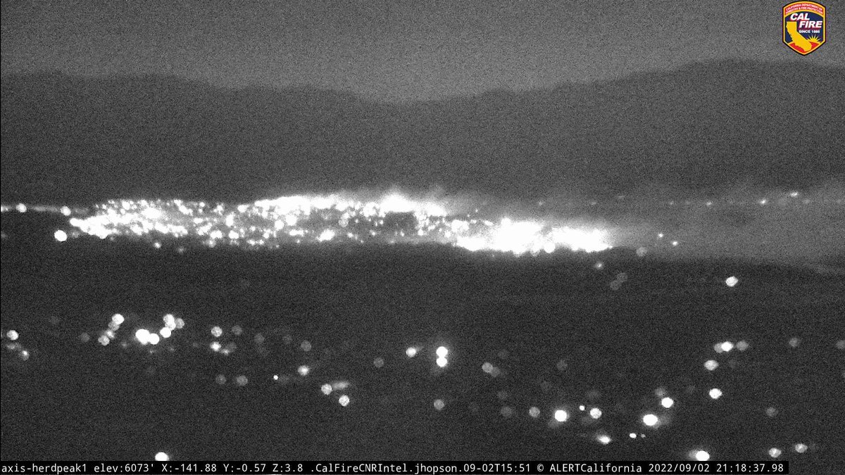
MillFire (Weed, Siskiyou Co) - Some of the area cameras have come back online, view below is from Herd Peak which is to the N/E of the fire. Zone SIS-3710 (Grenada area) got reduced from an evac order to a warning
Earthquake of magnitude 4.7 - 51 km W of Chara, Russia
Earthquake of magnitude 5.3 - 15 km SSE of Palekastro, Greece
Avenue S and Casa Verde vegetation fire near railroad tracksSheriff and FD enroute code 3 : E131 on scene fire at 1/8 acre continuing assignment 2: forward progress stopped at 1/4 acre
The MountainFire has spotted to the north side of Gazelle Callahan Road, per radio traffic, in an unspecified location
Fairmont. Brush fire. 210th and Highway 138. LeonaFire. E78 reports they are still en route and reporting the fire is likely in the area west and north of this location
 3 year ago
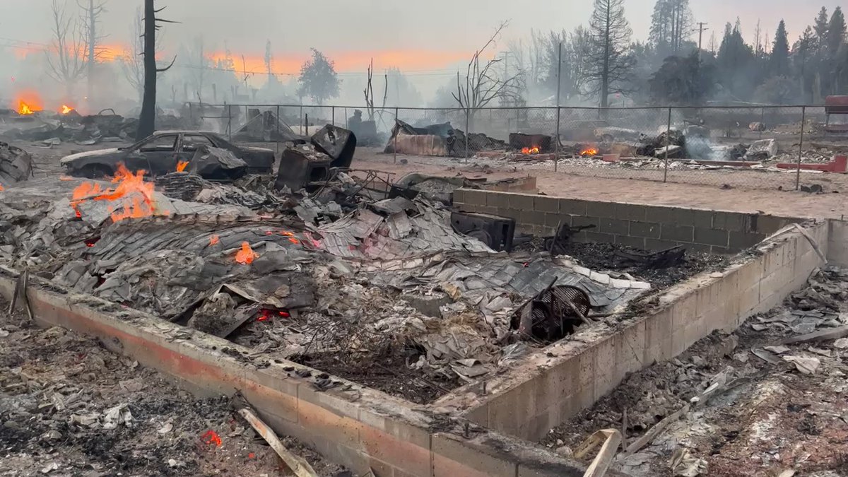
MillFire and a devastated neighborhood between Railroad Ave and E Lincoln Ave Weed CA
Fairmont. Brush fire. 210th and Highway 130. LaCoFD E130 reports heavy smoke showing 15 miles out. Requesting a full first alarm
Fairmont. Brush fire. 210th and Highway 138
Firefighters responding to a vegetation fire FynnFire in the area of North Flynn Rd X I 580 in the Altamont . Initial reports are putting the fire at 3 to 5 acres
Earthquake of magnitude 4.9 - Kuril Islands
Earthquake of magnitude 5.4 - 150 km SE of Kuril’sk, Russia
Earthquake of magnitude 5.1 - 133 km SE of Kuril’sk, Russia
Earthquake of magnitude 6.1 - 111 km WNW of Kandrian, Papua New Guinea
Earthquake of magnitude 4.6 - 14 km NNE of Ōhara, Japan
Earthquake of magnitude 4.7 - 127 km ENE of Hihifo, Tonga
Earthquake of magnitude 4.9 - Fiji region
Earthquake of magnitude 4.7 - Kepulauan Babar, Indonesia
3.2 magnitude earthquake. 19 km from Rotan, TX, UnitedStates
Earthquake of magnitude 5.0 - 181 km NNW of Nuku‘alofa, Tonga
Earthquake of magnitude 4.9 - Hindu Kush region, Afghanistan
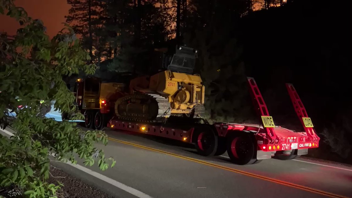
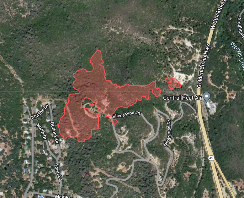
New Incident: WoodsFire off Stockton Road and Mill Villa Ct., Southwest of Sonora in Tuolumne County is 21 acres and 10% contained
![Fire west of Potrero [update] Fire remains 4,438 acres and is now 20% contained. Some evacuation orders were lifted yesterday](https://disasters.liveuamap.com/pics/2022/09/02/22484462_0.jpg) 3 year ago
3 year agoFire west of Potrero [update] Fire remains 4,438 acres and is now 20% contained. Some evacuation orders were lifted yesterday
The Cedar Creek Fire in eastern Lane County is sending a massive plume of smoke northward across central Oregon and south central Washington
By early Friday morning, Cal Fire said the WoodsFire's forward progress had been halted. The 21-acre blaze was burning near the Mother Lode towns of Sonora and Jamestown
3.0 magnitude earthquake. 23 km from Soledad, CA, UnitedStates
3.0 magnitude earthquake. 23 km from Soledad, CA, UnitedStates
 3 year ago
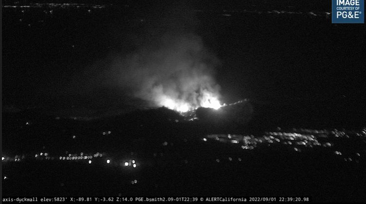
WoodsFire (Jamestown/Sonora, Tuolumne Co) - FIRIS mapped the fire at approximately 20 acres, several spot fires - map below is from their data. Perimeters don't reflect structure protection efforts on the ground
3.0 magnitude earthquake. 23 km from Soledad, CA, United States
 3 year ago
WoodsFire (Jamestown/Sonora, Tuolumne Co) - 40 acres in heavy fuels & steep terrain per the CAL FIRE TCU update from about a half hour ago. The fire is backing into the Golden Links Subdivision
Earthquake of magnitude 5.1 - 266 km NNE of Bamboo Flat, India
Earthquake of magnitude 5.6 - 252 km NNE of Bamboo Flat, India
 3 year ago
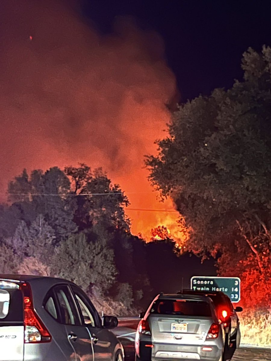
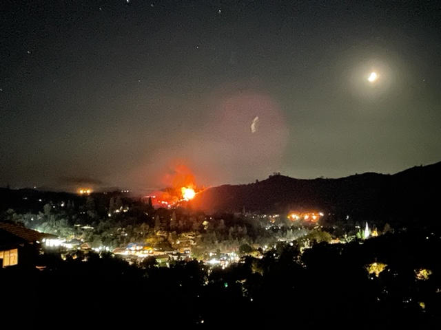
Looking toward the WoodsFire from Jamestown, 3 miles away from Sonora. We just arrived at this spot moments ago. We can see flames, bright orange glow in the night sky. Evacuees/people stopped on the side of Hwy 49 looking fire
 3 year ago
Mandatory evacuation orders and evacuation warnings in effect because of WoodsFire burning near Sonora in Tuolumne County.
 3 year ago
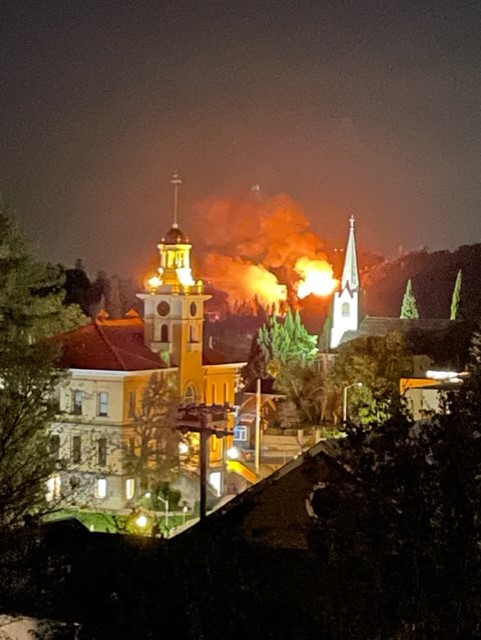
WoodsFire in Tuolumne Co. progressing - photo taken from Meyers Hill in Sonora courtesy. ROAD CLOSURES per Tuolumne Co. Sheriff Stockton Road from Hwy 108 to Ponderosa Way
 3 year ago
WoodsFire (Jamestown/Sonora, Tuolumne Co) - IC requesting 3 strike teams of type 3 engines (15 engines), 2 strike teams of handcrews (4 crews) + 2 strike teams of dozers (4 dozers) immediate need. 1 Air Attack, 4 tankers + 4 copters for tomorrow morning
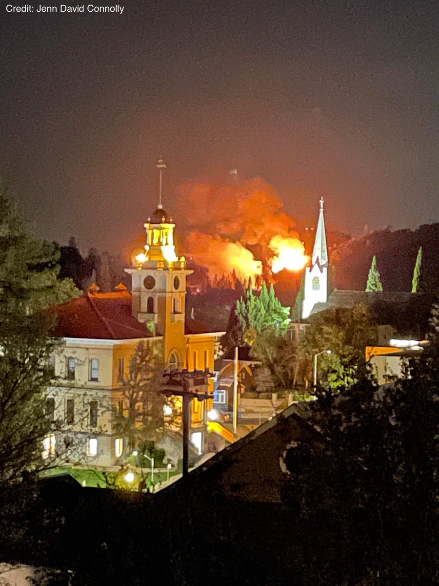
 3 year ago
Shepherd St. in Sonora of WoodsFire. Photos courtesy of Jenn David Connolly
 3 year ago
5 additional engines any type needed at McKibbon road for structure defense due to long range spotting. Evacuation orders and warnings are changing fast
 3 year ago
WoodsFire (Jamestown/Sonora, Tuolumne Co) - IC requesting 5 additional engines immediate need closest resource for structure protection in the McKibbon Dr area due to long range spotting. Evac orders & warnings are changing very rapidly
 3 year ago
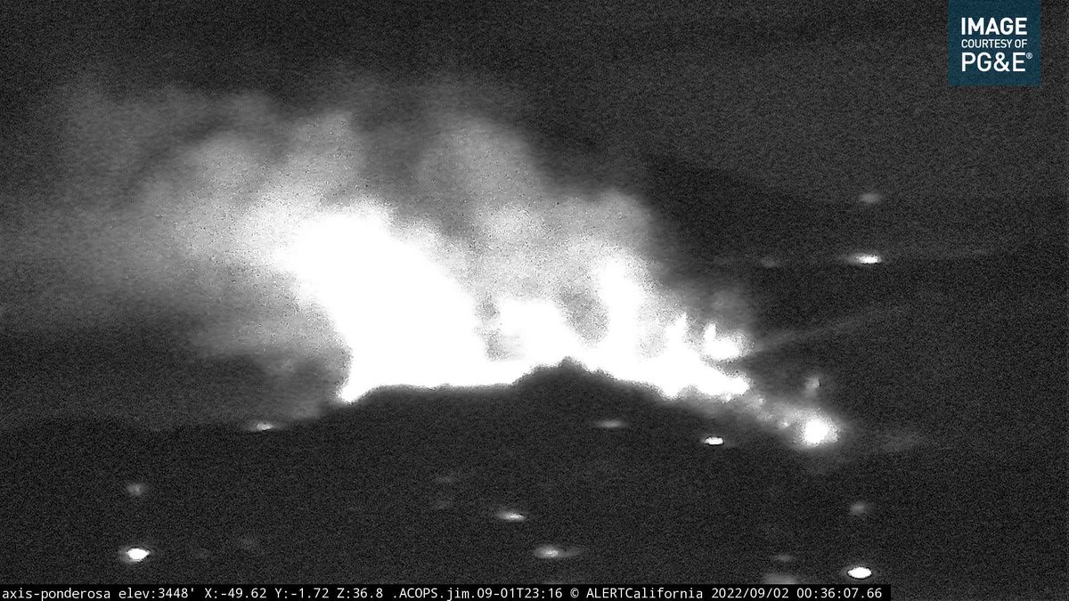
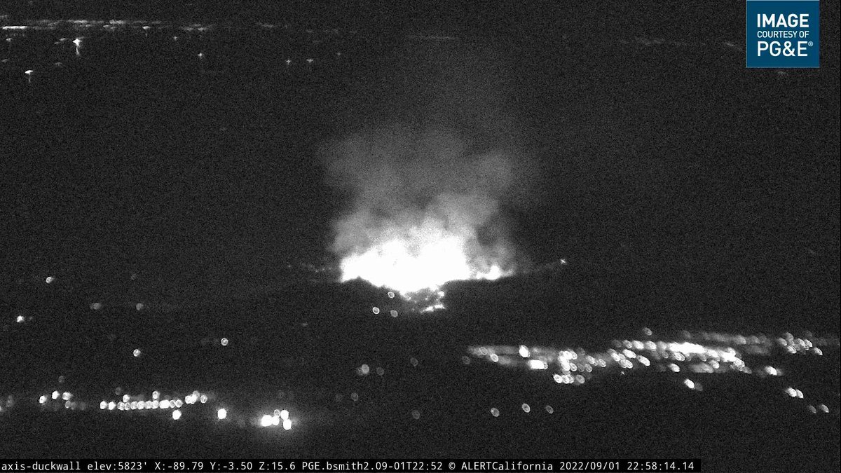
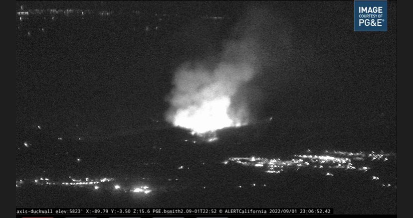
Evacuation orders have expanded as the fire continues to burn near the towns of Jamestown and Sonora. Below is a photo taken by an AlertWildfire camera in the area moments ago. as info comes
The sheriff's office has called for evacuations along two roads
 3 year ago
A vegetation fire burning just outside of the Tuolomne County community of Sonora has prompted evacuations.
Fire prompts evacuation orders near Jamestown, Sonora in Tuolumne County
Earthquake of magnitude 5.0 - 281 km WNW of Neiafu, Tonga
Earthquake of magnitude 4.6 - Kepulauan Barat Daya, Indonesia
Earthquake of magnitude 4.7 - 27 km SSE of Singkil, Indonesia
Earthquake of magnitude 4.7 - 31 km SSW of Adak, Alaska
Earthquake of magnitude 4.7 - South Sandwich Islands region
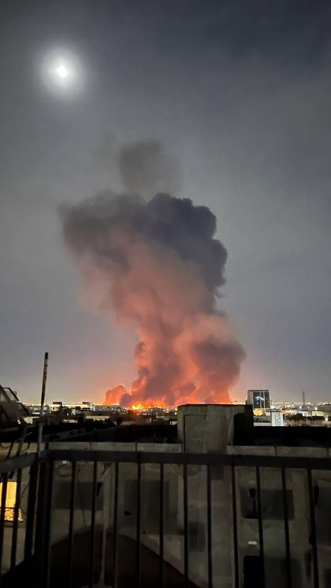
Crews have investigated the area and have confirmed that the smoke in our district is a result of drift smoke from the Border32Fire burning in San Diego County. Heavy smoke is seen throughout our district. There is no fire threat to our district
 3 year ago
Border32Fire - Barrett Junction/Potrero - FIRIS has mapped the fire at 4,438 acres as of 25 minutes ago. Minimal fire activity visible on the cameras for the past several hours. Numerous air and ground resources on scene.