Earthquake of magnitude 5.2 - south of the Fiji Islands
 16 hour ago
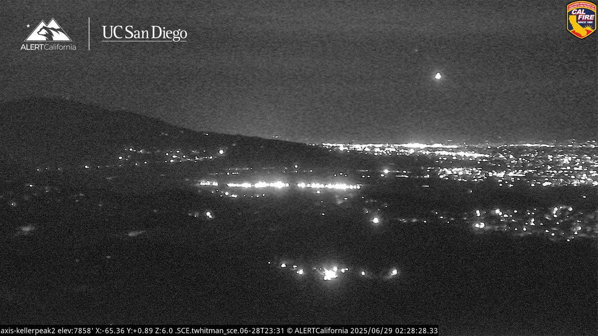
LakeFire - Forward rate of spread has been stopped. : Lake Fire Air Attack
 16 hour ago
LakeFire Forward Progress has been stopped at 477 acres.No Activity is showing on cams.LakeFire Not much radio traffic tonight, Aircraft have been off the Fire for 2 hours, no Flare ups have been seen on the Cams
 16 hour ago
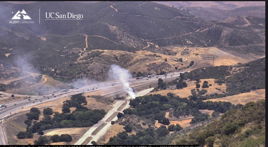
Units making good progress beginning to release resources. Five Fire E149 on scene vehicle fire with a 20 by 20 spot that has spreaded to the structures threatened
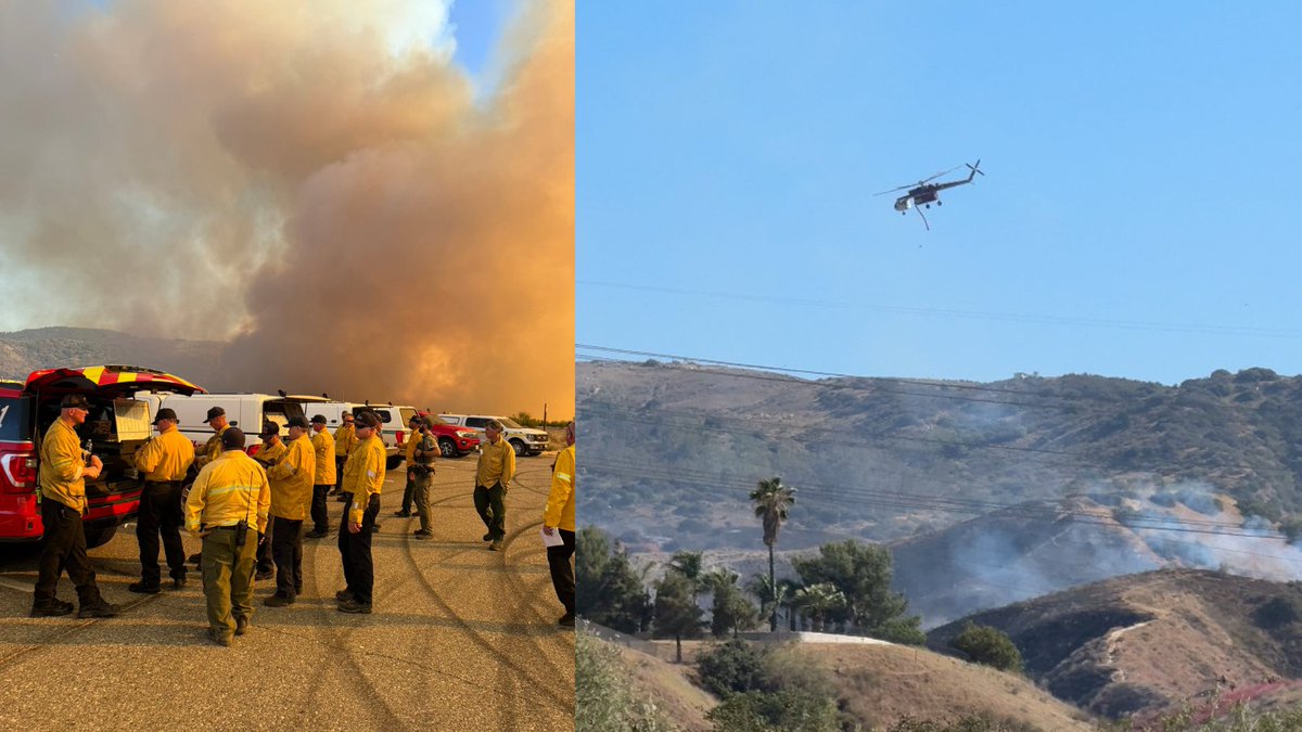
The Lake Fire near Hesperia is still burning, but the blaze’s forward progress has been stopped, according to Cal Fire
2.4 magnitude earthquake. 3 mi from Larkfield-Wikiup, CA, UnitedStates
2.9 magnitude earthquake. 23 mi from Ferndale, CA, United States
Firefighters have stopped the forward progress of the fire. Crews will remain at scene for the next couple of hours conducting heavy mop-up operations and strengthening containment lines
 18 hour ago
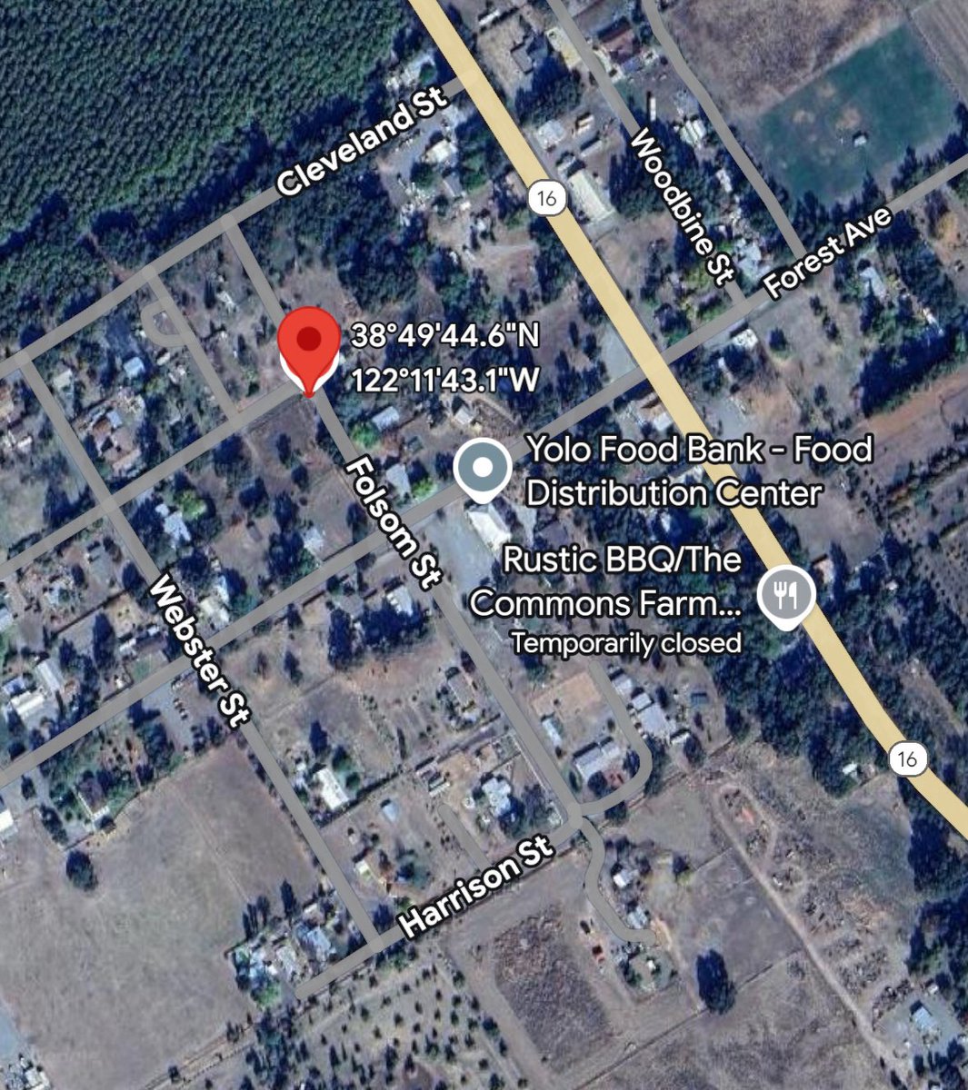
FolsomFire: CAL FIRE and local agencies are responding to a vegetation fire in Guinda near Thurman St and Folsom St. The fire is approximately 1/2 acre, burning in grass at a medium rate of spread with two structures threatened
Morning The Lake Fire is currently 478 acres and 10% contained under Unified Command with CAL FIRE, San Bernardino National Forest, San Bernardino County Fire, and the San Bernardino County Sheriff.
2.3 magnitude earthquake. 21 mi from Searles Valley, CA, UnitedStates
Earthquake of magnitude 4.9 - 187 km ESE of Attu Station, Alaska
Earthquake of magnitude 4.6 - 266 km SE of Attu Station, Alaska
Earthquake of magnitude 5.2 - 103 km N of Tatsugō, Japan
Earthquake of magnitude 5.1 - 157 km SSW of Lorengau, Papua New Guinea
 1 day ago
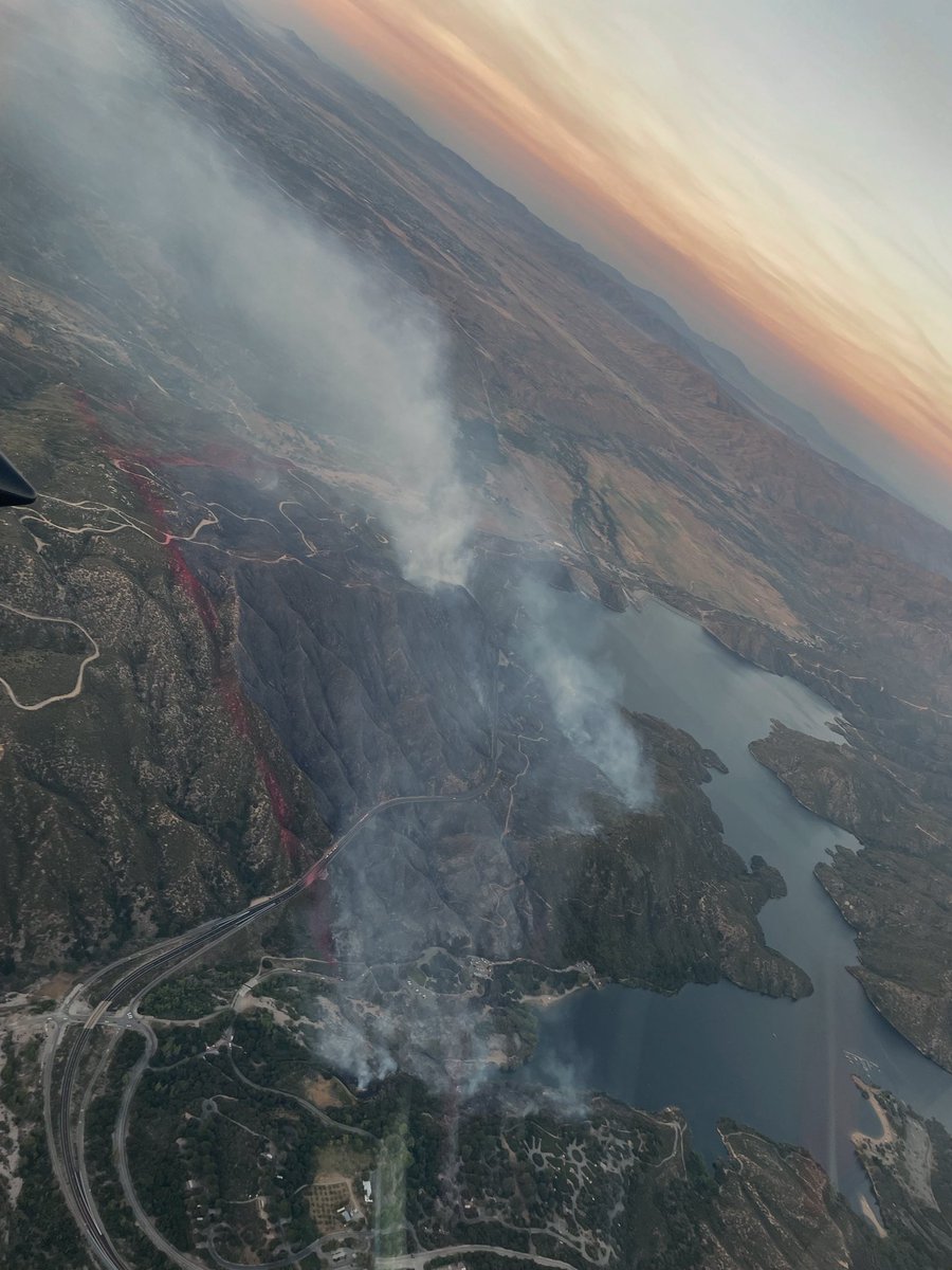
The LakeFire burning near Silverwood Lake in San Bernardino County has grown to 478 acres with 0% containment on Saturday night. Fire crews on the ground and in the air will be working overnight to contain the blaze.
Earthquake of magnitude 5.1 - south of Panama
 1 day ago
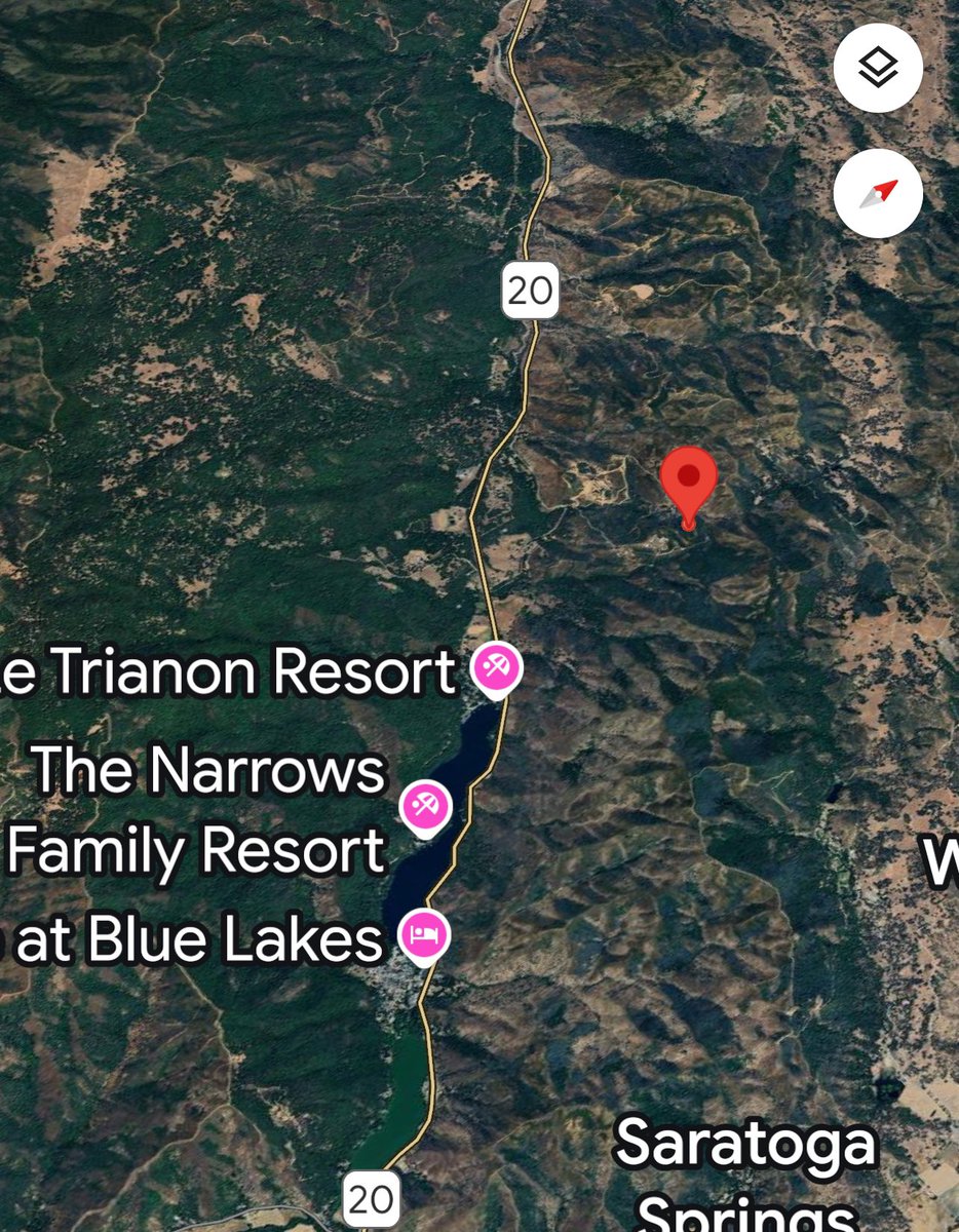
Firefighters are at scene of a 3/4 acre vegetation fire east of Old State Highway/Highway 20 near Upper Lake. Firefighters are trying to gain access to the fire and the fire is reported to be a slow rate of spread
Silverwood Lake / Hesperia Area The Lake Fire has burned approximately 478 acres with no containment at this time. The incident is in Unified Command with the USFS: San Bernardino National Forest
Earthquake of magnitude 4.6 - 199 km ESE of Kuril’sk, Russia
Earthquake of magnitude 4.8 - 9 km SE of Deep Springs, CA
Earthquake of magnitude 4.8 - 37 km ENE of Big Pine, California
The wildfire is now at 200 acres and is burning about 8 miles southwest of the Window Rock area.
Earthquake of magnitude 4.8 - 30 km SW of Hihifo, Tonga
Earthquake of magnitude 5.4 - 100 km NNW of Tatsugō, Japan
Earthquake of magnitude 4.9 - 100 km NNW of Tatsugō, Japan
Earthquake of magnitude 5.3 - 56 km NNE of Barkhan, Pakistan
Earthquake of magnitude 5.1 - 31 km SSW of Puerto San José, Guatemala
Earthquake of magnitude 5.1 - South Sandwich Islands region
Earthquake of magnitude 5.3 - 138 km NW of Tobelo, Indonesia
Earthquake of magnitude 4.8 - 21 km N of La Serena, Chile
Earthquake of magnitude 5.1 - 285 km NW of Chokurdakh, Russia
Earthquake of magnitude 6.5 - Scotia Sea
Earthquake of magnitude 6.6 - Scotia Sea
 2 day ago
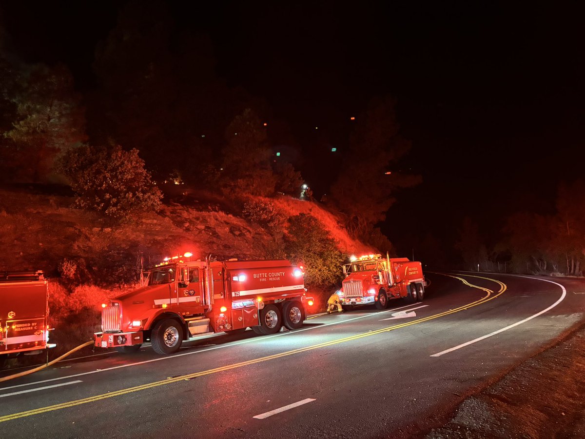
Firefighters are at scene of a vegetation fire near Lime Saddle Marina. Fire is 2 acres. Forward progress stopped and hose line around the fire. Resources will remain at seeing the next 2 to 3 hours gaining full control. Fire is under investigation and no injuries
Earthquake of magnitude 4.8 - 155 km S of Nikolski, Alaska
Earthquake of magnitude 5.2 - 170 km S of Nikolski, Alaska
Earthquake of magnitude 4.7 - 140 km SW of El Palmarcito, Mexico
Earthquake of magnitude 4.8 - 117 km NNW of Hihifo, Tonga
Earthquake of magnitude 4.8 - South Georgia Island region
Palmdale,ca: 904b (brush fire) 6th st e and Palmdale blvd. Brush fire near structures, multiple callers
Earthquake of magnitude 5.5 - 165 km NNW of Houma, Tonga
Earthquake of magnitude 4.9 - 60 km E of Sarangani, Philippines
Earthquake of magnitude 6.1 - 71 km ESE of Sarangani, Philippines