Earthquake of magnitude 5.2 - 4 km WSW of Yujing, Taiwan
Earthquake of magnitude 4.6 - 50 km SE of Vanimo, Papua New Guinea
 13 hour ago
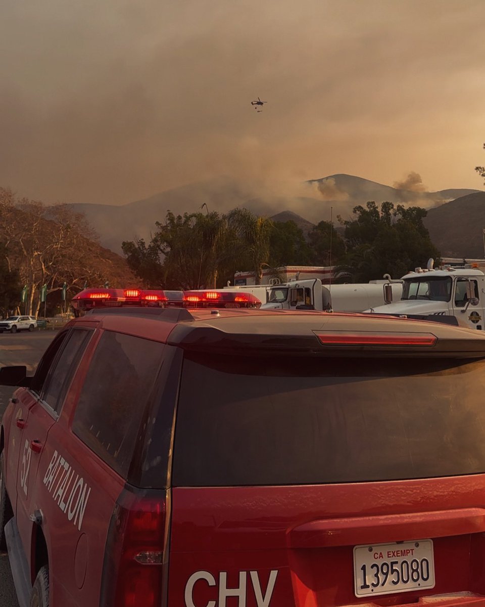
Chula Vista Fire Department continues to monitor the progress of firefighting efforts on the Border 2 Fire. Evacuation warnings remain in effect until containment perimeter increases nearest Chula Vista
2.4 magnitude earthquake. 4 mi from MorongoValley, CA, United States
Earthquake of magnitude 4.9 - 31 km NE of Donggang, Taiwan
2.8 magnitude earthquake. 4 mi from DesertEdge, CA, UnitedStates
Earthquake of magnitude 5.1 - 8 km N of Yujing, Taiwan
2.5 magnitude earthquake. 20 mi from Ferndale, CA, United States
Earthquake of magnitude 4.7 - 199 km W of Bandon, Oregon
Earthquake of magnitude 4.8 - 127 km SW of Fakfak, Indonesia
 1 day ago
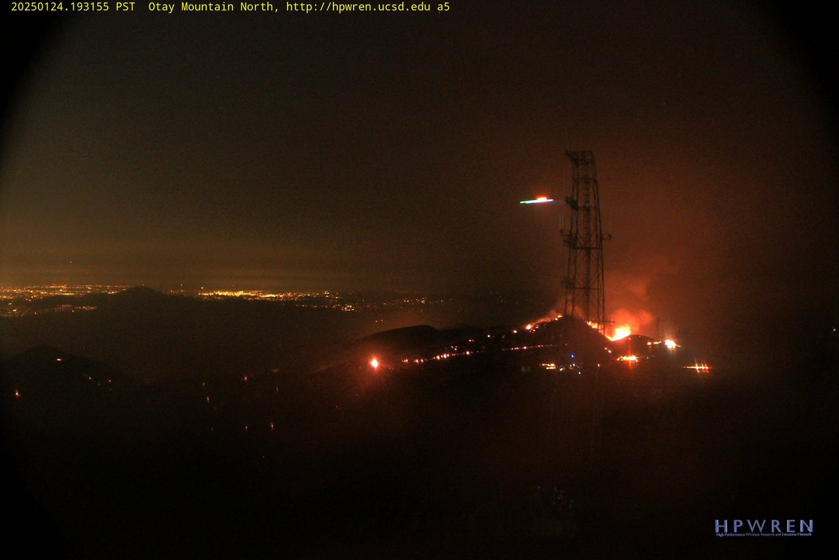
Border2Fire Additional Helicopter, CalFire Copter 613, 3 Water dropping Helicopters and 1 Helco is working the Fire tonight.The Fire remains Calm this Evening slowly pushing to the Northeast due to a Wind shift from earlier today.
Earthquake of magnitude 4.6 - 183 km NW of Vallenar, Chile
 1 day ago
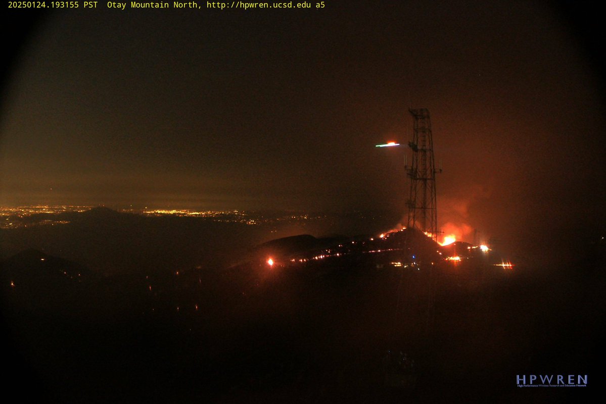
Border2Fire Night Ops Aircraft Assisting.Helco Copter 4AS.Helitanker 8PJ, CalFire Copter 602
Earthquake of magnitude 4.9 - Volcano Islands, Japan region
 1 day ago
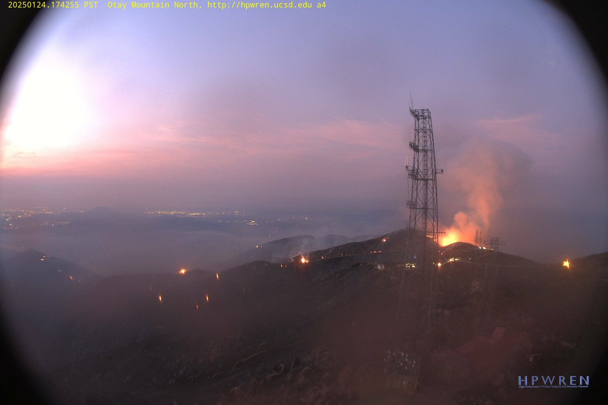
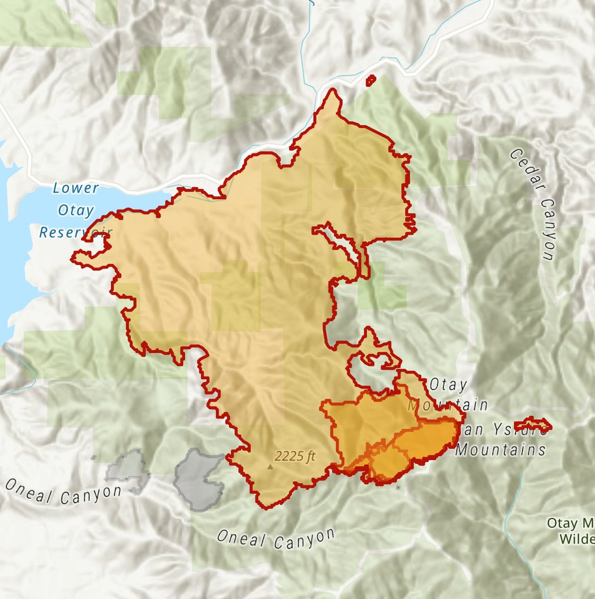
Border2Fire An Intel Flight by Cal Fire has Mapped the Fire at 6,272 acres.All Aircraft has been Released for the Evening, no word if Helicopters will be getting Requested tonight
Earthquake of magnitude 4.9 - 5 km NW of Yujing, Taiwan
 1 day ago
Border2Fire Recent Mapping has the Fire at 5,389 acres, 10% Containment
 1 day ago
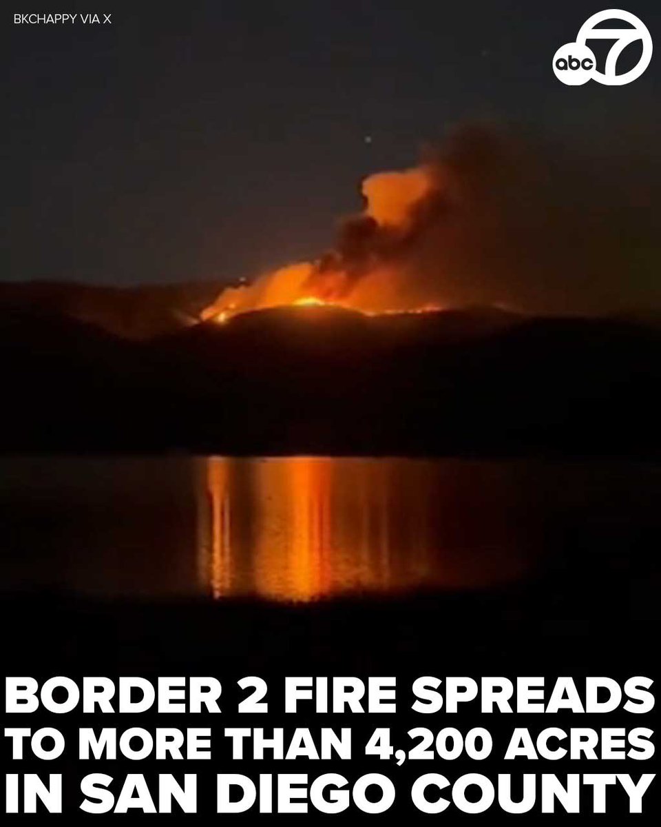
The so-called Border 2 Fire spread to more than 4,250 acres and was 10% contained on the day after it ignited several miles north of the U.S.-Mexico border
LAFD Alert- PacificPalisades Palisades Fire - Partial Repopulation For Residents ONLY 1190 N Piedra Morada Dr
 1 day ago
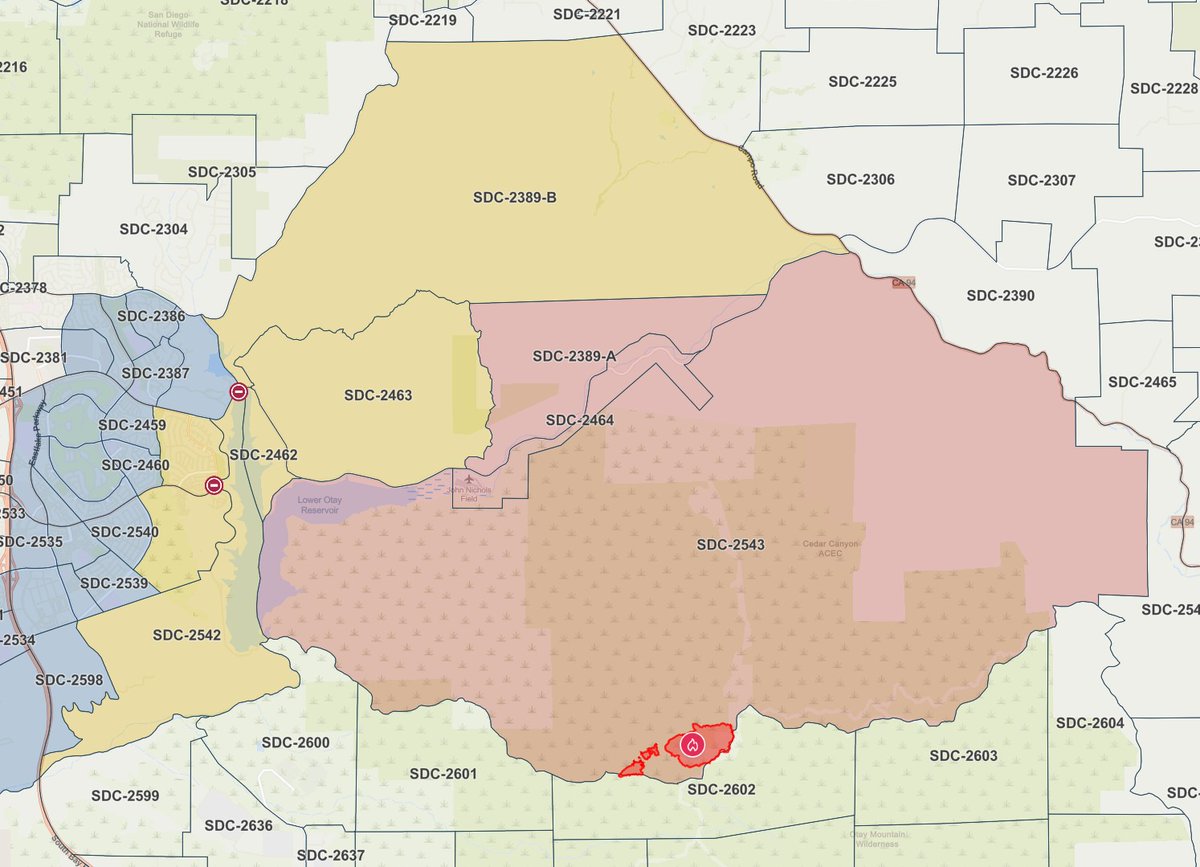
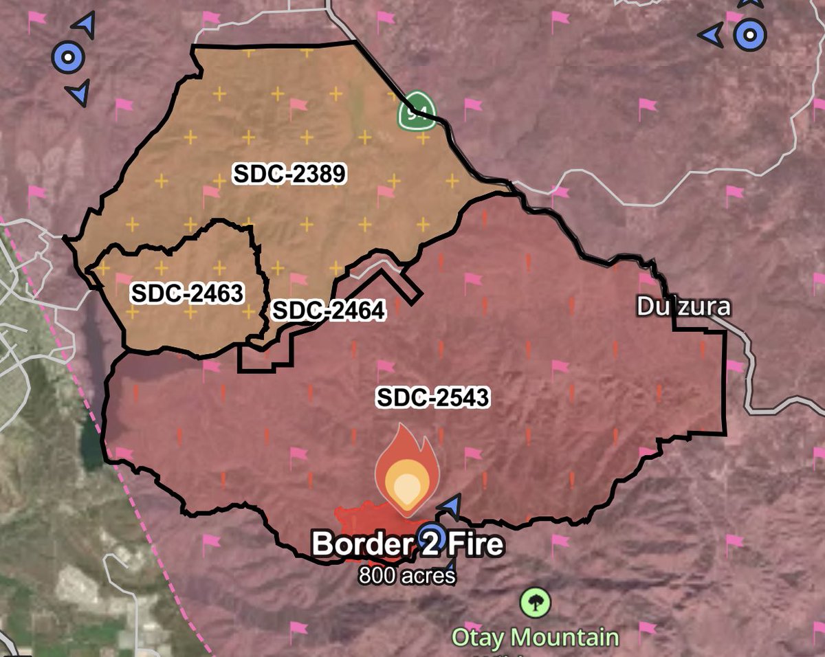
Latest EVACUATION ORDERS (red) and S (yellow) for the Border2Fire.
Earthquake of magnitude 5.7 - 148 km S of Kavieng, Papua New Guinea
 1 day ago
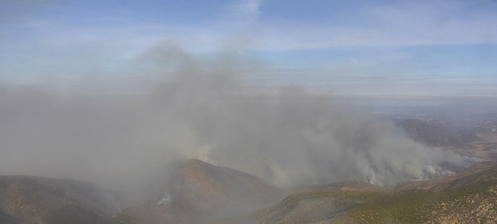
Border 2 Fire AFFECTED AREA: Southwestern San Diego County AFFECTED COMMUNITIES: Otay Mesa and surrounding areas
Earthquake of magnitude 5.3 - 68 km ESE of Palca, Peru
Earthquake of magnitude 4.6 - 194 km WNW of Lata, Solomon Islands
Earthquake of magnitude 4.7 - 79 km NW of Mohr, Iran
Earthquake of magnitude 4.7 - 32 km NNE of Āwash, Ethiopia
Earthquake of magnitude 4.8 - 81 km W of Kendari, Indonesia
 1 day ago
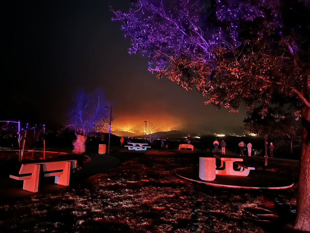
Wildfire in Eastern Chula Vista Near Otay Lake. EVACUATION WARNING in effect. Evacuation site is Southwestern College. People who need extra time should begin evacuating now in an abundance of caution. SWC is open for residents west and south of the lake
LAFD. Brush fire. Park Row and Grand View. 1/4 to 1/2 acre burning with a slow rate of spread near the reservoir. Holding all units. No structures threatened
Active Vegetation Fire incident reported in Elysian Park, Los Angeles
LAFD. Brush fire. Park Row and Grand View. E201 on scene with a fire burning however unable to gain access at this time.
Earthquake of magnitude 5.2 - 3 km WNW of Yujing, Taiwan
 1 day ago
Border2Fire A brush fire is burning near Otay Mountain Truck Trail located within the Otay Wilderness Area.
 1 day ago
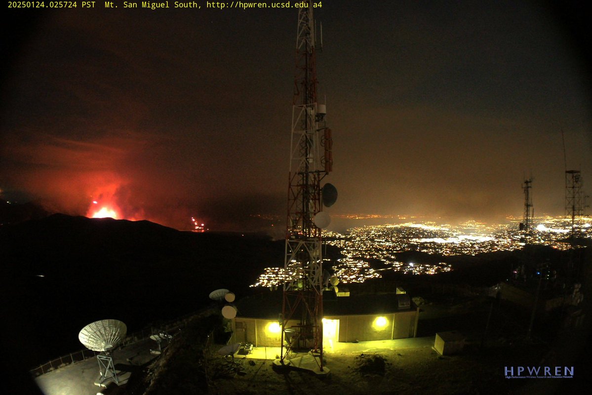
Border2Fire Hearing from Radio Traffic sounds like the Fire is going to Jump Otay Lakes Road. Cal Fire Copter 605 lifted and is enroute from Hemet, Copter 608 is onscene
 1 day ago
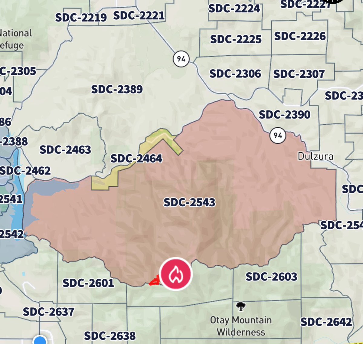
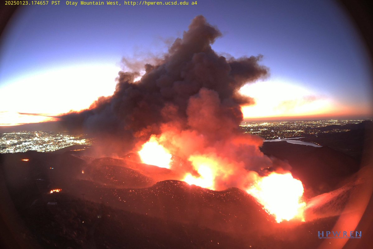
Border2Fire. tTe fire is now 800 acres with long range spotting and extreme fire behavior
Border2Fire The Fire is 800 acres, there is Extreme Fire Behavior ongoing with Long Range Spotting
Earthquake of magnitude 4.8 - Prince Edward Islands region
2.4 magnitude earthquake. 2 mi from Mentone, CA, United States
Earthquake of magnitude 4.6 - 121 km NE of Lobuche, Nepal
2.9 magnitude earthquake. 10 mi from Coachella, CA, UnitedStates
Border2Fire The Fire is 600 acres, Moderate Rate of Spread still, activity has Moderated for the Evening.No night flying aircraft are expected tonight, and there is no Evacuations at this Time
Earthquake of magnitude 4.9 - West Chile Rise
The Border2Fire has now burned over 500 acres in the Otay Mountain Wilderness Area in San Diego County
![Border2Fire [update] The fire is now 566 acres and is 0% contained](https://disasters.liveuamap.com/pics/2025/01/24/22731783_0.jpg) 2 day ago
2 day agoBorder2Fire [update] The fire is now 566 acres and is 0% contained
Fire burning at Otay Mountain jumps to nearly 600 acres with 0% containment
Border2Fire An Intel Flight just Mapped the Fire at 566 acres.The Fire is moving at a Moderate Rate of Spread to the Northwest
Earthquake of magnitude 4.6 - 203 km WNW of Abepura, Indonesia
Vegetation Fire: 28000 Block of Silver Dew Drive in the City of Hemet. CAL FIRE/Riverside County firefighters were requested by the City of Hemet for a vegetation fire, the first arriving Battalion Chief reported three-to-four acres of vegetation burning at a moderate rate. Multiple air and ground resources stopped the forward progress of the fire at 15 acres. Firefighters will remain on scene over night performing mop up
 2 day ago
Border 2 Fire All Aircraft is Released for the Evening, the Fire is 300 acres,The Fire continues to Actively burn, No Night Flying Helicopters were Requested
Earthquake of magnitude 4.7 - 38 km N of Āwash, Ethiopia