Earthquake of magnitude 4.6 - 96 km SSW of Bengkulu, Indonesia
Earthquake of magnitude 4.8 - 52 km NE of Lae, Papua New Guinea
Overnight Friday into Saturday, CALFIRELNU was in unified command with Esparto FPD on a commercial structure fire with spread into the vegetation off of Yolo CR 22, west of Esparto. The structure of origin was a 3,000-sq-ft commercial building filled with bee boxes and bees wax
Strong local government response, no additional structures were damaged. Additional responding agencies include Capay Valley Fire, the Yocha Dehe Fire Department, Willow Oak FPD, Winters Fire, Madison FPD, Yolo FPD and Woodland Fire
Earthquake of magnitude 4.8 - 81 km NNE of Tobelo, Indonesia
Earthquake of magnitude 5.1 - 38 km ESE of Ransiki, Indonesia
Earthquake of magnitude 5.1 - 42 km WSW of Ollagüe, Chile
Earthquake of magnitude 4.6 - 58 km W of Lata, Solomon Islands
Earthquake of magnitude 4.9 - 108 km ENE of Labasa, Fiji
Earthquake of magnitude 4.9 - Kermadec Islands, New Zealand
 2 year ago
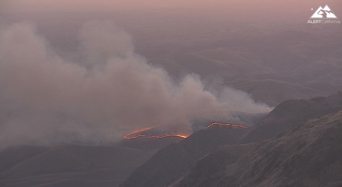
A brush fire, named the Ranch Fire in northeast Bakersfield has burned at least 50 acres, with no known containment, according to brush fire in northeast Bakersfield is burning with no known containment, according to cameras in the area. Fire officials could not be reached at this time for comment
 2 year ago
A brush fire in northeast Bakersfield is burning with no known containment, according to cameras in the area. Fire officials could not be reached at this time for comment
 2 year ago
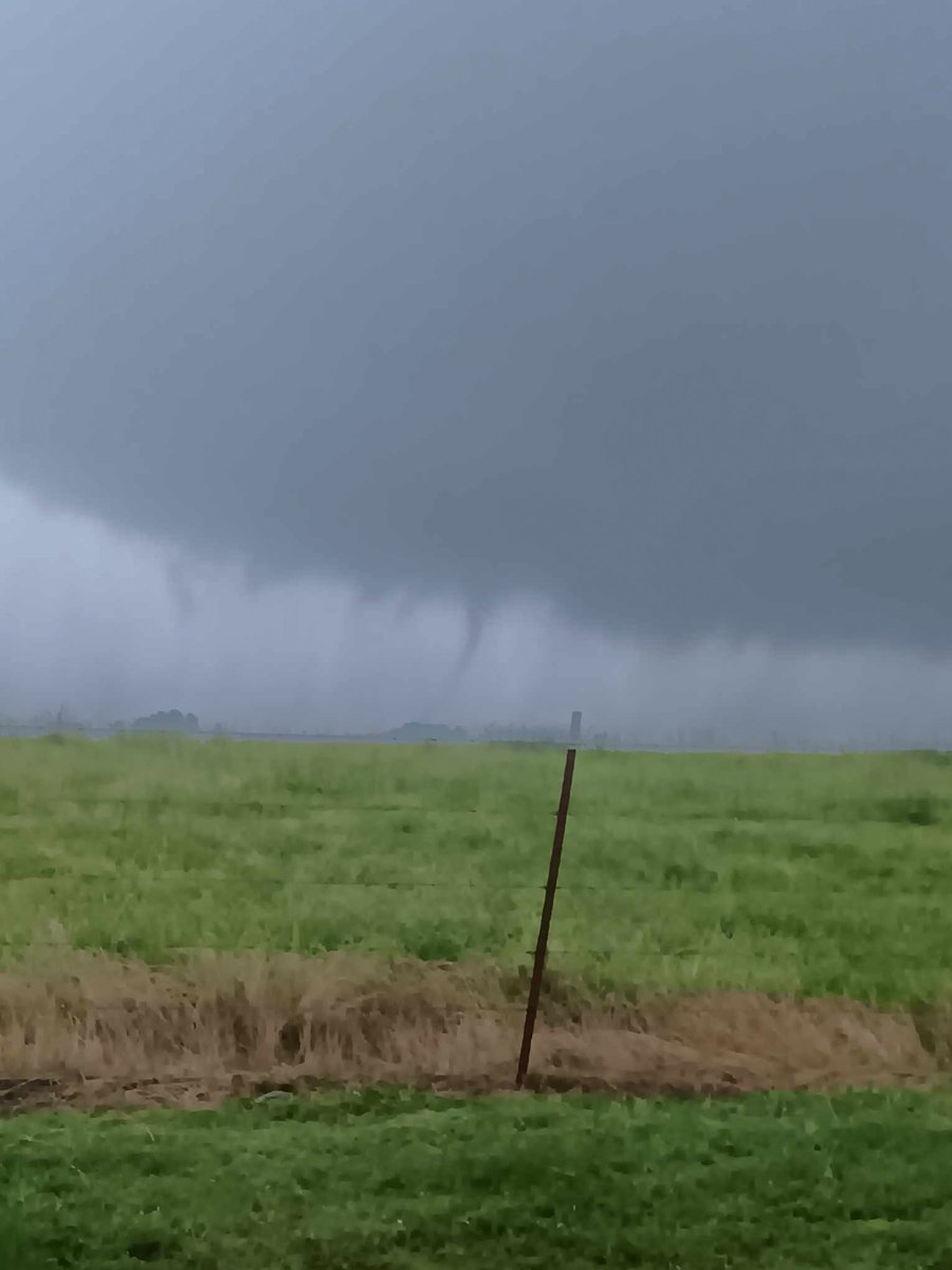
Some minor barn damage in the same area that this funnel/possible tornado was spotted. Both images are from the Gravel Hill Road area in Joy, Arkansas (White County).
 2 year ago
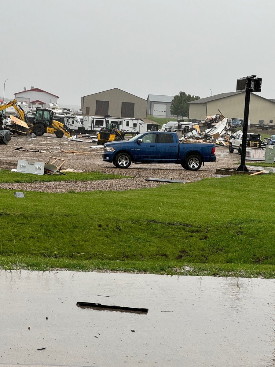
A severe storm damaged several structures in Sheldon, Iowa Friday afternoon. a storm ripped apart several buildings and flipped RVs
Earthquake of magnitude 4.8 - 58 km NW of Pante Makasar, Timor Leste
Earthquake of magnitude 4.6 - 151 km NNW of Masohi, Indonesia
Earthquake of magnitude 4.9 - 159 km ENE of Georgetown, Saint Helena
Earthquake of magnitude 4.7 - 6 km NE of Aras-asan, Philippines
Earthquake of magnitude 5.2 - 151 km ENE of Tatsugō, Japan
Earthquake of magnitude 5.6 - western Xizang
Earthquake of magnitude 4.6 - 70 km SSE of Gorontalo, Indonesia
Earthquake of magnitude 4.8 - Maug Islands region, Northern Mariana Islands
Earthquake of magnitude 5.2 - Kermadec Islands, New Zealand
Earthquake of magnitude 5.1 - Kermadec Islands region
Earthquake of magnitude 4.7 - 23 km W of Uwajima, Japan
A preliminary-magnitude 3.8 earthquake shook the Ojai area in Ventura County, the USGS said
Earthquake of magnitude 5.2 - 11 km NNW of Hualien City, Taiwan
Earthquake of magnitude 6.2 - Kermadec Islands region
Earthquake of magnitude 6.3 - Prince Edward Islands region
Earthquake of magnitude 5.0 - southeast of the Loyalty Islands
Earthquake of magnitude 4.9 - 89 km N of San Vicente, Philippines
Earthquake of magnitude 5.0 - 63 km SE of Panguna, Papua New Guinea
Earthquake of magnitude 5.6 - South Sandwich Islands region
Earthquake of magnitude 4.8 - Volcano Islands, Japan region
Earthquake of magnitude 4.6 - 89 km ENE of Hihifo, Tonga