Earthquake of magnitude 4.8 - 114 km NW of Ternate, Indonesia
Earthquake of magnitude 4.6 - 129 km WNW of Ternate, Indonesia
Earthquake of magnitude 4.7 - 118 km NW of Ternate, Indonesia
 3 day ago
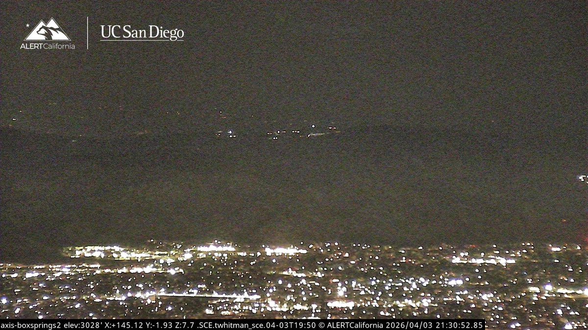
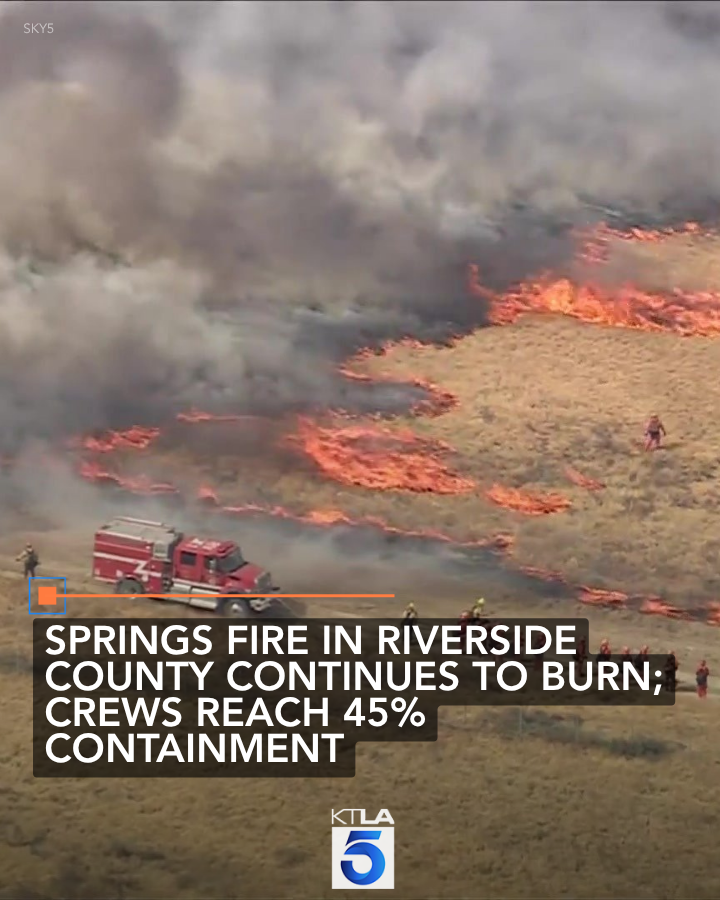
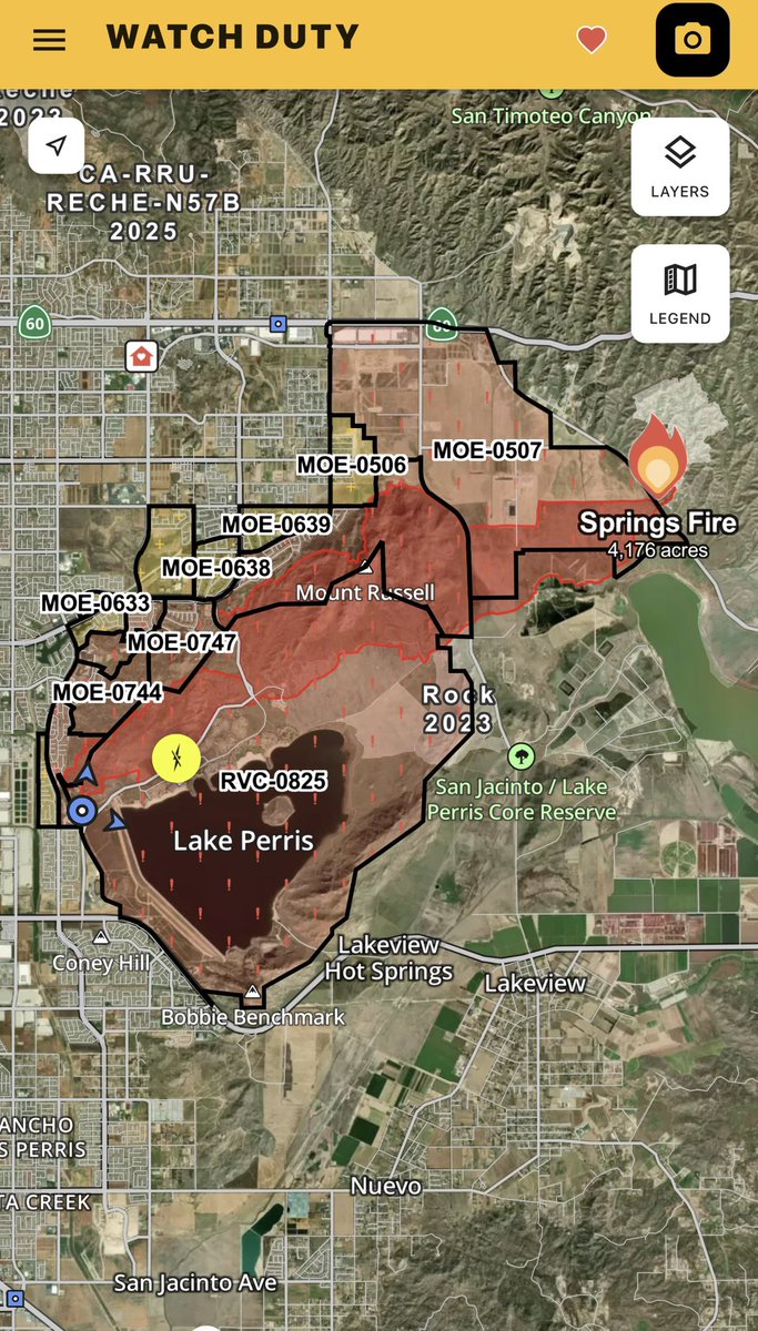
SpringsFire This Morning the Fire sits at 4,175 acres, with 45% containment.Ground crews will continue cutting line around the Fire today and douse possible hotspots still burning.SpringsFire Fire Activity has calmed significantly tonight, expect some drift smoke throughout the night especially with some small spots still burning due to low humidity
Earthquake of magnitude 5.5 - 77 km SSW of Yulara, Australia
Earthquake of magnitude 5.5 - 4 km ENE of Hualien City, Taiwan
Earthquake of magnitude 4.6 - off the coast of Central America
Earthquake of magnitude 5.2 - 160 km E of Kokopo, Papua New Guinea
Earthquake of magnitude 4.6 - 54 km SE of Koseda, Japan
 4 day ago
Firefighters are continuing to battle the Springs Fire in Riverside County on Saturday
Earthquake of magnitude 4.9 - 39 km N of Playas, Ecuador
Earthquake of magnitude 5.2 - 46 km E of Tuapejat, Indonesia
Earthquake of magnitude 4.9 - 33 km ESE of Lae, Papua New Guinea
Earthquake of magnitude 5.0 - 41 km E of Onagawa Chō, Japan
Earthquake of magnitude 6.0 - 90 km SE of Sarangani, Philippines
Earthquake of magnitude 4.8 - 31 km WNW of Cuya, Chile
Earthquake of magnitude 4.6 - 85 km NNW of Fangale’ounga, Tonga
Earthquake of magnitude 5.0 - 246 km N of Hicks Bay, New Zealand
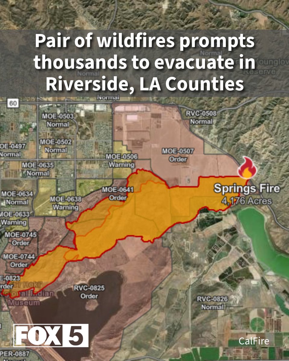
Springs Fire burning in Moreno Valley now 25% contained, CAL FIRE says
Earthquake of magnitude 5.1 - 21 km SSE of Erciş, Turkey
 4 day ago
As raging Southland brush fires stretch from Acton to Moreno Valley, hotter, windier weather is on the way for the weekend.
Earthquake of magnitude 5.5 - Mid-Indian Ridge
 4 day ago
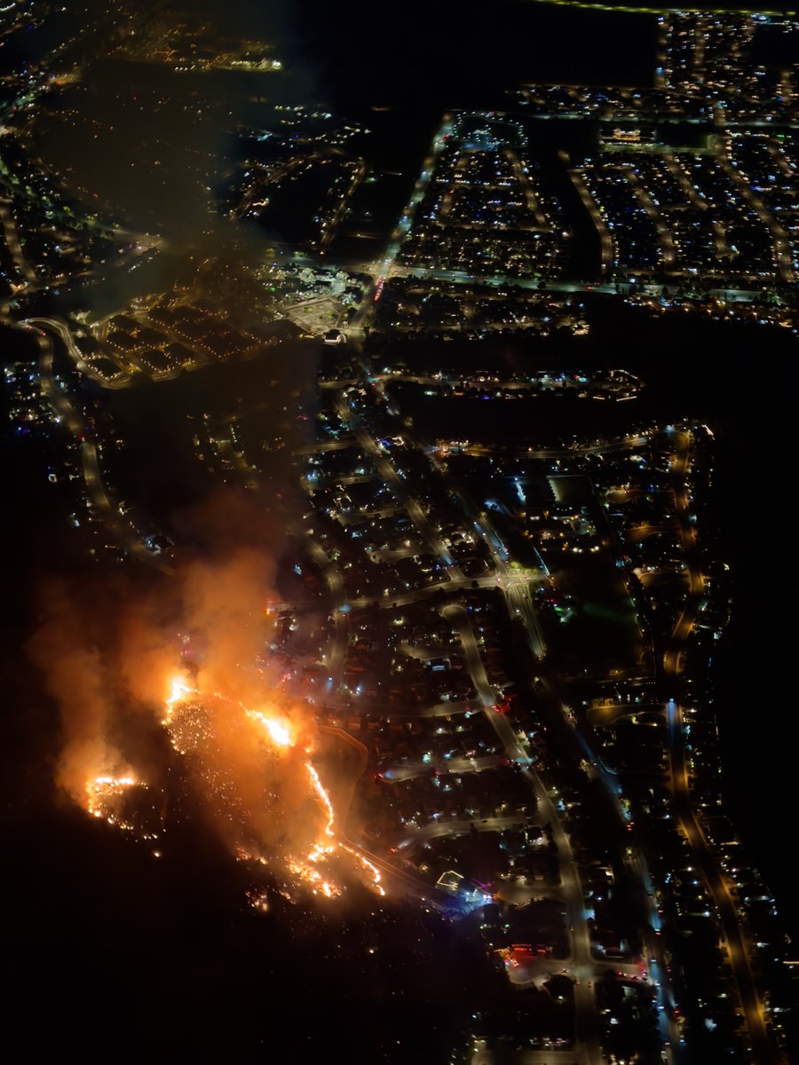
Thousands of people in Riverside and Los Angeles Counties are under evacuation after two wildfires broke out early Friday
Springs Fire burning near homes in Moreno Valley
 4 day ago
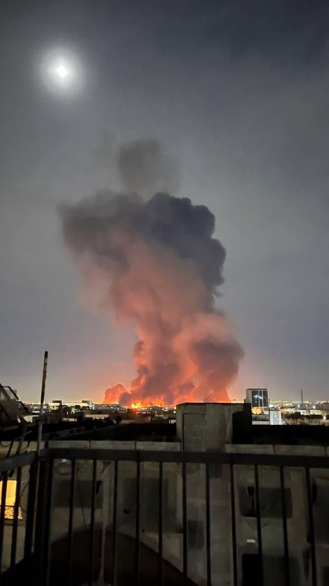
Riverside / California SpringsFire has been mapped in excess of 4100 acres and continues to spread. Multiple areas are under evacuation orders tonightThe fire has been mapped at 4,175.8 acres
 4 day ago
The Springs Fire is raging into the night as it encroaches towards the Ridgecrest neighborhood in Riverside County, CA.
Earthquake of magnitude 4.9 - 115 km ESE of Bitung, Indonesia
Earthquake of magnitude 5.9 - 111 km ESE of Bitung, Indonesia
Earthquake of magnitude 4.7 - 128 km E of Bitung, Indonesia
Earthquake of magnitude 5.1 - 125 km E of Bitung, Indonesia
 4 day ago
The Los Angeles County Fire Department is battling a 2-alarm brush fire in the Acton area that prompted evacuations on Friday afternoon
 4 day ago
SpringsFire The Fire is 1,500 acres, with a Potential for 5,000 acres.Air Attack is wants to put a No Divert on 3 Air Tankers due to Life Safety Threat, and is Requesting 2 Additional Type 1 Copters
 4 day ago
SpringsFire The Fire is in the flats, pushing Northwest, Structures at Via Del Lago and Moreno Beach
 4 day ago
The CrownFire is now at 250 acres with a potential for 600 acres. Very powerful winds in the area.Heres the evacuation map. Acton is circled in black just to get an idea. Still no acknowledgment from the 2 air tankers that were requested so there still waiting on that.
80 l N Crown Valley Rd/ Soledad Canyon Rd. Acton At 11:23 a.m. LACoFD units arrived to a 2nd alarm brush fire, currently at approximately 80 acres with moderate rate of spread
 4 day ago
The fire is now 80 acres with a potential for 300. Moving at a moderate rate of spread.Structures are threatened,Units are trying to prevent the fire from jumping Soledad Canyon Rd. CrownFireThe CrownFire is now 30 acres burning in light to medium fuels.Still wind driven.Mandatory evacuations going out for nearby homes.Air Tankers 70 & 85 is overhead as also enroute
 4 day ago
Structure protection group has been set up.2 houses have been evacuated.There are only 2 helicopters on this fire so far. CrownFirePer Copter 22 the fire is spotting ahead of its self. Has a strong potential for multiple structural threats. Requesting a second alarm brush response
VEGETATION FIRE 15900 block Gilman Springs Road, east of Moreno Valley. Firefighters are on-scene of 5-6 acres burning in light flashy fuels. Gilman Springs Road is closed from Alessandro Road to Bridge Street
Earthquake of magnitude 5.8 - 35 km S of Jurm, Afghanistan
Earthquake of magnitude 4.6 - 220 km ESE of Attu Station, Alaska
Earthquake of magnitude 5.1 - 132 km NW of Ternate, Indonesia
Earthquake of magnitude 5.5 - 49 km ESE of Rasht, Tajikistan
Earthquake of magnitude 4.9 - 127 km WNW of Ternate, Indonesia
Earthquake of magnitude 5.1 - 223 km ESE of Attu Station, Alaska
Earthquake of magnitude 5.2 - 101 km E of Bitung, Indonesia
Earthquake of magnitude 5.4 - 111 km WNW of Ternate, Indonesia
Earthquake of magnitude 4.8 - 116 km S of Hihifo, Tonga
Earthquake of magnitude 5.0 - Kermadec Islands region
Earthquake of magnitude 4.9 - 128 km ESE of Bitung, Indonesia
Earthquake of magnitude 5.1 - Kuril Islands
Earthquake of magnitude 4.8 - 110 km W of Ternate, Indonesia
Earthquake of magnitude 4.7 - 129 km W of Ternate, Indonesia
Earthquake of magnitude 5.3 - 124 km WNW of Ternate, Indonesia
Earthquake of magnitude 4.6 - 118 km W of Ternate, Indonesia
Earthquake of magnitude 5.3 - 130 km WNW of Ternate, Indonesia
Earthquake of magnitude 5.4 - 117 km WNW of Ternate, Indonesia
Earthquake of magnitude 5.4 - 73 km NNE of Isangel, Vanuatu