 1 day ago
For the MesaFire Air Attack 310 Requested 2 Additional Type 1 Helicopters, unable to Drop the Air Tankers due to low visibility.This is the MesaFire, heard a bunch of mixed chatter sounded like AA310 said the Fire is 75 acres.Air Attack 310 is overhead on another Fire in the Whiskey Impact Area, 3 acres head of the Fire is burning into a burnscar
Earthquake of magnitude 4.6 - Chagos Archipelago region
Earthquake of magnitude 5.0 - 85 km E of Petropavlovsk-Kamchatsky, Russia
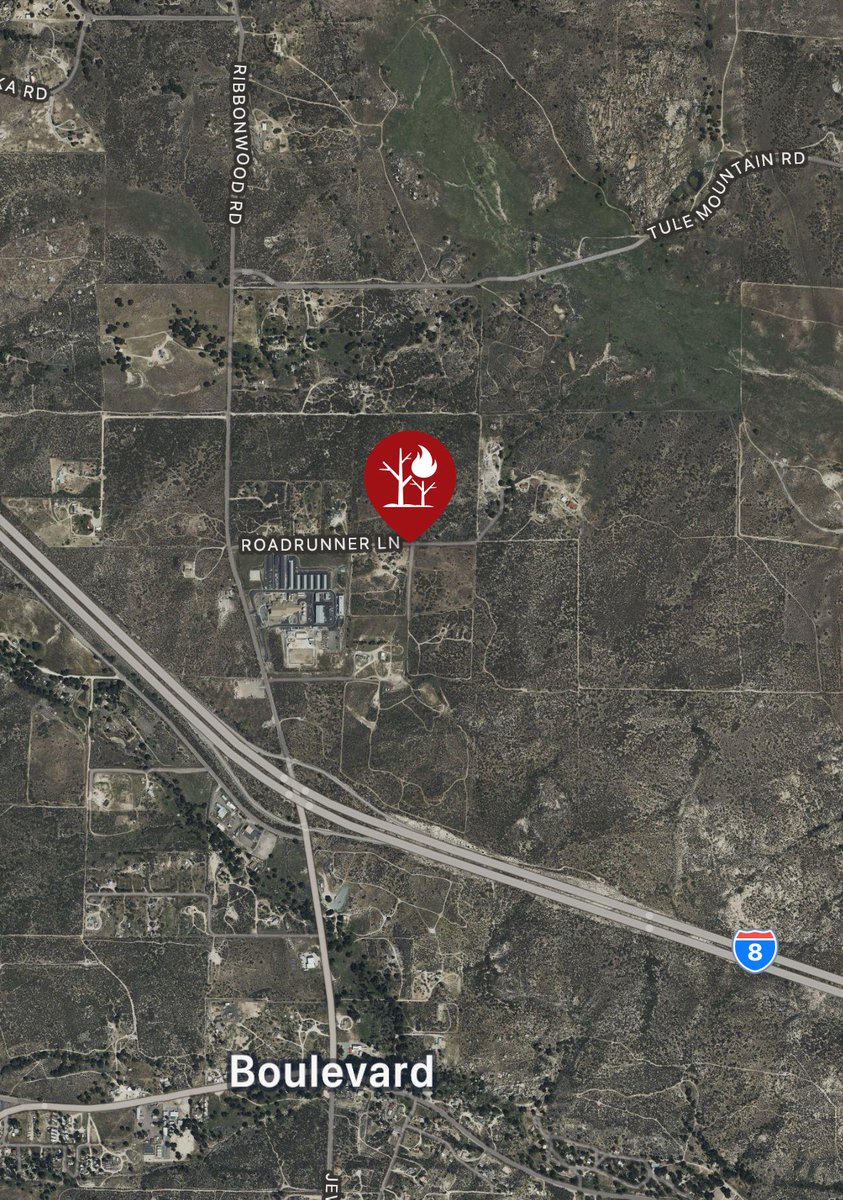
![RoadrunnerFire [update] The fire is now 25 acres and is 0% contained](https://disasters.liveuamap.com/pics/2025/08/08/22779083_0.jpg) 1 day ago
1 day agoRoadrunnerFire [update] The fire is now 25 acres and is 0% contained
 1 day ago
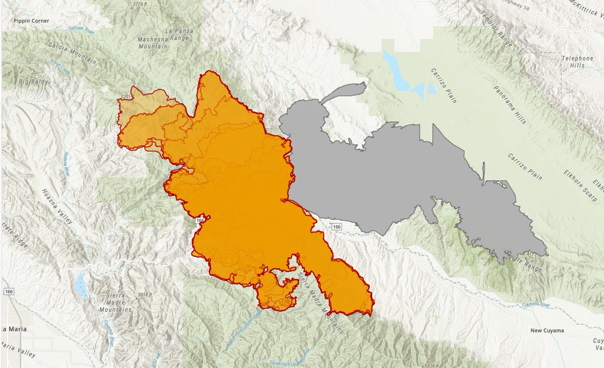
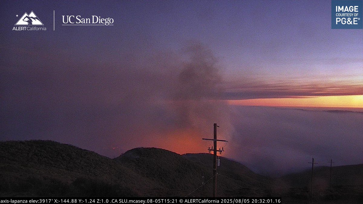
GiffordFire has been updated to 101,933 acres
 1 day ago
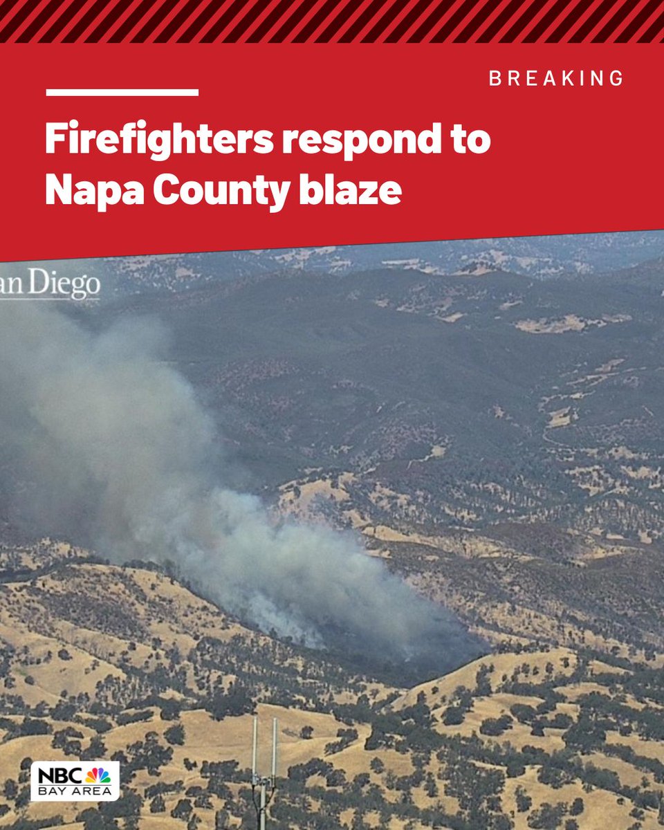
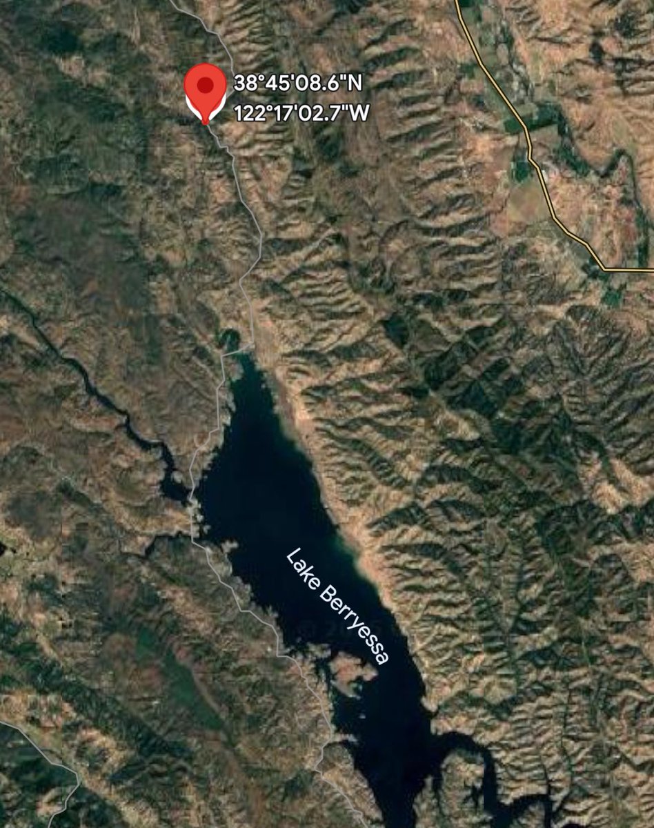
Brush fire burns about 50 acres north of Lake Berryessa in Napa County, Cal Fire says
 1 day ago
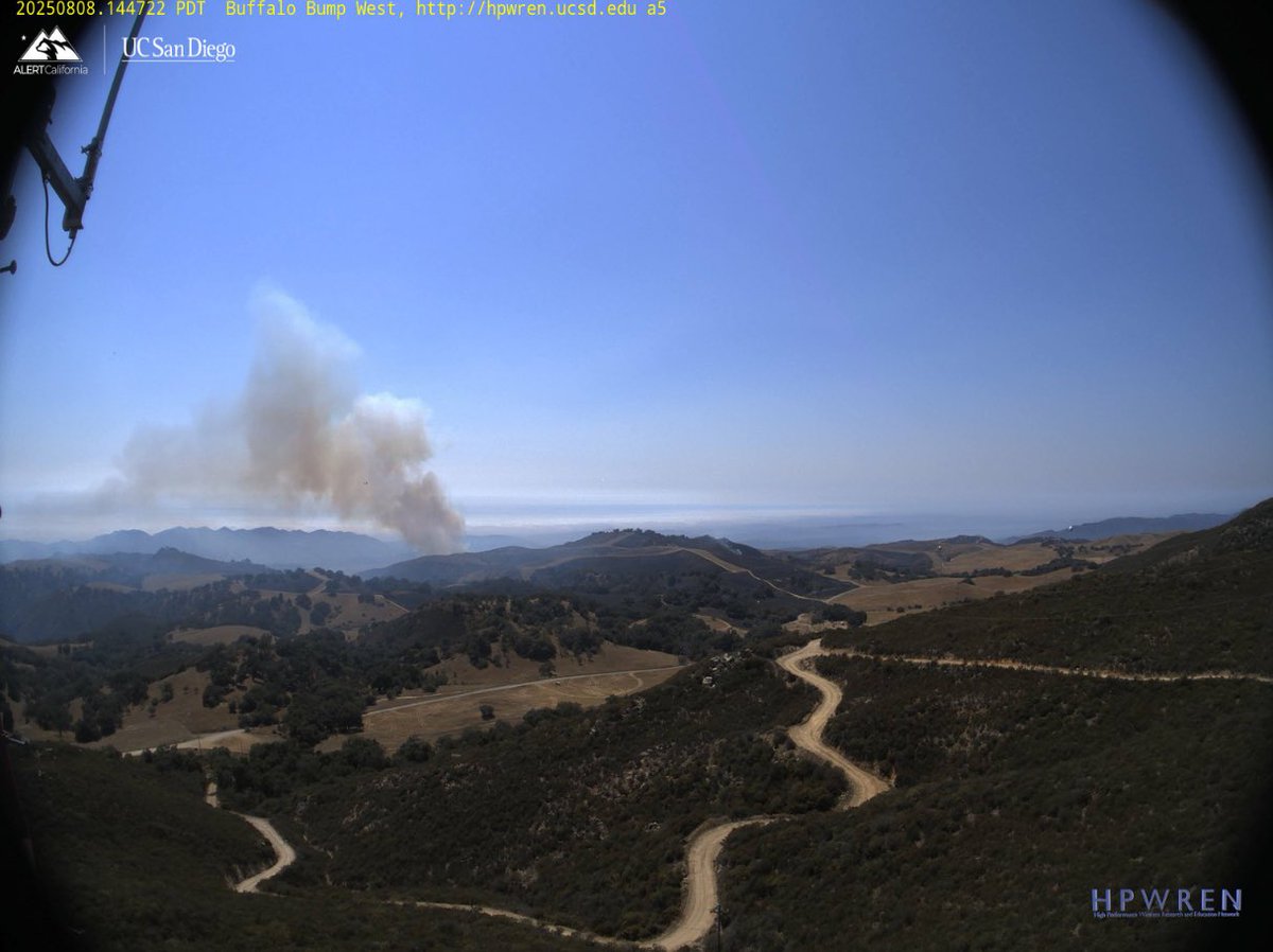
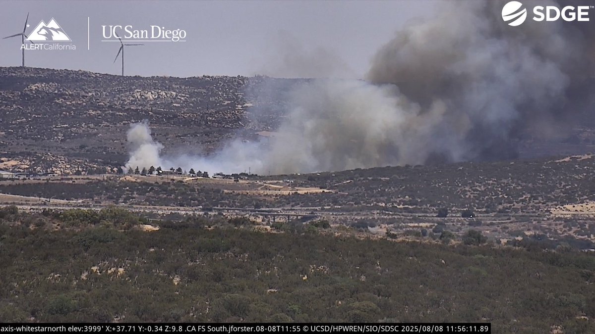
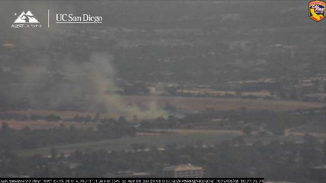
New Brush Fire Roadrunner Lane, Boulevard, San Diego County.10 acres, Moderate Rate of Spread.Air Attack 330, Air Tankers 70, 71, Copter 14, 128
 1 day ago
@CALFIRESANDIEGO is at scene of a vegetation fire near Roadrunner Lane and Moonlit Trail in Boulevard. Fire is 10 acres, moderate rate of spread with immediate structure threat
Gifford Fire: Minimal growth overnight; area burned remains steady at 99,232 acres
 1 day ago
Berryessa Knoxville Road, north of Lake Berryessa (Napa County)Time of Dispatch: 10:50 a.m. Aug. 8, 2025 Initial Report on Conditions: The fire is approximately 50 acres burning at a moderate rate of spread. Units at seen are
LAFD Alert-Knockdown - SepulvedaBasin Brush Fire 5600 N Woodley Av FS88; Fire Held To Seven (7) Acres. No Injury. No Structures. No Evacuation
Earthquake of magnitude 4.8 - 94 km W of San Antonio de los Cobres, Argentina
 1 day ago
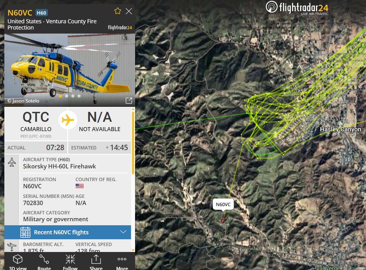
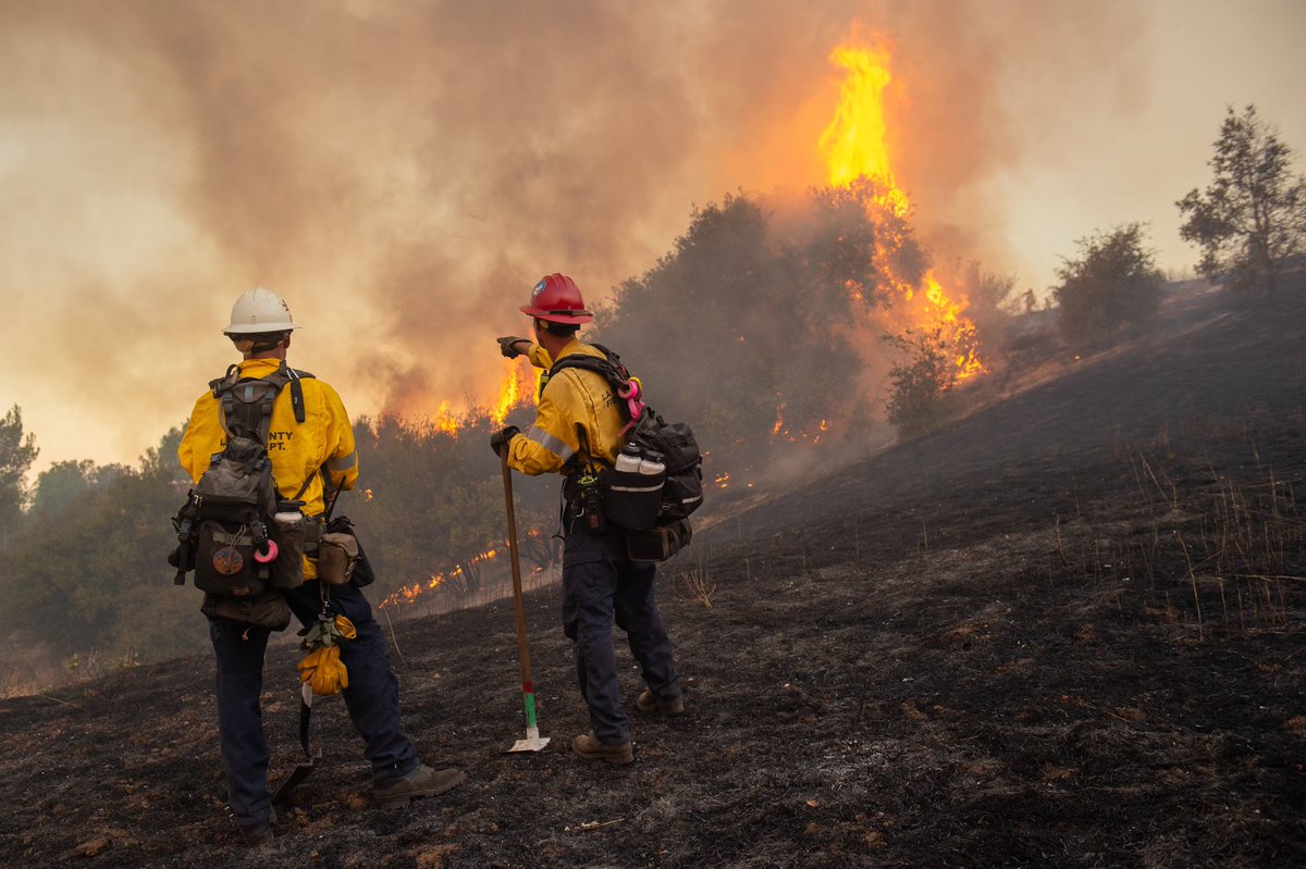
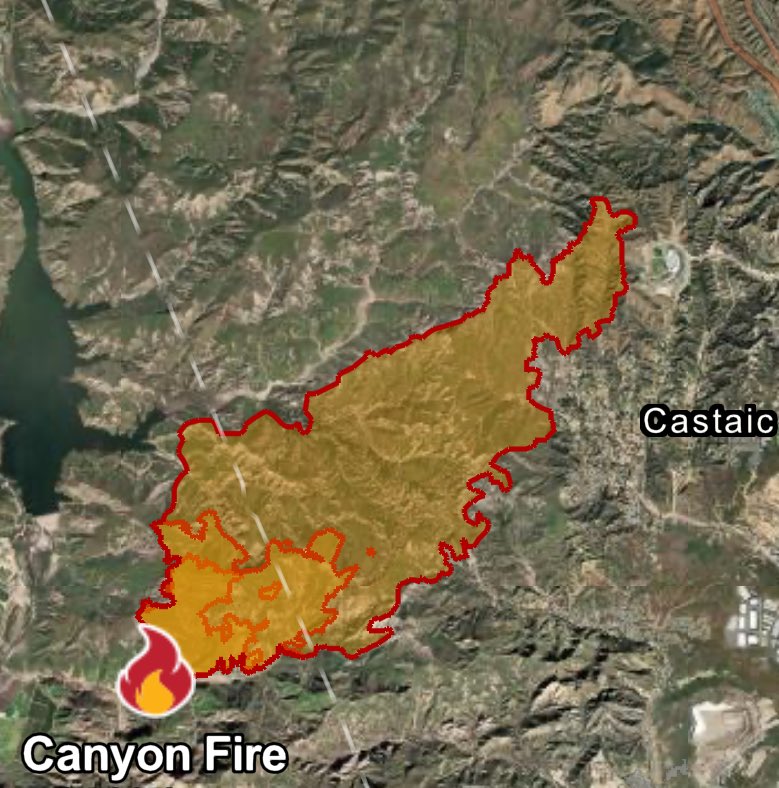
CanyonFire 17 homes have been affected by the fireCanyonFire : 7 homes have been destroyed and another 10 damaged by the fire. @VCFD copter working hot spots at the head of the fire along Hasley Canyon
 1 day ago
Another fire in the Sepulveda Basin LAFD
LAFD Alert- SepulvedaBasin Brush Fire 5600 N Woodley Av FS88; LAFD ground and air response to one-quarter (0.25) acre burning in light grass north of Burbank Boulevard
Earthquake of magnitude 4.7 - 256 km WSW of Tual, Indonesia
LosAngeles / California Dramatic video of a home EXPLODING during the CanyonFire Fire is over 5,000 acres now with multiple homes burned
 1 day ago
CanyonFire : 7 homes have been destroyed and another 10 damaged by the fire. @VCFD copter working hot spots at the head of the fire along Hasley Canyon
 1 day ago
CanyonFire Morning update: The fire is now over 4,856 acres & 0% contained. Fire activity overnight was pretty mild.
Earthquake of magnitude 4.8 - 192 km ESE of Severo-Kuril’sk, Russia
Earthquake of magnitude 5.0 - 93 km S of Vilyuchinsk, Russia
Earthquake of magnitude 4.7 - 192 km SSE of Vilyuchinsk, Russia
Earthquake of magnitude 5.3 - 103 km W of Tobelo, Indonesia
Earthquake of magnitude 4.7 - 55 km N of Naisano Dua, Indonesia
Earthquake of magnitude 4.7 - 84 km ESE of Takahagi, Japan
Earthquake of magnitude 4.6 - 75 km ENE of Kokopo, Papua New Guinea
Earthquake of magnitude 4.8 - 153 km SSW of Severo-Kuril’sk, Russia
Castaic: Canyonfire has now burned over 4,500 acres. Video shows damages to property and the firefighters working tirelessly to contain the blaze. Threats overnight in the ‘Silverstrand Movie Ranch’. Fire crews were on standby as flames burned through the 200 acre property
Earthquake of magnitude 4.7 - 115 km ESE of Severo-Kuril’sk, Russia
Earthquake of magnitude 4.8 - 26 km ESE of Mungaa, Tanzania
3.6 magnitude earthquake. 133 km SW of Point Hope, Alaska
Multiple areas in Los Angeles County are under evacuation orders as a new wildfire, dubbed the "Canyon Fire," has rapidly spread, burning nearly 5,000 acres
The Canyon Fire continues to grow in Ventura and Los Angeles Counties. At least 1 structure has burned so far
 2 day ago
Close up look of Hasley Canyon, Castaic, Val Verde, 1 more labeled with road names other one being a satellite picture.OES Intel 24 has Mapped the CanyonFire at 4,856 acres,
Earthquake of magnitude 4.6 - 37 km E of Port-Olry, Vanuatu
CANYON FIRE l Castaic LACoFD 4856 acres, no residences damaged, no reported injuries.
Earthquake of magnitude 4.6 - 218 km ESE of Severo-Kuril’sk, Russia
Earthquake of magnitude 4.6 - 104 km E of Severo-Kuril’sk, Russia
3.7 magnitude earthquake. 56 mi from Sand Point, AK, UnitedStates
3.4 magnitude earthquake. 172 km WNW of Port Orford, Oregon
Earthquake of magnitude 4.8 - 162 km S of Severo-Kuril’sk, Russia
Earthquake of magnitude 4.6 - southeast of the Loyalty Islands
Earthquake of magnitude 4.9 - 111 km ESE of Severo-Kuril’sk, Russia
Earthquake of magnitude 4.8 - 16 km E of Severo-Kuril’sk, Russia
VEGETATION FIRE - Granite Hill Drive / Camino Real Road in the the city of @jurupaValleyGov. Firefighters are on-scene of a 10 acre vegetation fire burning at a moderate rate of spread. Additional resources responding
Earthquake of magnitude 4.7 - 51 km NE of Punta Cana, Dominican Republic
Earthquake of magnitude 4.8 - 132 km WNW of Salahonda, Colombia
Earthquake of magnitude 5.1 - 195 km E of Severo-Kuril’sk, Russia
Earthquake of magnitude 4.7 - 194 km SE of Vilyuchinsk, Russia
Earthquake of magnitude 4.7 - 228 km ESE of Petropavlovsk-Kamchatsky, Russia
Earthquake of magnitude 5.1 - 246 km ESE of Severo-Kuril’sk, Russia
2.38 magnitude earthquake. 42 mi from Cascade, ID, United States
Earthquake of magnitude 4.6 - 161 km SSW of Severo-Kuril’sk, Russia
2.6 magnitude earthquake. 232 km W of Crescent City, California
Earthquake of magnitude 4.8 - 88 km SE of Ozernovskiy, Russia
Earthquake of magnitude 6.0 - 76 km E of Kokopo, Papua New Guinea
Earthquake of magnitude 5.3 - 53 km WSW of Padangsidempuan, Indonesia
2.9 magnitude earthquake. 28 mi from Bridgeport, CA, United States
Earthquake of magnitude 4.8 - 3 km NNE of Methóni, Greece
Earthquake of magnitude 4.9 - 157 km SSE of Lata, Solomon Islands
Earthquake of magnitude 5.2 - 143 km SSE of Vilyuchinsk, Russia
Earthquake of magnitude 4.8 - 175 km SSE of Vilyuchinsk, Russia
Earthquake of magnitude 5.9 - 18 km N of Yonakuni, Japan
 3 day ago
GiffordFire This is most likely a Firing Operation looking back at Cams seems like the Fire was getting dragged along on the Plowshare Peak Cam. GiffordFire All Air Tankers and Helicopters are Released.
2.4 magnitude earthquake. 27 mi from Hawthorne, NV, UnitedStates
Earthquake of magnitude 4.7 - 259 km SE of Vilyuchinsk, Russia
Earthquake of magnitude 5.2 - 233 km SE of Petropavlovsk-Kamchatsky, Russia
Earthquake of magnitude 4.7 - 188 km SSE of Vilyuchinsk, Russia
Earthquake of magnitude 4.6 - 185 km SE of Sarangani, Philippines
Earthquake of magnitude 4.6 - Reykjanes Ridge
Earthquake of magnitude 4.6 - 157 km S of Severo-Kuril’sk, Russia
Earthquake of magnitude 5.3 - West Chile Rise
Earthquake of magnitude 4.7 - 220 km SE of Petropavlovsk-Kamchatsky, Russia
Earthquake of magnitude 4.9 - 258 km S of Ushuaia, Argentina
Earthquake of magnitude 4.9 - 12 km S of Tsukawaki, Japan
Earthquake of magnitude 5.0 - southern Mid-Atlantic Ridge
Earthquake of magnitude 4.7 - 143 km SE of Petropavlovsk-Kamchatsky, Russia
Earthquake of magnitude 5.2 - 68 km NE of Fangale’ounga, Tonga