3.0 magnitude earthquake. 23 km from Soledad, CA, UnitedStates
3.0 magnitude earthquake. 23 km from Soledad, CA, UnitedStates
 3 year ago
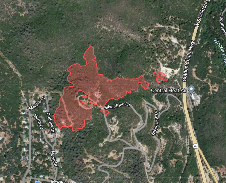
WoodsFire (Jamestown/Sonora, Tuolumne Co) - FIRIS mapped the fire at approximately 20 acres, several spot fires - map below is from their data. Perimeters don't reflect structure protection efforts on the ground
3.0 magnitude earthquake. 23 km from Soledad, CA, United States
 3 year ago
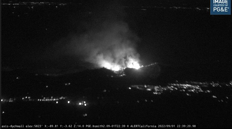
WoodsFire (Jamestown/Sonora, Tuolumne Co) - 40 acres in heavy fuels & steep terrain per the CAL FIRE TCU update from about a half hour ago. The fire is backing into the Golden Links Subdivision
Earthquake of magnitude 5.1 - 266 km NNE of Bamboo Flat, India
Earthquake of magnitude 5.6 - 252 km NNE of Bamboo Flat, India
 3 year ago
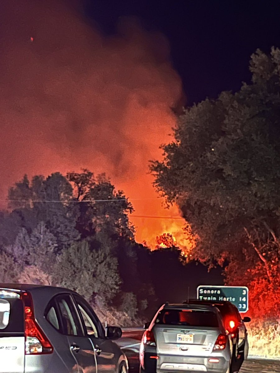
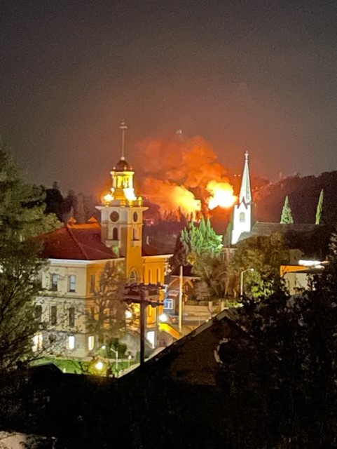
Looking toward the WoodsFire from Jamestown, 3 miles away from Sonora. We just arrived at this spot moments ago. We can see flames, bright orange glow in the night sky. Evacuees/people stopped on the side of Hwy 49 looking fire
 3 year ago
Mandatory evacuation orders and evacuation warnings in effect because of WoodsFire burning near Sonora in Tuolumne County.
 3 year ago
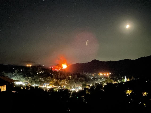
WoodsFire in Tuolumne Co. progressing - photo taken from Meyers Hill in Sonora courtesy. ROAD CLOSURES per Tuolumne Co. Sheriff Stockton Road from Hwy 108 to Ponderosa Way
 3 year ago
WoodsFire (Jamestown/Sonora, Tuolumne Co) - IC requesting 3 strike teams of type 3 engines (15 engines), 2 strike teams of handcrews (4 crews) + 2 strike teams of dozers (4 dozers) immediate need. 1 Air Attack, 4 tankers + 4 copters for tomorrow morning
 3 year ago
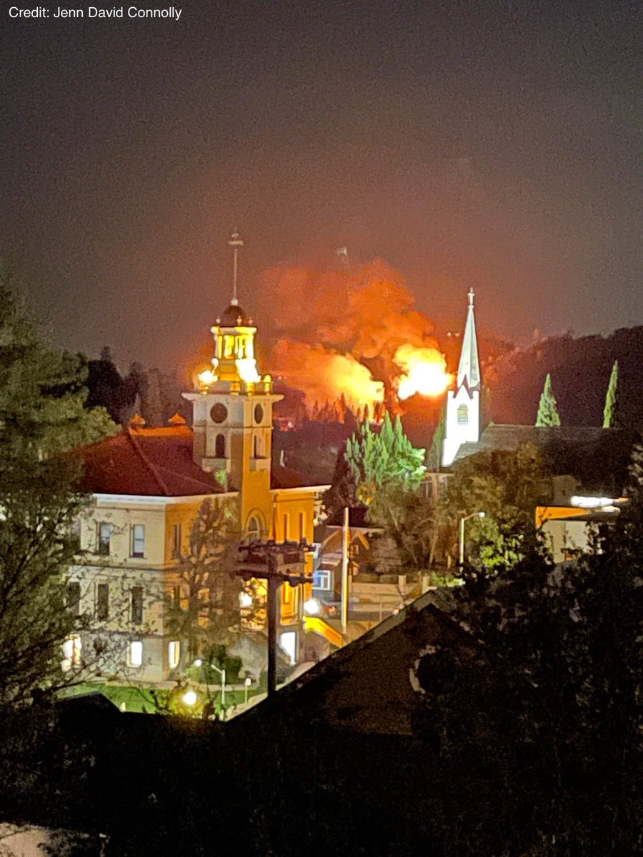
Shepherd St. in Sonora of WoodsFire. Photos courtesy of Jenn David Connolly
 3 year ago
5 additional engines any type needed at McKibbon road for structure defense due to long range spotting. Evacuation orders and warnings are changing fast
 3 year ago
WoodsFire (Jamestown/Sonora, Tuolumne Co) - IC requesting 5 additional engines immediate need closest resource for structure protection in the McKibbon Dr area due to long range spotting. Evac orders & warnings are changing very rapidly
 3 year ago
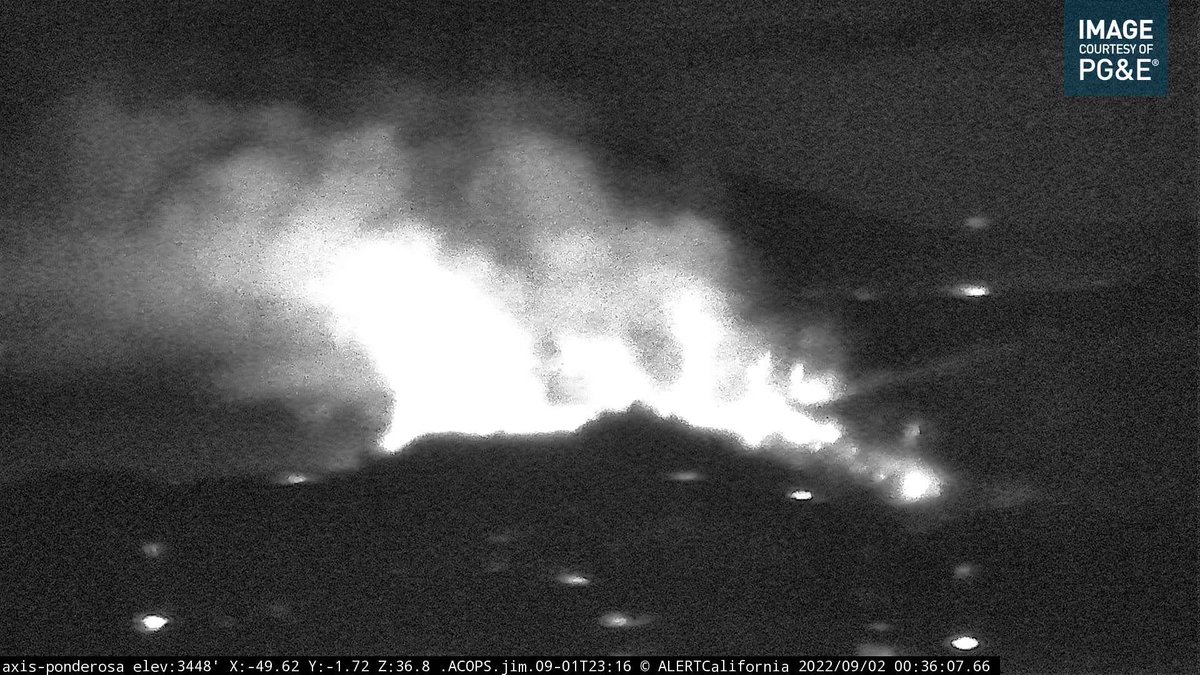
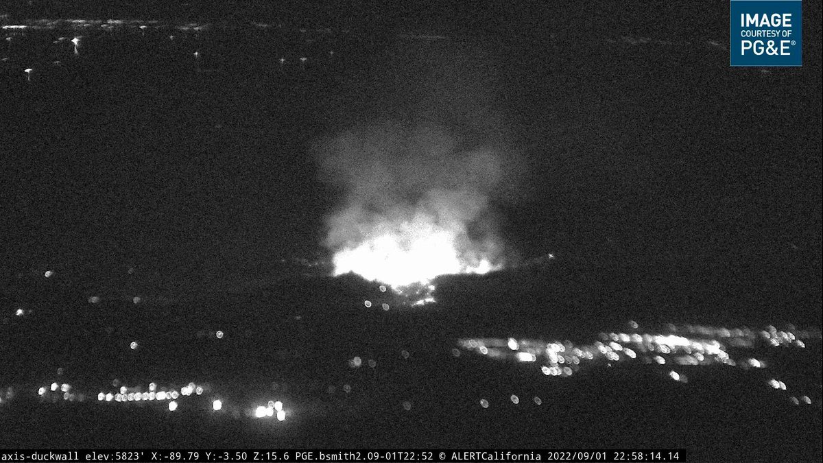
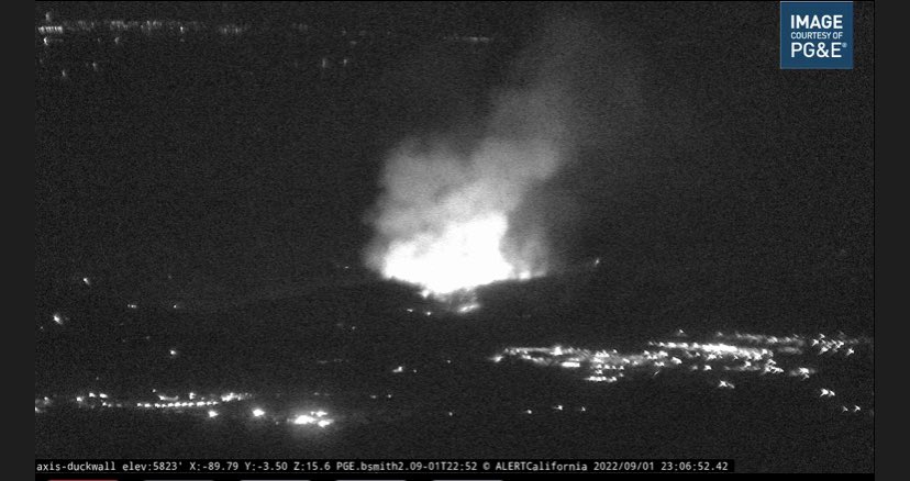
Evacuation orders have expanded as the fire continues to burn near the towns of Jamestown and Sonora. Below is a photo taken by an AlertWildfire camera in the area moments ago. as info comes
The sheriff's office has called for evacuations along two roads
 3 year ago
A vegetation fire burning just outside of the Tuolomne County community of Sonora has prompted evacuations.
Fire prompts evacuation orders near Jamestown, Sonora in Tuolumne County
Earthquake of magnitude 5.0 - 281 km WNW of Neiafu, Tonga
Earthquake of magnitude 4.6 - Kepulauan Barat Daya, Indonesia
Earthquake of magnitude 4.7 - 27 km SSE of Singkil, Indonesia
Earthquake of magnitude 4.7 - 31 km SSW of Adak, Alaska
Earthquake of magnitude 4.7 - South Sandwich Islands region
Crews have investigated the area and have confirmed that the smoke in our district is a result of drift smoke from the Border32Fire burning in San Diego County. Heavy smoke is seen throughout our district. There is no fire threat to our district
 3 year ago
Border32Fire - Barrett Junction/Potrero - FIRIS has mapped the fire at 4,438 acres as of 25 minutes ago. Minimal fire activity visible on the cameras for the past several hours. Numerous air and ground resources on scene.
Earthquake of magnitude 5.2 - Kepulauan Barat Daya, Indonesia
Earthquake of magnitude 4.6 - western Texas
 3 year ago
Firefighters continue to battle the 4,200+ acre blaze. The Tecate Port of Entry remains closed and power is out for 400 homes. Ongoing updates here:
Magnitude 4.0 earthquake felt near Soledad, Calif
Earthquake of magnitude 4.7 - 34 km E of Sulangan, Philippines
 3 year ago
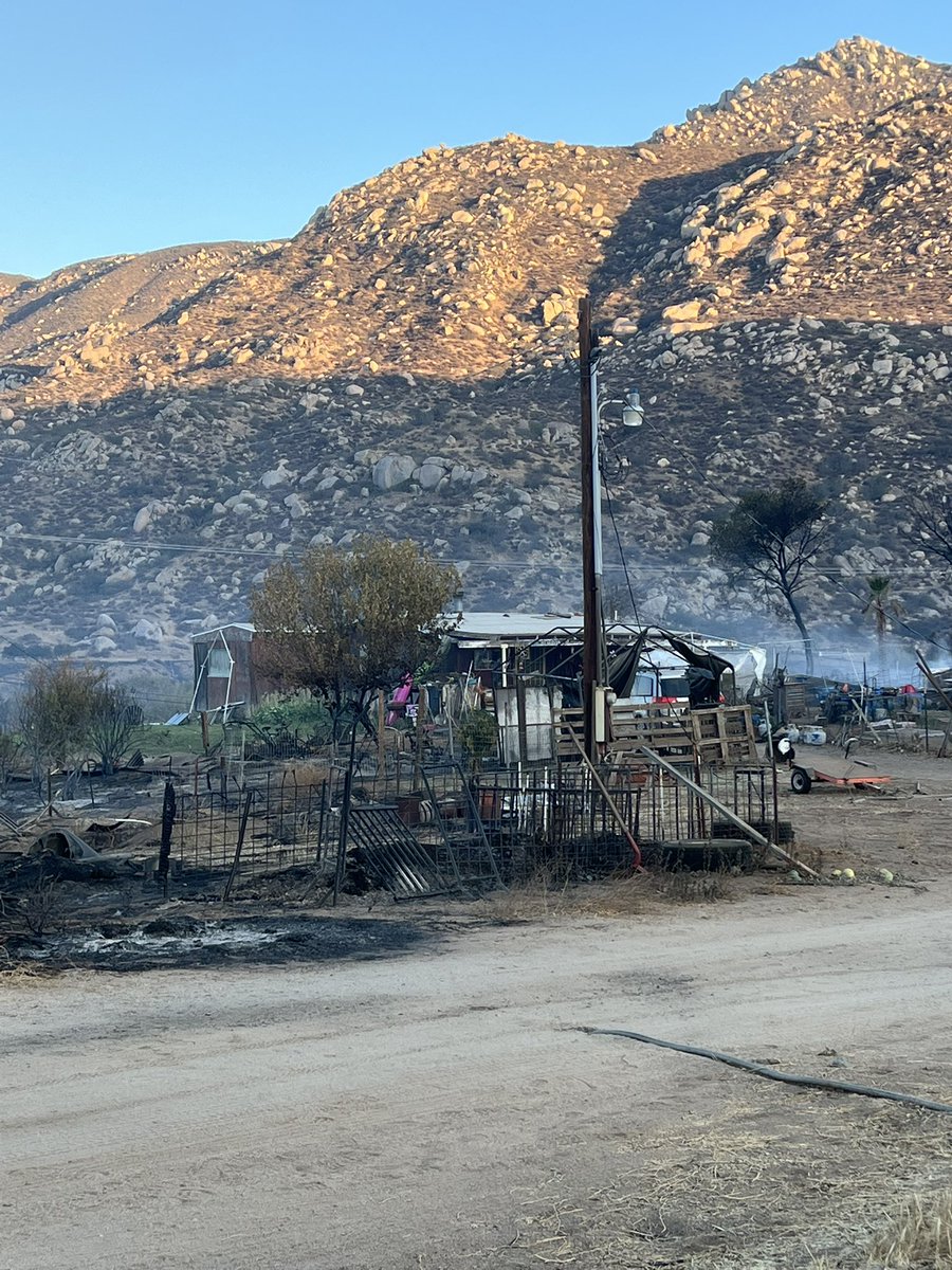
Just spoke to a family who returned home to see what remained. Their house was saved but cars, barns, and chickens were burned. They are looking for two horses they let run free.
Earthquake of magnitude 4.7 - 295 km WNW of Neiafu, Tonga
Earthquake of magnitude 4.9 - 47 km SE of Nichinan, Japan
 3 year ago
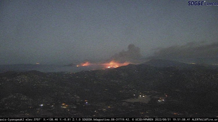
Border32Fire (San Diego Co) - This is what the fire perimeter looked like from the FIRIS update at 9:30pm. Not much to report since - per radio traffic: the fire has laid down, resources are picking up spot fires & keeping the fire in place for now
Earthquake of magnitude 4.9 - 58 km NNE of Calama, Chile
Earthquake of magnitude 5.4 - Owen Fracture Zone region
 3 year ago
The camera view is looking @ south end. The entire Quick Reaction Force just departed their bases heading to this fire for night time drops: FW76 + Helitankers 47, 55 & 61. FIRIS also overhead = better maps soon
 3 year ago
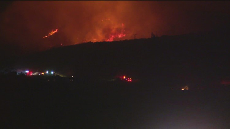
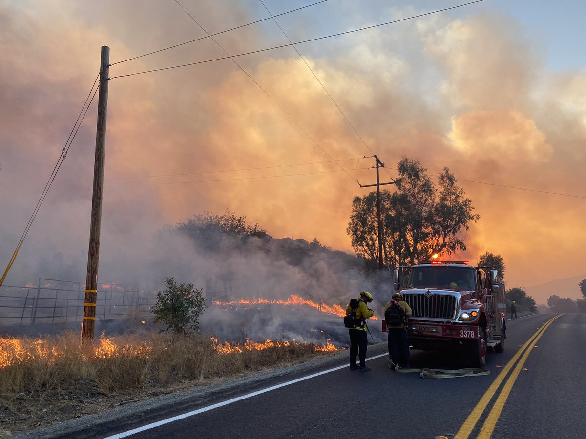
Erratic fire behavior at the Border32Fire this evening as it barrels toward the US border with Mexico
A brush fire burning near Dulzura has so far scorched 4,243 acres and 5% contained
 3 year ago
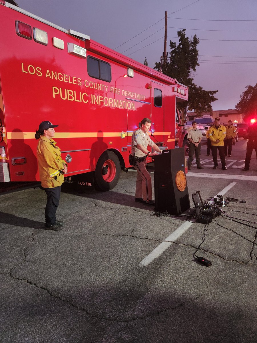
Border32Fire in San Diego County explodes in size. Erratic fire behavior shuts down US/Mexican border, closes highways, burns buildings, sparks evacs and injures civilians and a firefighter.
RouteFire evacuations north of Lake Hughes Road, east of I-5, west of Castaic Lagoon, and south of Northlake Hills Elementary School are being lifted
 3 year ago
Border32 1,600 acres have burned. 400+ structures are in the path of the fire. crews are tracking shifting winds trying to keep it from pushing further into heavily populated Tecate Dulzura SanDiegoCounty
RouteFire (Castaic, LA County) - Evacuation orders have been lifted for the area south of Northlake Hills Elementary School to Lake Hughes Rd per SCV Sheriff's. Evacuation orders remain in place for areas north of the school
Due to Border Fire 32, schools in the Mountain Empire Unified School District will be closed on Thursday, Sept. 1, 2022. The Jamul-Dulzura Union School District has canceled or adjusted several bus routes
RouteFire : Officials say 4625 acres have burned. Eight firefighters suffered heat-related injury, six of which were transported. No structures are threatened at this time. Evacuation orders remain in effect
Earthquake of magnitude 4.6 - 48 km S of Champerico, Guatemala
 3 year ago
Officials say the brush fire in Castaic has grown to 4625 acres. 100-200 homes have been evacuated
 3 year ago
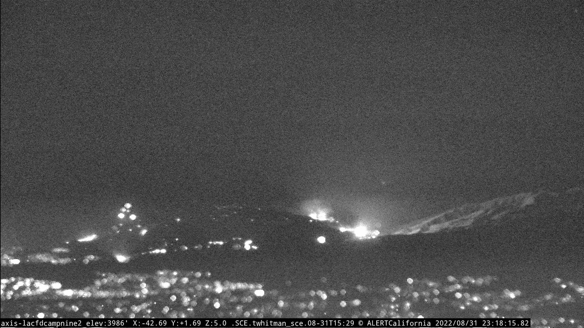
Border32Fire still showing active fire behavior tonight. Has burned around 1,500 acres
 3 year ago
Border32Fire (BarrettJunction, San Diego Co) - All of Potrero is now under an evacuation order & evac orders have expanded further to the north east recently
RouteFire: Officials are now saying 8 firefighters have sustained heat-related injuries and six have been taken to the hospital
Vegetation fire was reported in the location of Del Dios and Calle Ambiente in Rancho Santa Fe. Forward progress of fire has been stopped by RSF Fire crews per "RANCHO IC" (B267). Del Dios is closed to through traffic at Mount Israel and Calle Ambiente by SDSO
 3 year ago
The fire is now 1,600 acres. Fire continues pushing east and has crossed Highway 94 on the eastern portion of the fire, now burning on both sides of Highway 94. Over 400 residential units are affected by evacuations
Earthquake of magnitude 4.8 - 127 km WNW of Naha, Japan