Earthquake of magnitude 5.3 - 94 km E of Port-Vila, Vanuatu
Earthquake of magnitude 5.0 - 5 km WSW of Badak, Philippines
Earthquake of magnitude 4.7 - 67 km WNW of El Aguilar, Argentina
Earthquake of magnitude 5.0 - Kermadec Islands region
Earthquake of magnitude 4.6 - 145 km WNW of Hihifo, Tonga
Earthquake of magnitude 4.8 - 71 km SSW of Ollagüe, Chile
Earthquake of magnitude 4.6 - south of the Kermadec Islands
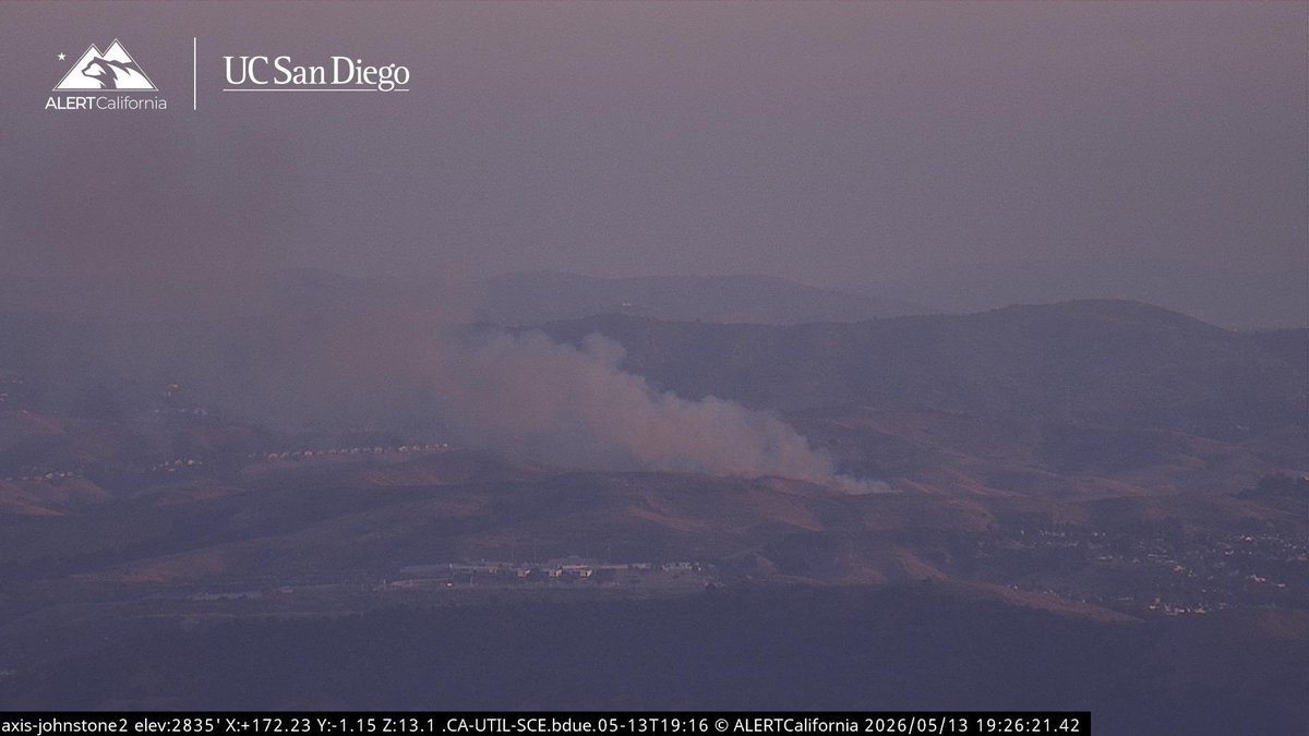
 1 month ago
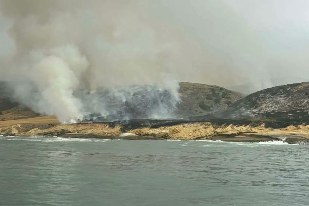
SantaRosaIslandFire Off South Rd & Lopez Road, Santa Rosa Island, Santa Barbara County. 3:20pm Air Attack 50 is overhead on the Ford Fire at the Channel Island National Park. Aircraft have been rotating in and out.
Earthquake of magnitude 4.7 - 219 km E of Levuka, Fiji
Earthquake of magnitude 4.6 - 95 km ESE of Port-Vila, Vanuatu
Earthquake of magnitude 4.9 - 11 km WNW of Palca, Peru
Earthquake of magnitude 6.6 - 8 km ESE of Ōfunato, Japan
Earthquake of magnitude 6.7 - 49 km ESE of Ōfunato, Japan
Earthquake of magnitude 4.8 - Bonin Islands, Japan region
Earthquake of magnitude 5.4 - 119 km SSE of Lorengau, Papua New Guinea
Earthquake of magnitude 4.8 - South Sandwich Islands region
Earthquake of magnitude 6.2 - 271 km WSW of Tual, Indonesia
Earthquake of magnitude 5.2 - Volcano Islands, Japan region
Earthquake of magnitude 5.3 - 32 km WNW of Darien, Colombia
Earthquake of magnitude 5.1 - South Sandwich Islands region
Earthquake of magnitude 4.7 - 28 km NNW of Bardsīr, Iran
 1 month ago
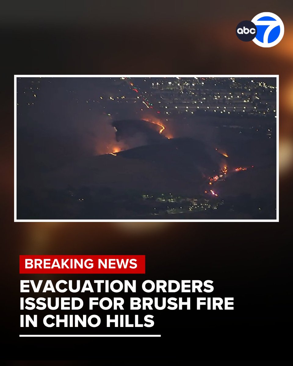
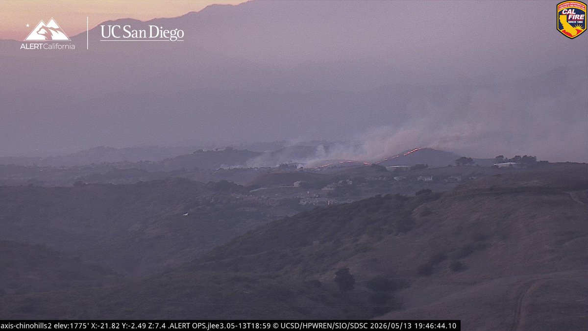
All evacuation orders and warnings have been lifted, fire officials say. orders have been issued for a 30-acre brush fire in Chino Hills, authorities say. The Cal Fire San Bernardino Unit says the fire has a moderate rate of spread and a potential for 200 acres
 1 month ago
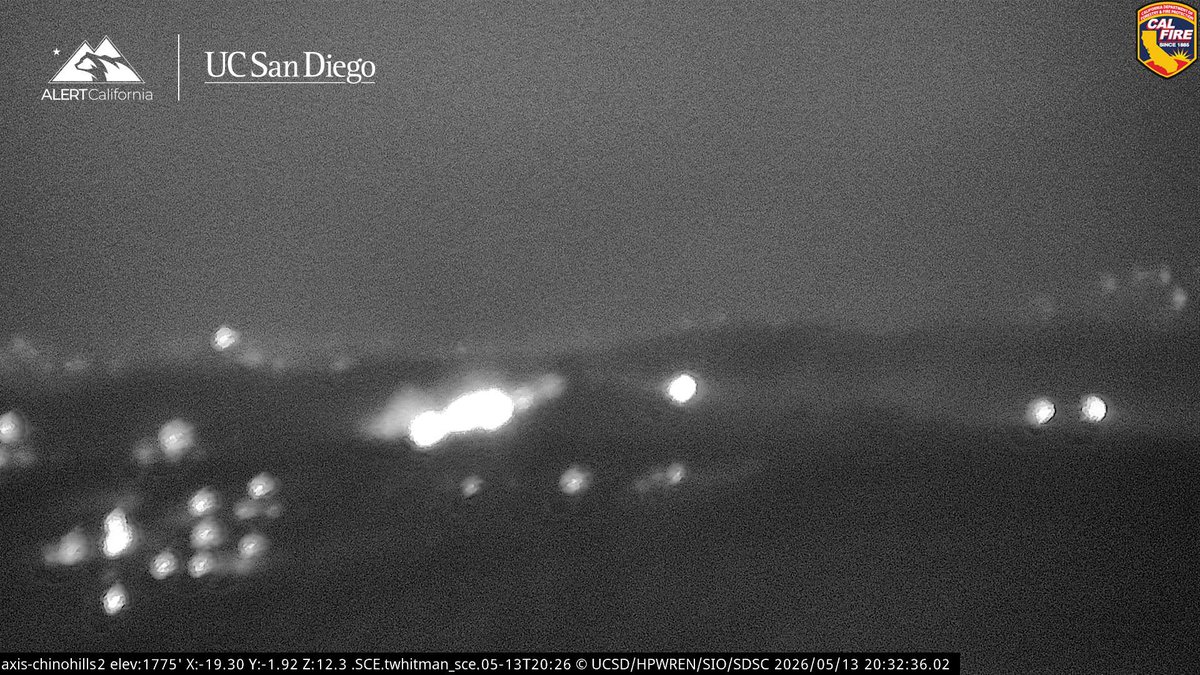
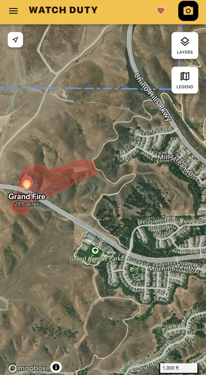
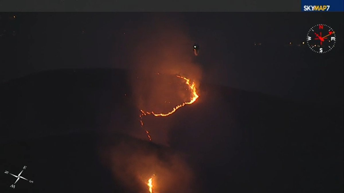
GrandFire The Fire was last Mapped at 29 acres at 7:58 PM, Progression was stopped on the South side of Grand Avenue. LACoFD Helitanker 55 remains overhead, to Clear things up with Rotor Wing only 3 Helicopters can fly without a Helco should have Forward Progress stopped soon.
Evacuation orders issued for 30-acre brush fire burning in Chino Hills
 1 month ago
ChinoHills / California The GrandFire in Chino Hills has been mapped at 29.6 acres by FIRIS OES Intel 24. Multiple evacuation orders are in effect now
 1 month ago
30-acre vegetation fire burns in San Bernardino County.
 1 month ago
GrandFire Aircraft Assisting. LACoFD Copters 11, 22, Helitanker 55. CalFire Copter 601. No Additional s at this Time, likely 19 acres, with an earlier Potential of 100-200 acres.OES Intel 24 has Mapped the GrandFire at 19.3 acres
Earthquake of magnitude 4.7 - 130 km W of Ternate, Indonesia
Earthquake of magnitude 4.7 - 69 km W of San Antonio de los Cobres, Argentina
 1 month ago
GrandFire This is now a 2nd Alarm Brush Fire, it is Late for Fixed Wing Air Tankers to Fly so Rotor Wing Helicopters will be working the Fire. OES Intel 24 is overhead Mapping, the Fire is on Both sides of Grand Avenue