Earthquake of magnitude 5.0 - 144 km SE of Pondaguitan, Philippines
Earthquake of magnitude 5.1 - 25 km SSE of Tambolaka, Indonesia
Earthquake of magnitude 4.9 - 267 km SSE of Dunhuang, China
Earthquake of magnitude 4.8 - 55 km WNW of Poso, Indonesia
 1 month ago
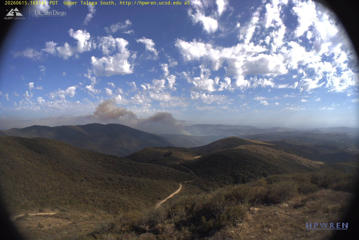
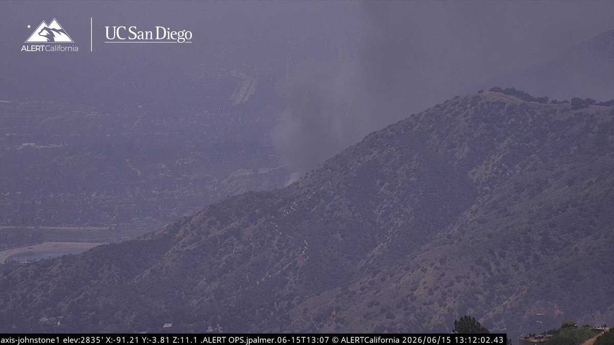
MateoFire The Fire is continuing to be Active this morning with a bunch of smoke lingering everywhere, last report was 990 acres with 10% Containment. Air Tankers were making drops this morning just Outside of Mateo Canyon to the South. Helicopters are also overhead assisting.
Earthquake of magnitude 4.8 - 52 km WNW of Poso, Indonesia
 1 month ago
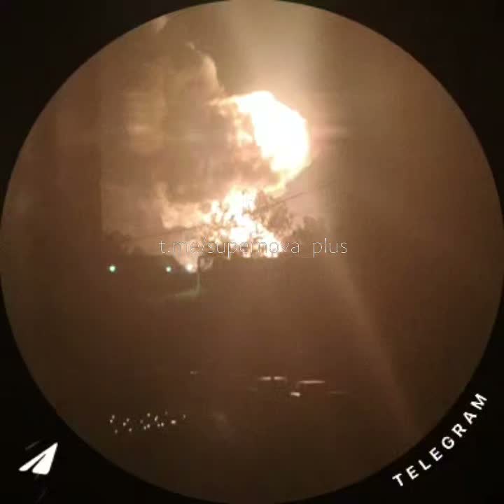
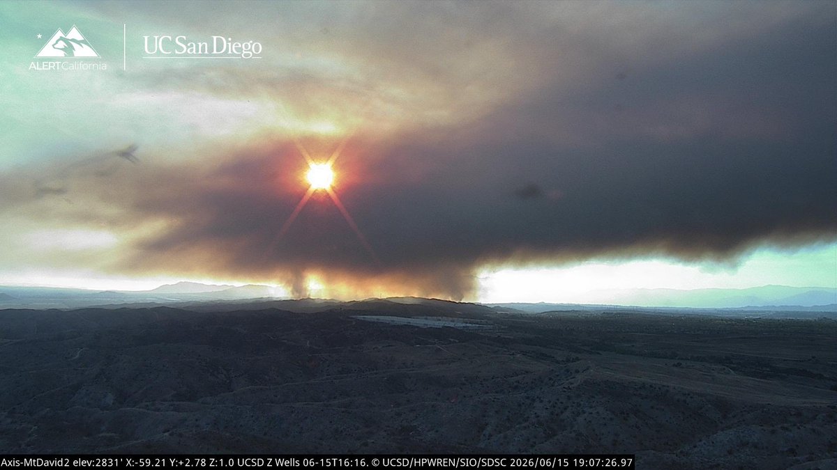
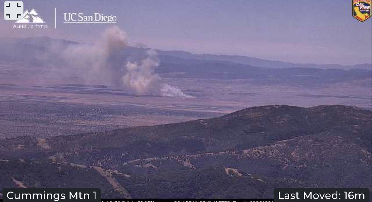
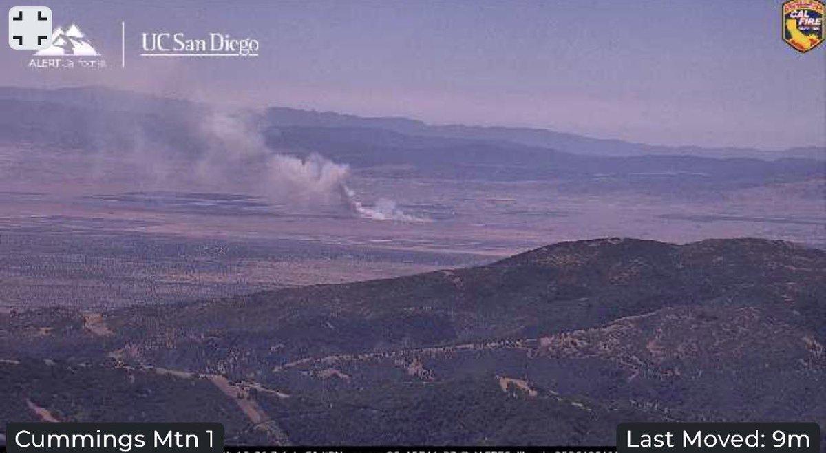
ShoreFire Evacuation Orders and Warnings remain in Place, the Fire is currently 2,600 acres with 25% Containment. Expect Smoke to linger throughout the day as Interior Pockets of Fuel will burn but everything remains within the Control Objectives.ShoreFire All Night Flying Helicopters are Released for Tonight, the Fire Remains Active Tonight likely from Firing Operations
Earthquake of magnitude 4.8 - South Sandwich Islands region
Earthquake of magnitude 4.9 - 256 km SSE of Dunhuang, China
Earthquake of magnitude 4.8 - 65 km S of Kokopo, Papua New Guinea
Earthquake of magnitude 4.8 - southeast central Pacific Ocean
Earthquake of magnitude 5.0 - 261 km SSE of Dunhuang, China
Earthquake of magnitude 4.8 - 52 km SE of Palu, Indonesia
Earthquake of magnitude 4.7 - 248 km SSE of Dunhuang, China
Earthquake of magnitude 5.5 - 4 km NW of Noda, Japan
Earthquake of magnitude 4.8 - 90 km WSW of Ternate, Indonesia
Earthquake of magnitude 5.4 - 277 km S of Dunhuang, China
Earthquake of magnitude 5.2 - 242 km SSE of Dunhuang, China
Earthquake of magnitude 6.3 - 260 km SSE of Dunhuang, China
Earthquake of magnitude 4.6 - 17 km SE of Viqueque, Timor Leste
Earthquake of magnitude 5.0 - 49 km ESE of Palu, Indonesia
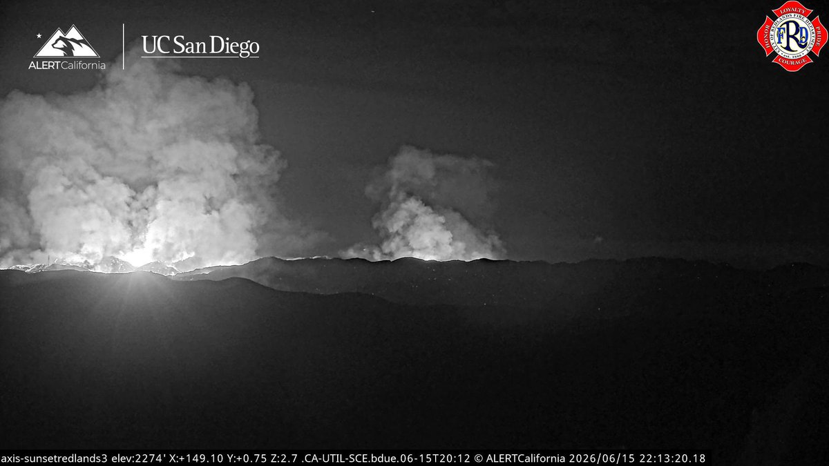 1 month ago
ShoreFire Some Resources are being Released for Tonight, the Fire is looking Good hasn’t jumped Highway 60. Back Firing Operations are going well, Copter 605 was Released, Both Helitankers are on the Ground Available if anything changes.
 1 month ago
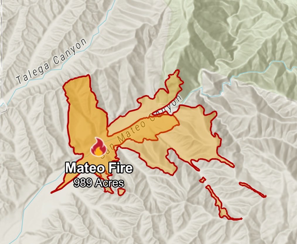
MateoFire at 989 acres, the Fire remains within Mateo Canyon, seems like they’re also doing Firing Operations judging by the Perimeter
Earthquake of magnitude 4.7 - 14 km SSW of Balangonan, Philippines
 1 month ago
ShoreFire Air Attack 51 is overhead and currently Mapping the Fire, sounds like they’re doing some Firing Operations likely to stop the head of the Fire.
 1 month ago
MateoFire Cleveland National Forest is in Unified Command with Camp Pendleton Fire Department as the Fire is moving into the San Mateo Wilderness. The Fire is burning in a North/Northeast Direction
 1 month ago
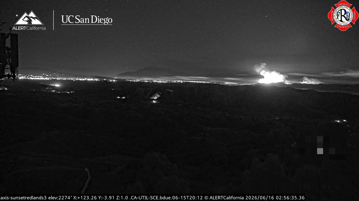
ShoreFire Night Ops Aircraft Assisting. Air Attack 51 - enroute will also map the Fire. Helco Copter 8AS. Helitankers 7PJ, 9PJ, Copter 605.
Earthquake of magnitude 5.0 - 51 km SSE of Palu, Indonesia
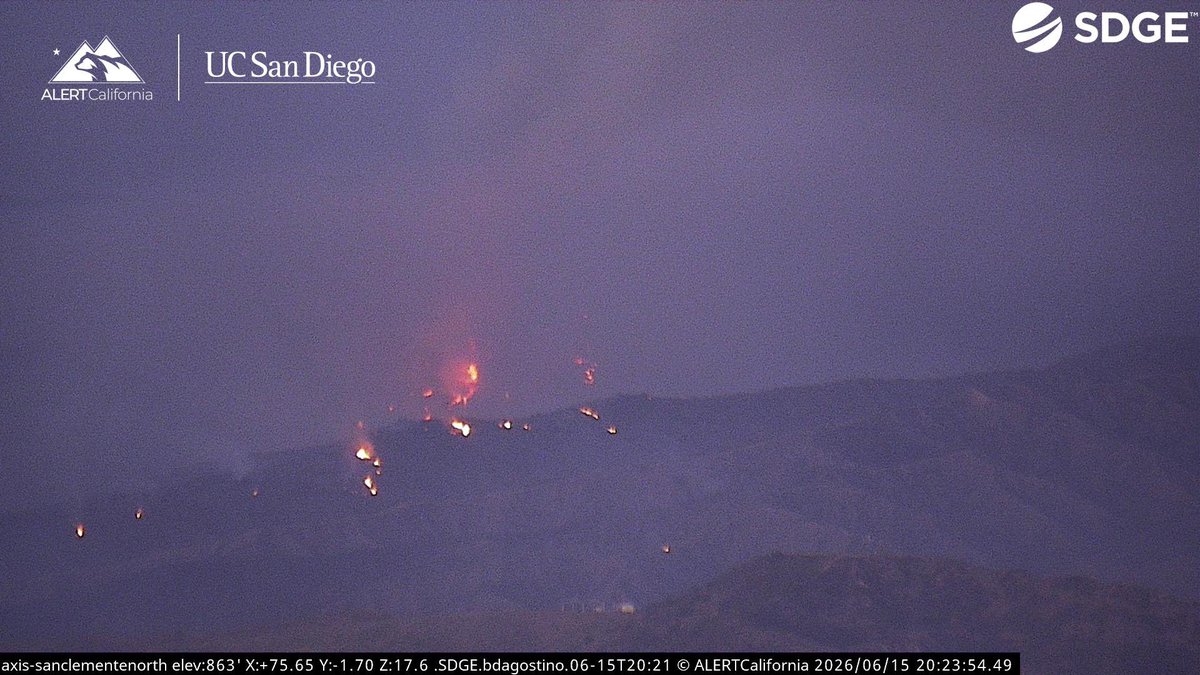
 1 month ago
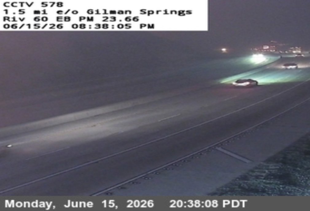
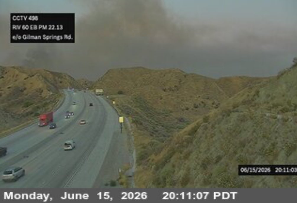
ShoreFire the Fire has Reached Highway 60 and Engines are in the Area ready to Engage. Helicopters are also overhead.ShoreFire The Fire is continuing to be Active
 1 month ago
MateoFire All Aircraft was Released from this Fire, the Fire is 650 acres with 5% Containment. Additional Resources will be on the Fire tomorrow.
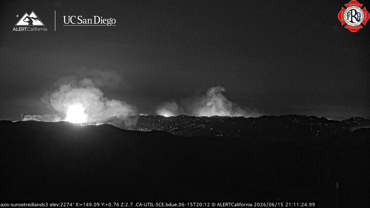
 1 month ago
ShoreFire The Fire is continuing to be Active this Evening and is pushing towards Highway 60, be careful driving East Bound on the Highway 60 due to Bad Visibility from Smoke. IC is Reporting West Bound Highway 60 has been Shutdown.
Earthquake of magnitude 4.9 - 46 km ESE of Palu, Indonesia
Earthquake of magnitude 5.2 - 44 km ESE of Palu, Indonesia
Earthquake of magnitude 6.7 - 46 km ESE of Palu, Indonesia
Earthquake of magnitude 4.7 - Izu Islands, Japan region
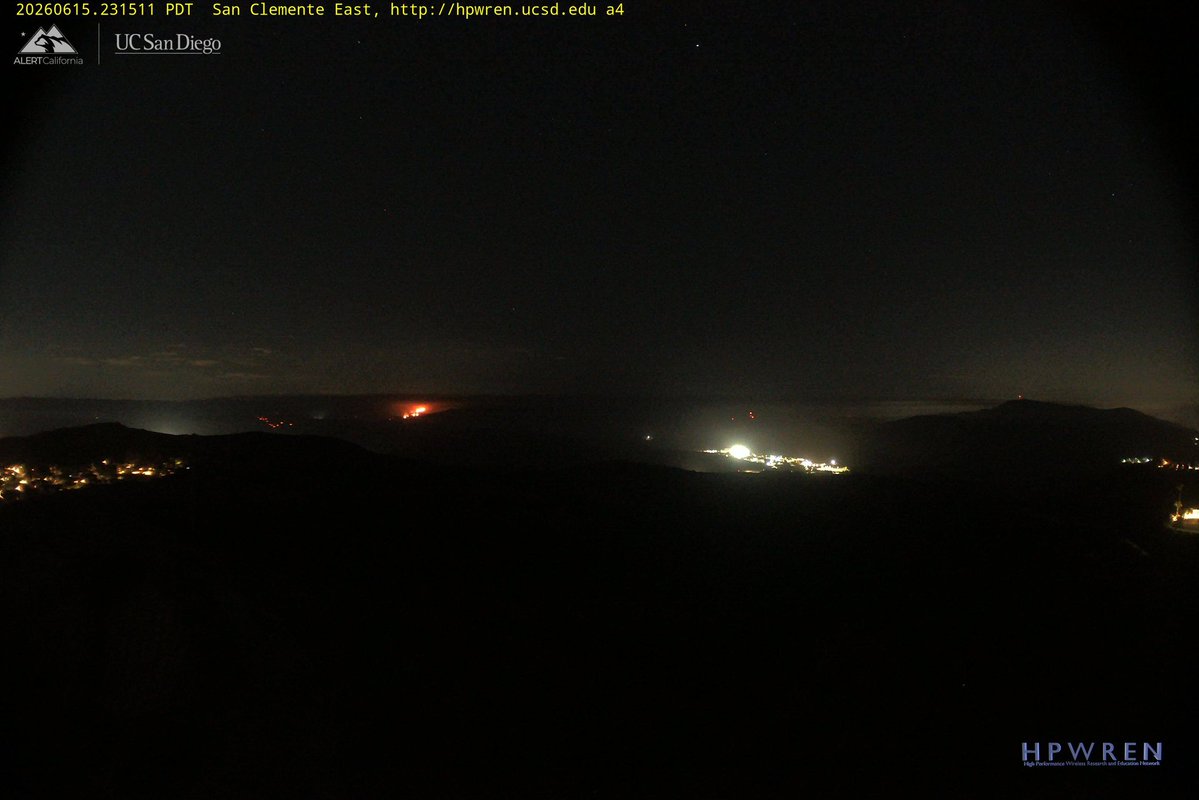
 1 month ago
ShoreFire From Incident Command the Fire 1,500 acres, and is Requesting an Intel Flight at 20:00 Hours. All Air Tankers and Non Night Flying Helicopters will be getting Released soon.ShoreFire Helco Copter 8AS, Helitankers 7PJ, 9PJ, Copter 605 will be Flying for Night Operations Tonight. AA12 is working to get a (TFR) in Place over the Fire for 6,000ft waiting on LAX to Approve it
LAFD Alert- Forward Progress Stopped Montecito Heights Brush Fire 6317 N Monterey Rd
LAFD Alert- Montecito Heights Brush Fire 6317 N Monterey Rd
Earthquake of magnitude 4.6 - Izu Islands, Japan region
2ND ALARM BRUSH FIRE W Magnolia Ln/W Autumn Pl StevensonRanch LACoFD responded to a report of a brush fire. A 2nd alarm was requested at 4:57 p.m. The fire is currently reported at approximately 15 acres with structures threatened
Earthquake of magnitude 4.7 - South Sandwich Islands region
 1 month ago
RubyFire The Fire is 2-3 acres, Moderate Rate of Spread, Potential for 50 acres, on Flat Ground, with little wind on the Fire.New Brush Fire Fish Canyon Road, Azusa, Los Angeles County. Large Column is currently showing on Cams.
Earthquake of magnitude 4.9 - 11 km W of Balangonan, Philippines
 1 month ago
Fairmont. 2nd alarm brush fire. 190th and Avenue C
Fairmont. 2nd alarm brush fire. 190th and Avenue C. E130 reports 100 acres running to the east with no structures threatened
Earthquake of magnitude 4.8 - southeast of the Loyalty Islands
 1 month ago
Fairmont. Brush fire. 190th and Avenue C
Earthquake of magnitude 5.0 - southeast of the Loyalty Islands
Earthquake of magnitude 4.9 - 98 km WNW of Mantua, Cuba