Earthquake of magnitude 4.7 - 7 km ENE of Cañete, Chile
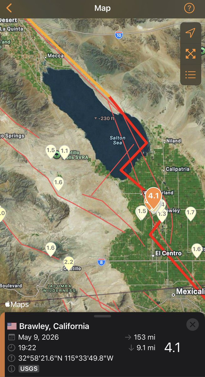
Earthquake of magnitude 4.7 - 4 km WSW of Brawley, CA
Earthquake of magnitude 5.0 - 174 km SSW of Tual, Indonesia
Earthquake of magnitude 5.5 - 27 km ENE of Cañete, Chile
 1 month ago
SaltonSea / California A magnitude 4.4 Earthquake just struck in the Salton Sea area near Brawley, which seems to be going through its own quake swarm at the moment
Earthquake of magnitude 4.6 - 78 km SSE of Pondaguitan, Philippines
Earthquake of magnitude 4.9 - 57 km WNW of Turangi, New Zealand
Earthquake of magnitude 5.3 - south of the Fiji Islands
 1 month ago
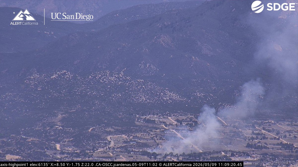
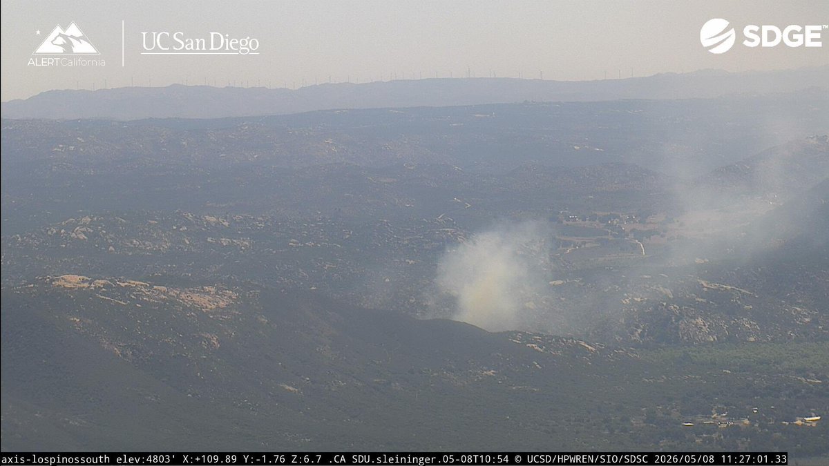
SaddleFire The Fire is 2.1 acres, the Fire is mostly surrounded by Retardant, Crews are getting a hose lay around the Fire. Both Air Tankers are Released.SaddleFire Air Attack 310, Air Tanker 73 is enroute
 1 month ago
SaddleFire Air Attack 310, Air Tanker 73 is enroute. Air Tanker 72 made its drop to mitigate a Structure Threat.
Earthquake of magnitude 4.6 - 44 km WNW of Ishigaki, Japan
Earthquake of magnitude 5.1 - South Sandwich Islands region
Earthquake of magnitude 5.0 - 113 km SSE of Lorengau, Papua New Guinea
Earthquake of magnitude 4.6 - 108 km WSW of Crescent City, CA
Earthquake of magnitude 5.8 - 292 km WSW of Adak, Alaska
Earthquake of magnitude 5.3 - Rat Islands, Aleutian Islands, Alaska
Earthquake of magnitude 6.1 - Rat Islands, Aleutian Islands, Alaska
Earthquake of magnitude 4.6 - 177 km WNW of Abepura, Indonesia
Earthquake of magnitude 4.9 - 100 km SSE of Lorengau, Papua New Guinea
Earthquake of magnitude 4.7 - 289 km WSW of Adak, Alaska
 1 month ago
CorralFire All Aircraft have been Released, the Fire remains 2 acres and holding.CorralFire Air Attack 330 is Reporting 1 acre,
 1 month ago
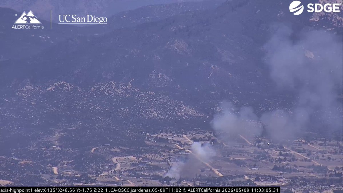
The CanyonFire was mapped at 2,038 acres by the (NIFC), 20% Containment. Just a bit ago a Kern County Sheriffs Helicopter just flew into the Incident.CanyonFire The Fire is 2,000 acres, 0% containment.
Earthquake of magnitude 4.8 - 76 km WNW of San Juan, Peru
Earthquake of magnitude 4.6 - 117 km ENE of Miyako, Japan
The Canyon Fire has burned 2,000 acres and is 20% contained
Earthquake of magnitude 4.9 - 114 km SSE of Lorengau, Papua New Guinea
Earthquake of magnitude 5.6 - 109 km SSE of Lorengau, Papua New Guinea
Earthquake of magnitude 4.7 - 114 km SE of Lorengau, Papua New Guinea
Earthquake of magnitude 4.7 - 160 km SE of Khovd, Mongolia
Earthquake of magnitude 5.4 - southeast Indian Ridge