Tornado Warning including Seabrook Island SC and Rockville SC until 12:00 AM EDT
Earthquake of magnitude 4.6 - 54 km NNW of Norðurþing, Iceland
Earthquake of magnitude 4.7 - Papua, Indonesia
Tornado Warning including Middleburg FL, Lawtey FL and Highland FL until 9:45 PM EDT
Earthquake of magnitude 5.9 - 259 km ESE of Biak, Indonesia
Earthquake of magnitude 5.8 - Papua, Indonesia
Earthquake of magnitude 6.1 - 262 km ESE of Biak, Indonesia
Earthquake of magnitude 5.1 - Banda Sea
Earthquake of magnitude 5.2 - South Sandwich Islands region
Earthquake of magnitude 5.1 - 159 km WNW of Tobelo, Indonesia
Earthquake of magnitude 4.8 - north of Ascension Island
 3 year ago
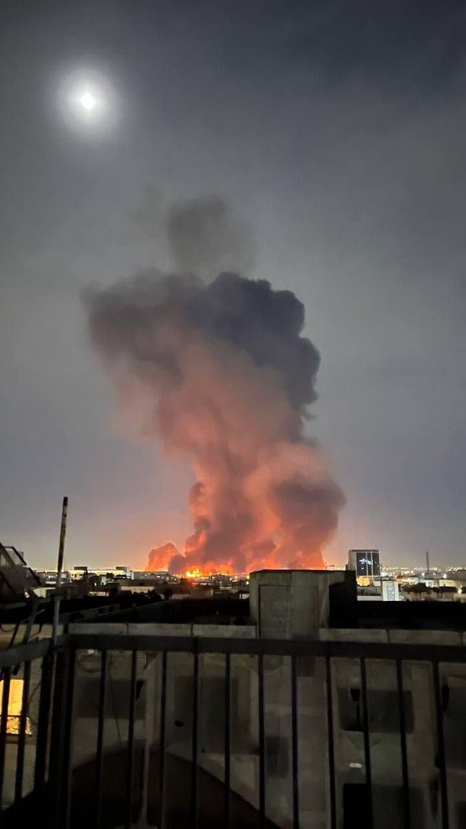
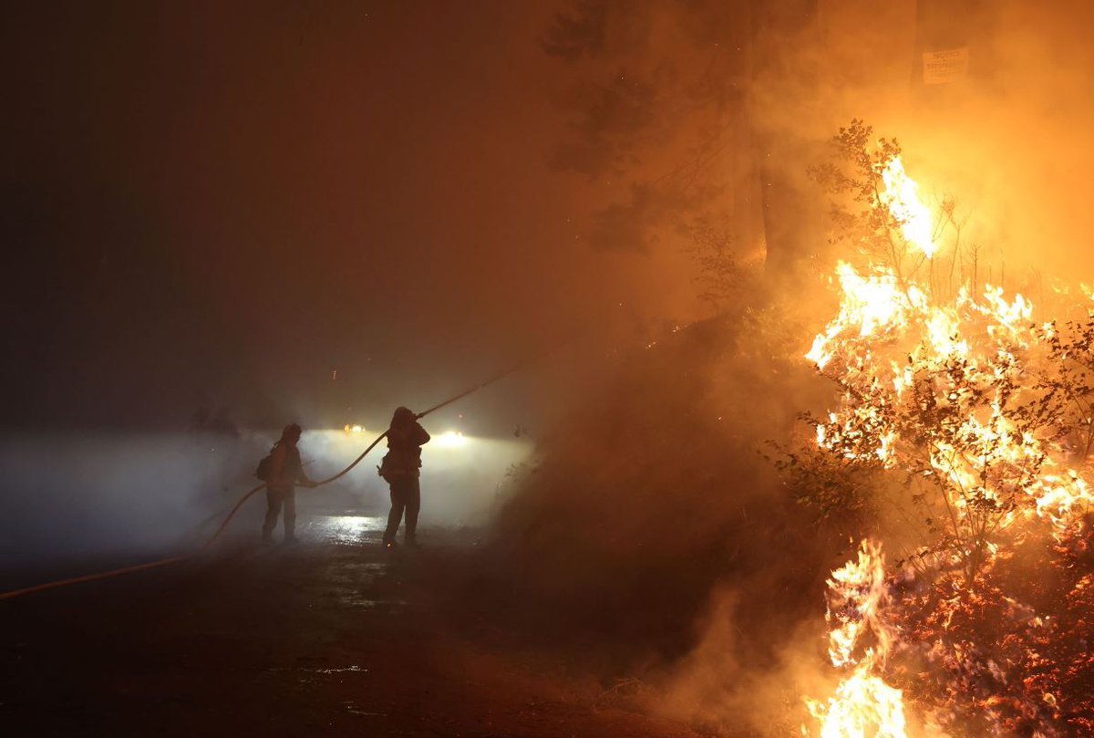
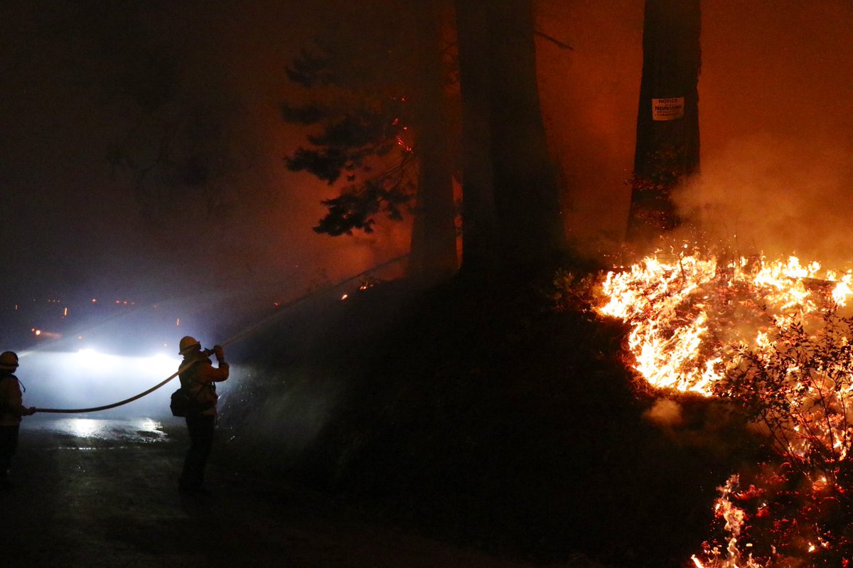
Structure lost off Volcanoville Rd. Part of the destruction of this MosquitoFire. This is portion of the fire in El Dorado County.
Earthquake of magnitude 5.2 - 27 km SW of Tari, Papua New Guinea
Earthquake of magnitude 5.1 - north of Ascension Island
Earthquake of magnitude 5.1 - 47 km SSE of Lospalos, Timor Leste
Earthquake of magnitude 5.2 - 142 km NNW of Okha, Russia
FairviewFire off Fairview Avenue and Bautista Canyon Road, near Hemet in Riverside County is 27,319 acres and 5% contained
 3 year ago
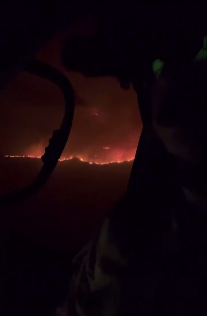
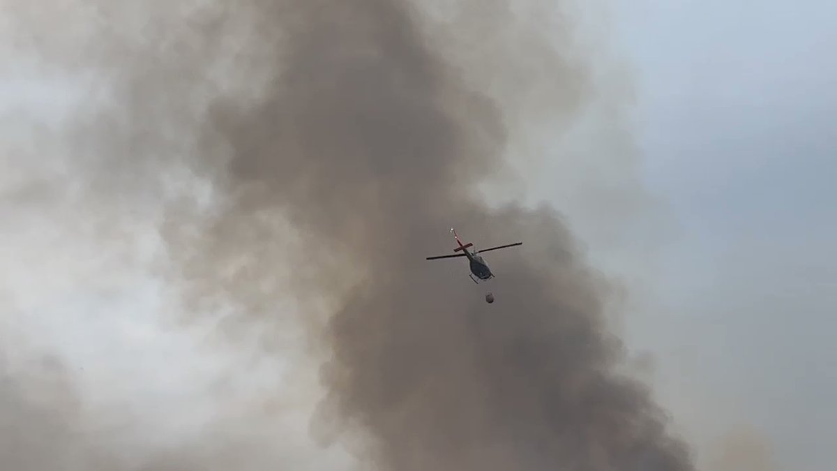
View from inside Fire watch 76 over the FairviewFire. This helicopter specializes in reconnaissance and intelligence as well as coordinating water drops. The crew uses night vision goggles (NVG) as seen in the video
 3 year ago
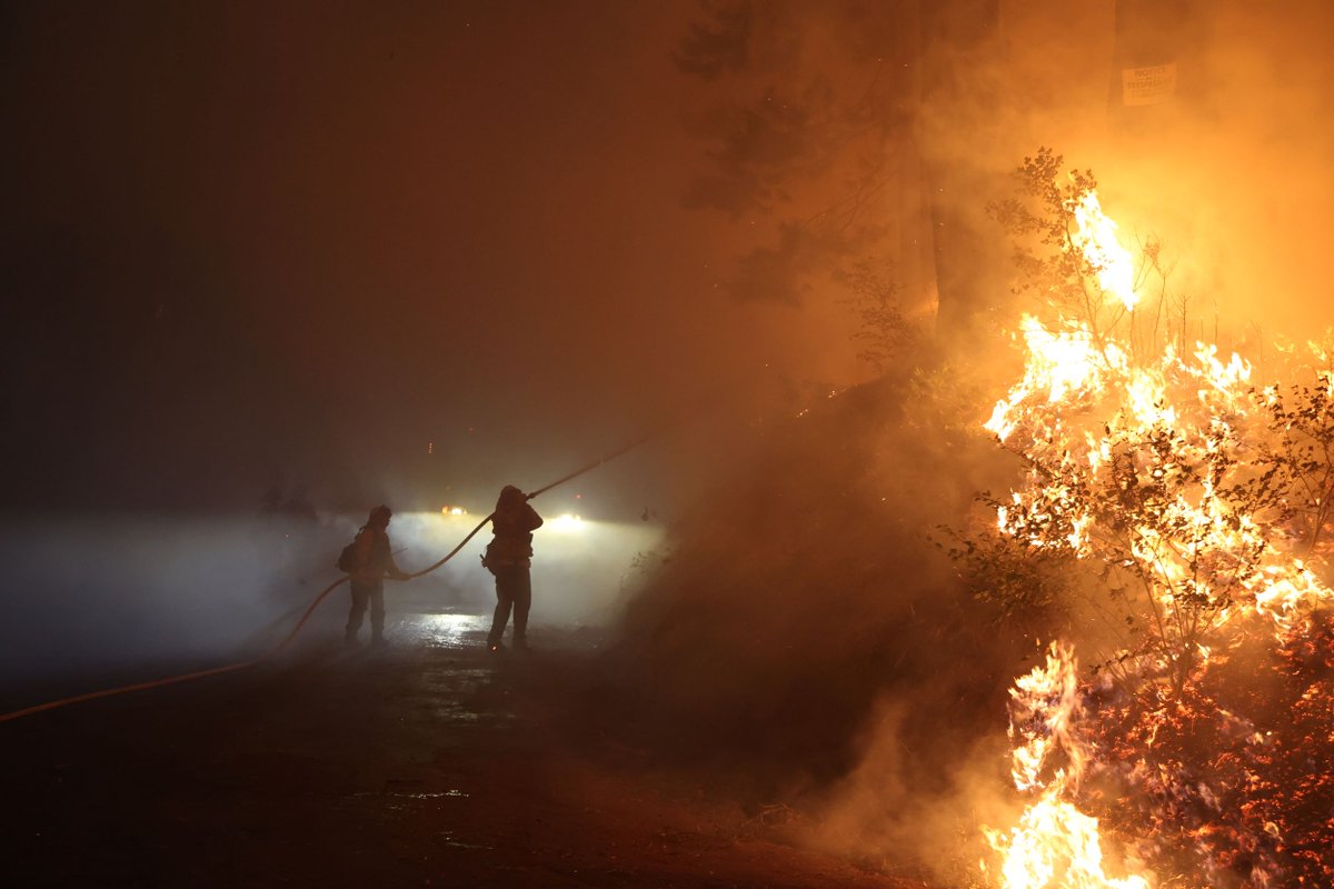
At the Mosquito Fire.
 3 year ago
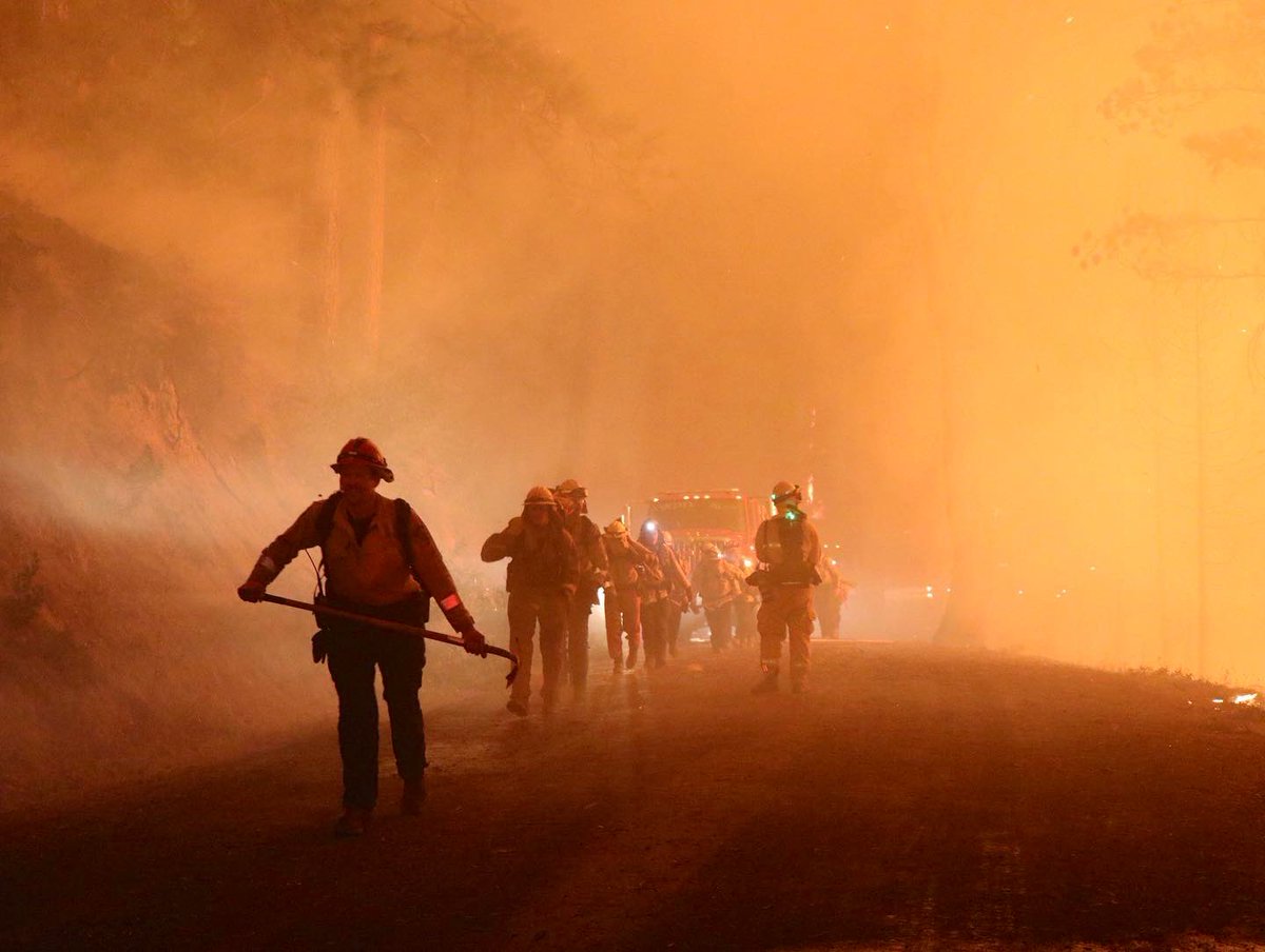
From the FairviewFire today in Hemet near Red Mountain Road and Sage Road as @CAL_FIRE firefighters put in work to build containment despite high temps and fire behavior
 3 year ago
MosquitoFire in Placer County is 13,705 acres and 0% contained
 3 year ago
Significant increase of fire activity on Mosquito Ridge road, spotting potential imminent, structure defense plan being put in place for Foresthill, fire is hitting it extremely hard
 3 year ago
FairviewFire (S/O ValleVista, Riverside Co) - Night time copters back over the fire & working the south side around Red Mountain Rd. 18,753 structures threatened per CAL FIRE. Evac orders and warnings continue to expand today
 3 year ago
scene of the #MosquitoFire
 3 year ago
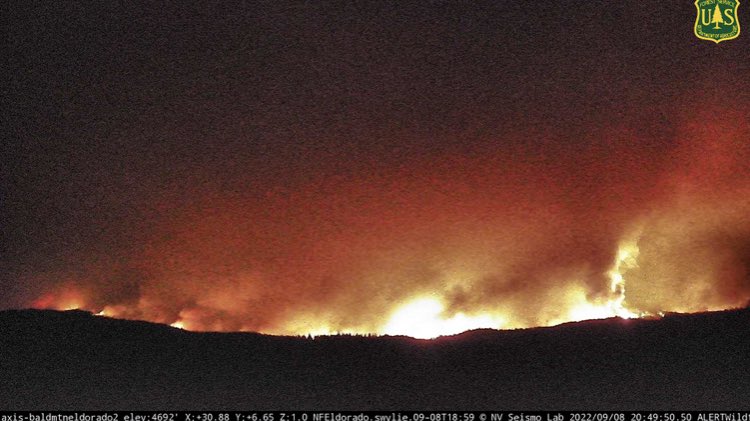
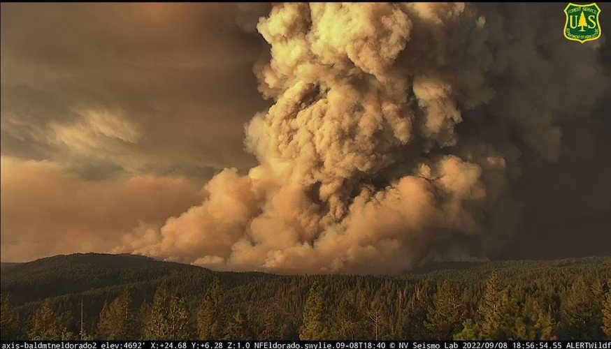
Smoke from the MosquitoFire as seen from AlertWildfire Bald Mountain camera is shocking to see. This is a 1-hour time-lapse of the fire burning in Placer and El Dorado counties
 3 year ago
FairviewFire looks to be like it's burning South of East Hemet
 3 year ago
MosquitoFire near Oxbow Reservoir, east of Forest Hill in Placer County is 13,705 acres and 0% contained. In Unified Command with @CALFIRENEU, @Tahoe_NF, @PlacerSheriff, and Foresthill Fire Protection District
 3 year ago
FairviewFire off Fairview Avenue and Bautista Canyon Road, near Hemet in Riverside County is 23,919 acres and 5% contained
 3 year ago
Mosquito fire plume as seen from Chico, CA
MosquitoFire - The fire did not push as far north as it did yesterday. The big push today was coming out of the reservoir & into El Dorado Co: 5,000 acre run. Confirmed there are structures destroyed in Volcanoville, but it isn't the whole community, too early for numbers
MosquitoFire (Foresthill, Placer Co/El Dorado Co) - Brief pieces from the townhall meeting (the stream was a bit iffy): Some progression to the west, very large amount of resources in there going direct on the fire & providing structure protection around Foresthill
Earthquake of magnitude 4.6 - western Xizang
 3 year ago
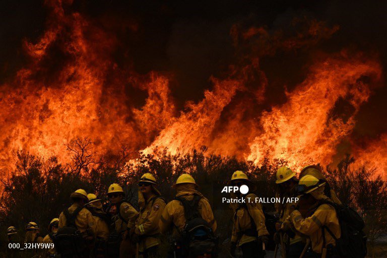
Helicopters dropping water over flames at Hwy 74 and Blackburn Road in Hemet. Cal Fire now says this fire has burned through 20K acres. Wind is shifting out here and will remain a challenge throughout the night
Earthquake of magnitude 4.9 - Kermadec Islands, New Zealand
Earthquake of magnitude 4.6 - 54 km NW of San Antonio de los Cobres, Argentina
Earthquake of magnitude 4.6 - Kuril Islands
Earthquake of magnitude 4.6 - 54 km NE of Luganville, Vanuatu
Earthquake of magnitude 5.4 - near the coast of southern Peru
Earthquake of magnitude 4.6 - 154 km ESE of Gorontalo, Indonesia
Earthquake of magnitude 4.9 - southern Sumatra, Indonesia