Earthquake of magnitude 4.8 - 69 km E of Severo-Kuril’sk, Russia
2.6 magnitude earthquake. 5 mi from Cobb, CA, UnitedStates
2.9 magnitude earthquake. 33 mi from Fort Irwin, CA, UnitedStates
Earthquake of magnitude 5.2 - 163 km SSE of Vilyuchinsk, Russia
Earthquake of magnitude 4.7 - 86 km S of Koshima, Japan
A shelter-in-place has been issued for some Madera County mountain residents due to a hazardous materials situation
Earthquake of magnitude 4.6 - 193 km E of Petropavlovsk-Kamchatsky, Russia
3.9 magnitude earthquake. 46 mi from Ferndale, CA, United States
Earthquake of magnitude 5.1 - 181 km WSW of Port Orford, Oregon
Earthquake of magnitude 4.9 - 181 km WSW of Port Orford, Oregon
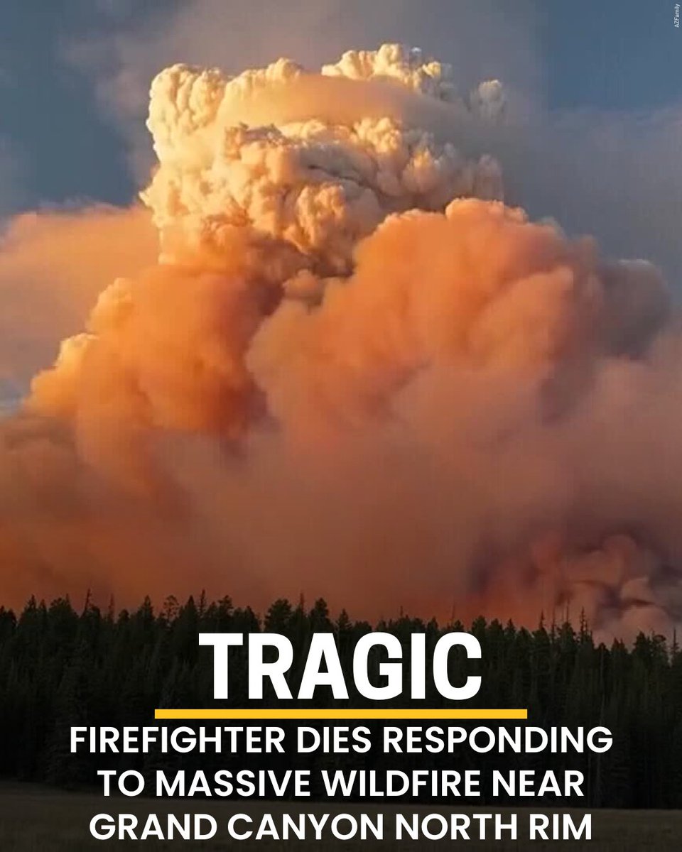 10 month ago
Firefighter dies responding to massive wildfire near Grand Canyon North Rim
Earthquake of magnitude 4.6 - 63 km NE of Masohi, Indonesia
Earthquake of magnitude 5.4 - Mid-Indian Ridge
2.7 magnitude earthquake. 38 mi from Joshua Tree, CA, United States
Earthquake of magnitude 4.9 - 61 km SW of Atocha, Bolivia
Earthquake of magnitude 4.7 - 111 km S of Ende, Indonesia
Earthquake of magnitude 4.7 - 255 km ESE of Ust’-Kamchatsk Staryy, Russia
3.6 magnitude earthquake. 24 mi from Ferndale, CA, United States
Earthquake of magnitude 4.8 - 9 km NNW of Giporlos, Philippines
 10 month ago
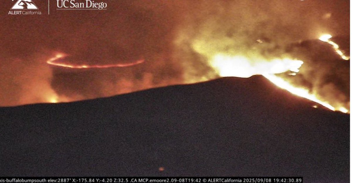
GarnetFire The 3 (QRF) Helitankers went back to Fresno Chandler Airport, the Low Visibility might be an issue due to the Inversion Layer, they made some drops along the Ridges cooling down slop overs.G
 10 month ago
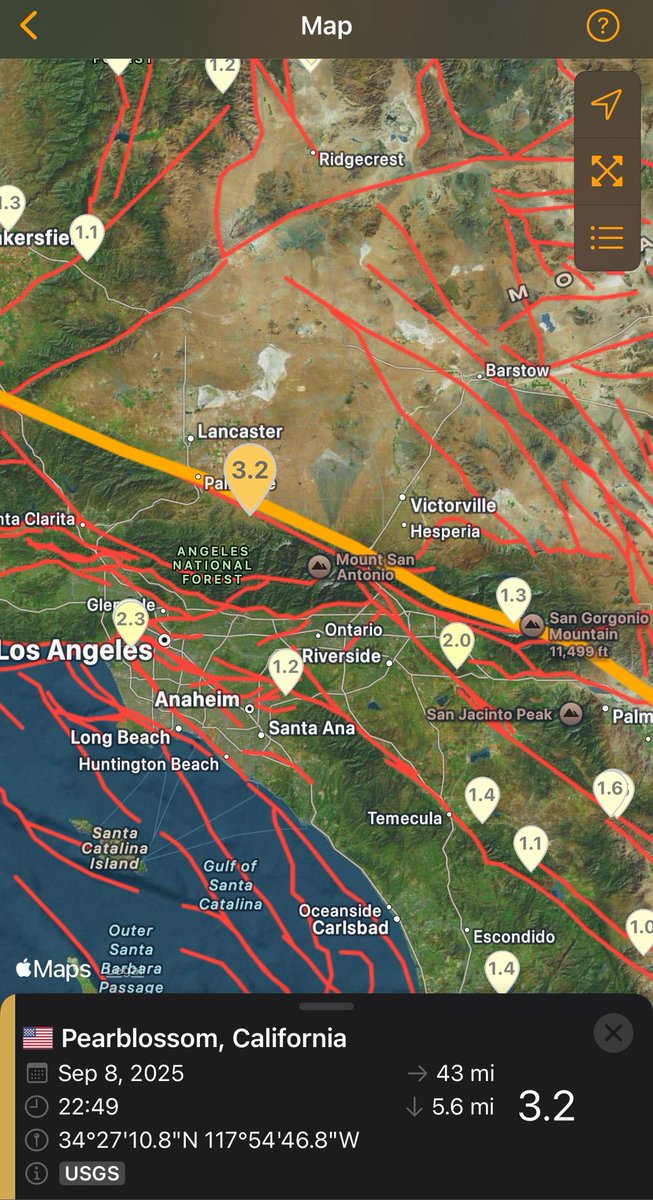
Palmdale / California A magnitude 3.2 Earthquake struck near Palmdale
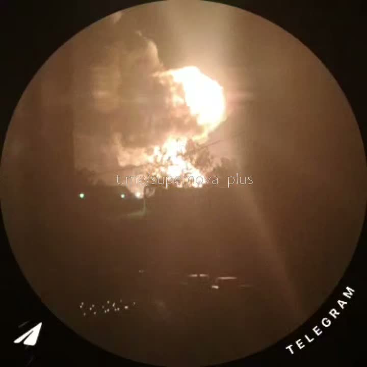
Fire injures two, burns at least seven homes in San Diego County community
Earthquake of magnitude 4.9 - 167 km WSW of Port Orford, Oregon
3.3 magnitude earthquake. 6 mi from Littlerock, CA, United States
All evacuations have been lifted for the fire that burned several homes and injured at least two people in Lakeside
 10 month ago
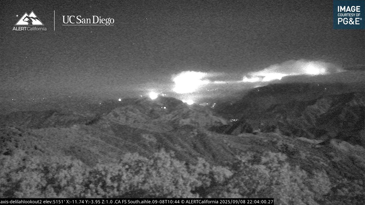
OrangeCounty South OC may be smelling smoke, there is currently a Fire on Camp Pendleton, the Charger 2 fire is approximately 850 acres. This is an image from about 2 hours ago. There is not a threat to OC at this time
Earthquake of magnitude 4.9 - 192 km S of Severo-Kuril’sk, Russia
Earthquake of magnitude 5.8 - 165 km WSW of Port Orford, Oregon
 10 month ago
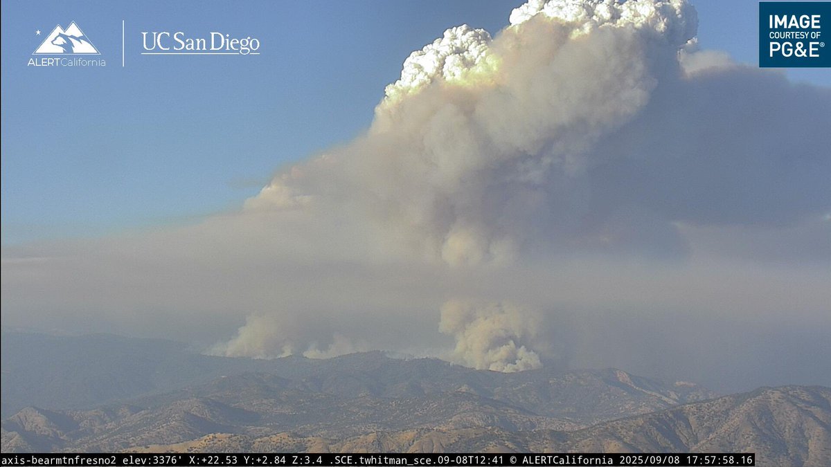
GarnetFire All Aircraft has been Released for the Night.From Sierra National Forest - When needed the (QRF) Quick Reaction Force is Available for Night Operations if Requested.The Fire is 54,924 acres mapped earlier by Cal Fire Intel 641
Earthquake of magnitude 4.9 - 197 km SSE of Burica, Panama
Earthquake of magnitude 5.1 - 8 km NE of Corralero, Mexico
Earthquake of magnitude 6.8 - Vanuatu region
Earthquake of magnitude 6.8 - Vanuatu region
Earthquake of magnitude 6.4 - Vanuatu region
Earthquake of magnitude 5.1 - 12 km NNW of Néa Stíra, Greece
 10 month ago
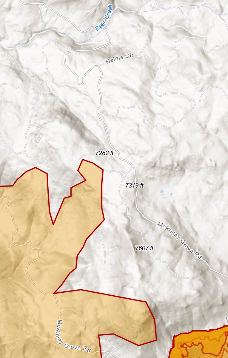
Fire Watch 51 has Mapped the GarnetFire at 53,352 acres.From Sierra National Forest they Reported it spotted across McKinley Grove Road