Earthquake of magnitude 4.9 - Kuril Islands
Earthquake of magnitude 5.0 - Carlsberg Ridge
2.7 magnitude earthquake. 6 mi from Isla Vista, CA, United States
Earthquake of magnitude 5.0 - 78 km NW of Isangel, Vanuatu
Earthquake of magnitude 4.7 - Carlsberg Ridge
Earthquake of magnitude 4.7 - 291 km SSE of Port Blair, India
Earthquake of magnitude 4.7 - 7 km ENE of Ruteng, Indonesia
Earthquake of magnitude 5.4 - Pacific-Antarctic Ridge
Earthquake of magnitude 5.2 - 140 km S of ‘Ohonua, Tonga
 4 month ago
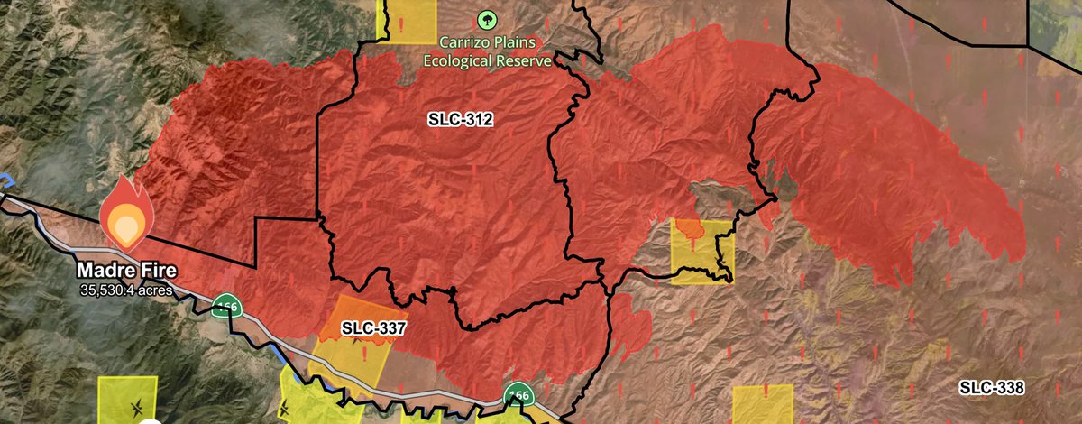
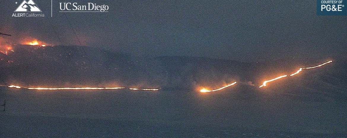
MadreFire Helitanker 7PJ remains overhead, 4 other Copters times out for the Night.There is a Report of Structures being Impacted at 18888 Chimineas Ranch Road.OES Intel 24 has Mapped the MadreFire at 35,530 acres
Earthquake of magnitude 5.5 - 108 km N of Tatsugō, Japan
 4 month ago
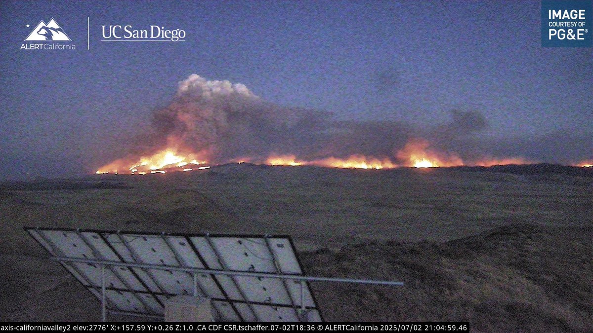
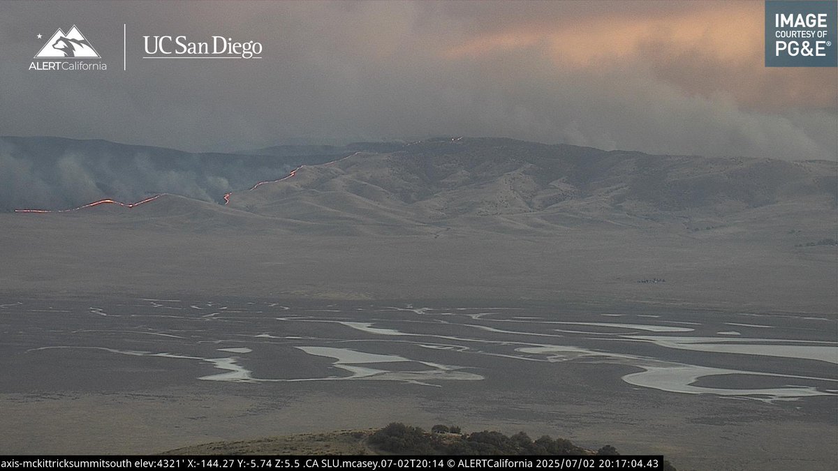
NnSantaMaria / California nnThe FIRIS Intel 24 plane has remapped the MadreFire and it is now listed at 35,530 acres. Average burn rate of 3,230 acres
 4 month ago
My final guess for this monster is 37,971 acres. I hope it’s not even above 20k but looking at intel it’s probably well above that… madrefire
Earthquake of magnitude 5.1 - 96 km N of Tatsugō, Japan
Earthquake of magnitude 4.9 - 29 km SSW of El Hoyo, Argentina
Earthquake of magnitude 5.0 - 101 km N of Tatsugō, Japan
Earthquake of magnitude 5.4 - 99 km SSW of Uyuni, Bolivia
Earthquake of magnitude 4.8 - 94 km N of Tatsugō, Japan
 4 month ago
OES Intel 24 is enroute to map the MadreFire .MadreFire Night Ops Aircraft Assisting.Helco Copter 8AS.SBCoFD Copter 964.Helitankers 4PJ, 7PJ.ANF Copter 531
 4 month ago
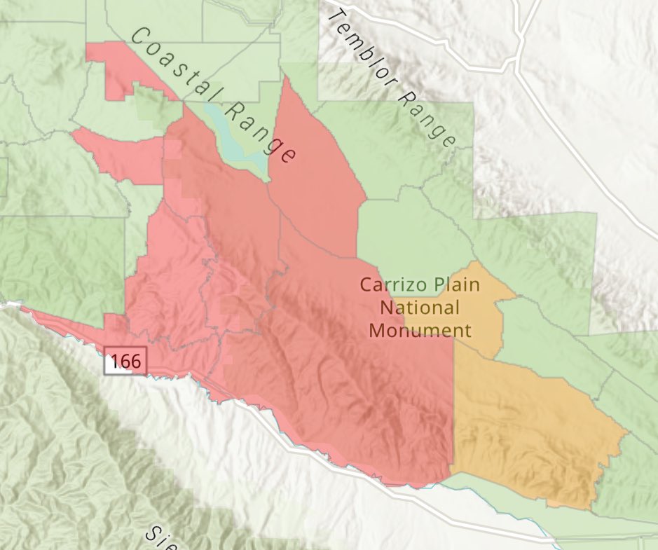
MadreFire Current Evacuation Map.Evacuation Orders for Zones SLC-226, 264, 265, 312, 337, 338.Evacuation Warnings for Zones SLC-313, 358
 4 month ago
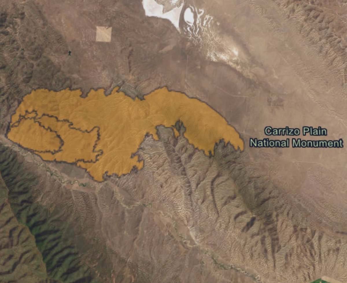
MadreFire the Fire still remains North of Highway 166 no reports of any spot fires across the Highway, its Progressed all the way to the Carrizo Plains.
Earthquake of magnitude 4.6 - 116 km SW of Banda Aceh, Indonesia
Earthquake of magnitude 5.3 - 219 km NW of Lautoka, Fiji
Earthquake of magnitude 4.7 - 101 km N of Tatsugō, Japan
Firefighters are at scene of a 50x50(foot) vegetation fire near the 3400 block of Hawks Beard, Sonoma. The forward progress has been stopped. Resources will remain on scene to put out hot spots
Earthquake of magnitude 4.9 - 93 km NNW of Tatsugō, Japan
Earthquake of magnitude 5.2 - South Sandwich Islands region
Earthquake of magnitude 5.2 - 96 km NNW of Tatsugō, Japan
2.4 magnitude earthquake. 4 mi from Anza, CA, UnitedStates
Earthquake of magnitude 4.8 - 29 km WNW of Ransiki, Indonesia