AeroFire off Rock Creek Rd and Hwy 4, North of Copperopolis in Calaveras County is 5009 acres
Officials have declared a fire emergency and issued an immediate evacuation as nearly 8000 people are being evacuated due to an out of control wildfire Ruidoso NewMexico
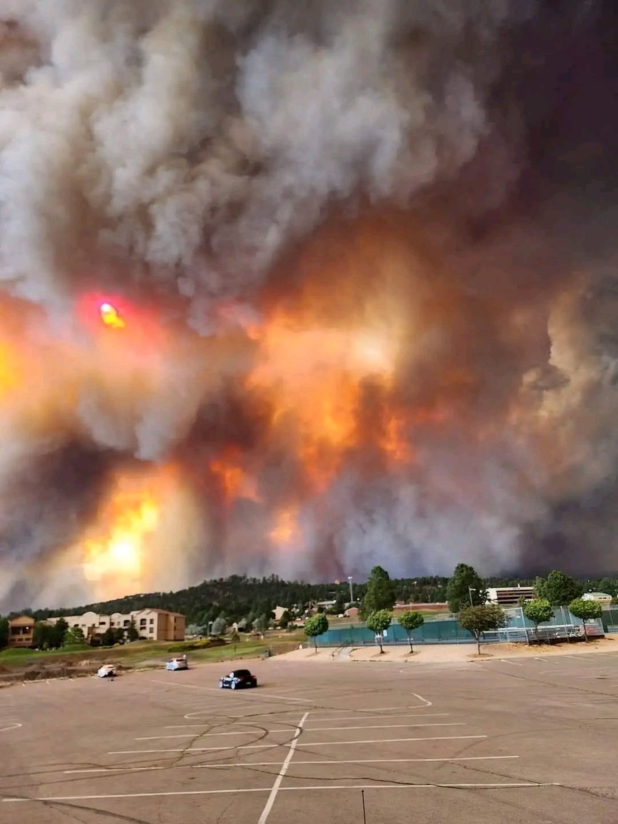
The Aero Fire in Calaveras County has spread to 5,000 acres as of 10 p.m. Monday. Crews plan to work through the night to get the fire under control
AeroFire off Rock Creek Rd and Hwy 4, North of Copperopolis in Calaveras County is 1900 acres
Earthquake of magnitude 6.0 - 87 km SE of Hihifo, Tonga
Earthquake of magnitude 5.9 - 64 km S of Hihifo, Tonga
 2 year ago
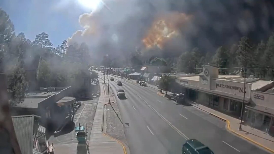
Massive uncontrollable forest fires on the Mescalero Apache reservation led to the evacuation of nearly 8,000 people from the town of #Ruidoso . The situation is critical, with the fires spreading very quickly. More than 1,770 acres already consumed.
 2 year ago
Major wildfire west of Ruidoso, NM triggering a traffic jam of evacuees trying to escape the ongoing blaze
 2 year ago
Immediate mandatory evacuation order has been issued for Ruidoso NewMexico. Wildfires erupted this afternoon aided by 30 mph winds and dry conditions. Major wildfire west of Ruidoso, NM triggering a traffic jam of evacuees trying to escape the ongoing blaze
PointFire at Stewarts Point Road and Skaggs Springs, Geyserville in Sonoma County is 1207 acres and 20% contained
Forest fire happening in Ruidoso of New Mexico, United States
 2 year ago
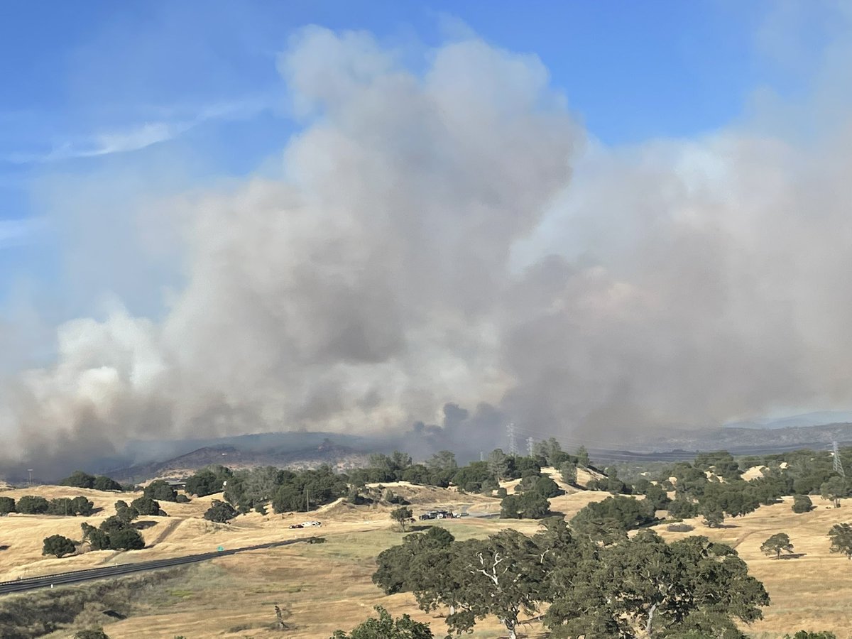
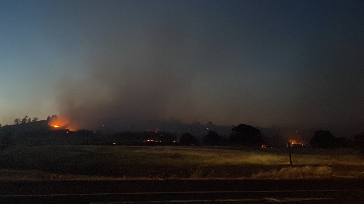
Aero Fire at 5K acres burned, fueled by the winds that got up to around 60 MPH today in Copperopolis area. The work crews put in to cut a line seen from Hwy. 4 (picture here near Hodson Rd) is clear tonight
 2 year ago
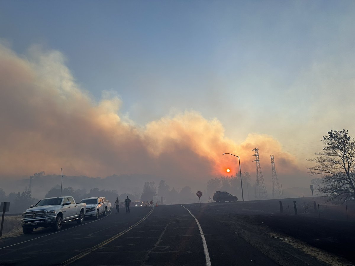
Main Street and Highway 4 @kcranews
 2 year ago
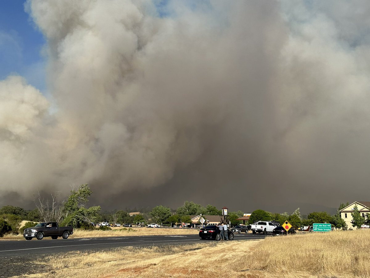
A few more picture from Highway 4, near the shopping center on Little John Road
 2 year ago
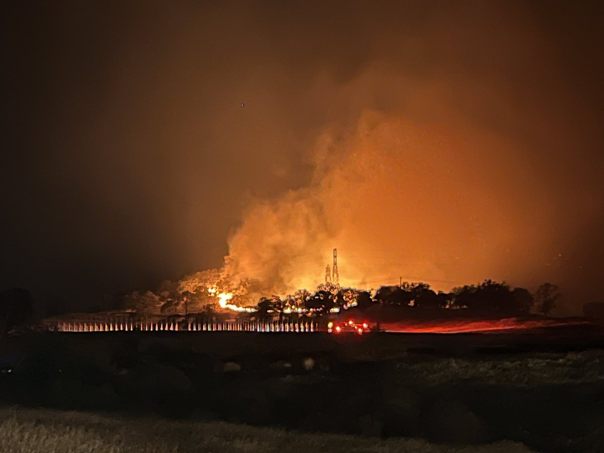
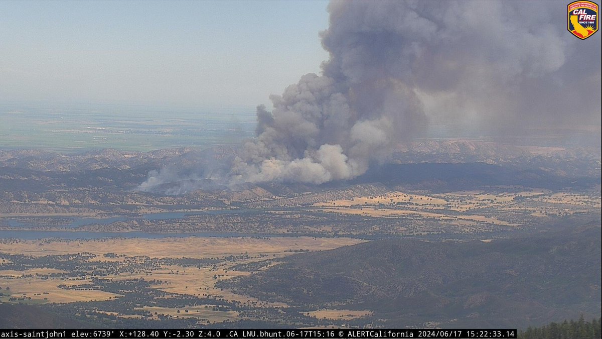
AERO FIRE just entered CalaverasCounty, about six miles from Copperopolis. The smoke has been visible nearly our entire drive here
 2 year ago
@CAL_FIRE spokesperson tells us Aero Fire has grown to 5,000 acres. No containment. Crews plan to work thru the night
 2 year ago
Aero Fire has grown to 5,000 acres. No containment.
HernandezFire off Airline HWY and Old Hernandez Rd, Beaver Dam in San Benito County is 642 acres and 45% contained. Unified Command: @CALFIREBEUand City of Hollister Fire Dept
Earthquake of magnitude 4.9 - 112 km SSW of Panguna, Papua New Guinea
Earthquake of magnitude 4.7 - 21 km NE of Hualien City, Taiwan
Earthquake of magnitude 5.5 - 54 km SSW of Alianza Cristiana, Peru
Earthquake of magnitude 5.0 - 181 km SW of Cuyutlán, Mexico
 2 year ago
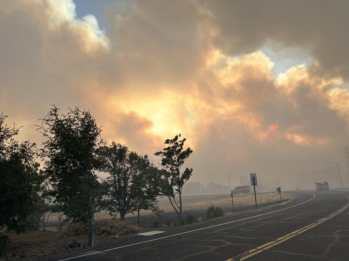
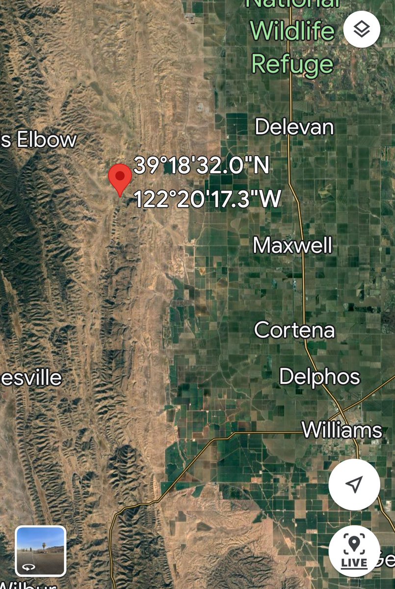
SitesFire Activity has significantly increased in the last 1/2 hour. Lodoga Colusa County Sites Fire
 2 year ago
A wind-whipped Southern California wildfire that started on Saturday ballooned to more than 15,600 acres on Monday. Firefighters managed to increase containment from 2% on Sunday to 8% on Monday, according to Cal Fire
 2 year ago
SitesFire New Incident - Vegetation Fire near Sites Lodoga Rd / Stone Corral Ave, Colusa. The fire approximately 50 acres that is influenced by Northernly Winds. If driving in the area use caution and give way to emergency vehicles
Earthquake of magnitude 5.2 - 47 km E of Kainantu, Papua New Guinea
The Post Fire has scorched nearly 14,625 acres in just two days. With only 8% containment and strong winds persisting, over 50 homes and 10 commercial properties remain under threat. Evacuations are ongoing.: Ventura County Fire Department /TMX
Strong winds and hot temperatures on Monday are expected to hinder efforts to contain a nearly 15,000-acre brush fire burning in Los Angeles and Ventura counties. Over 1,200 people have been evacuated, officials say
Earthquake of magnitude 5.6 - 91 km SSE of Lata, Solomon Islands
Earthquake of magnitude 5.5 - 76 km ESE of Neiafu, Tonga
Earthquake of magnitude 5.3 - 229 km SE of Lorengau, Papua New Guinea
Earthquake of magnitude 4.8 - 23 km ENE of Nichinan, Japan
 2 year ago
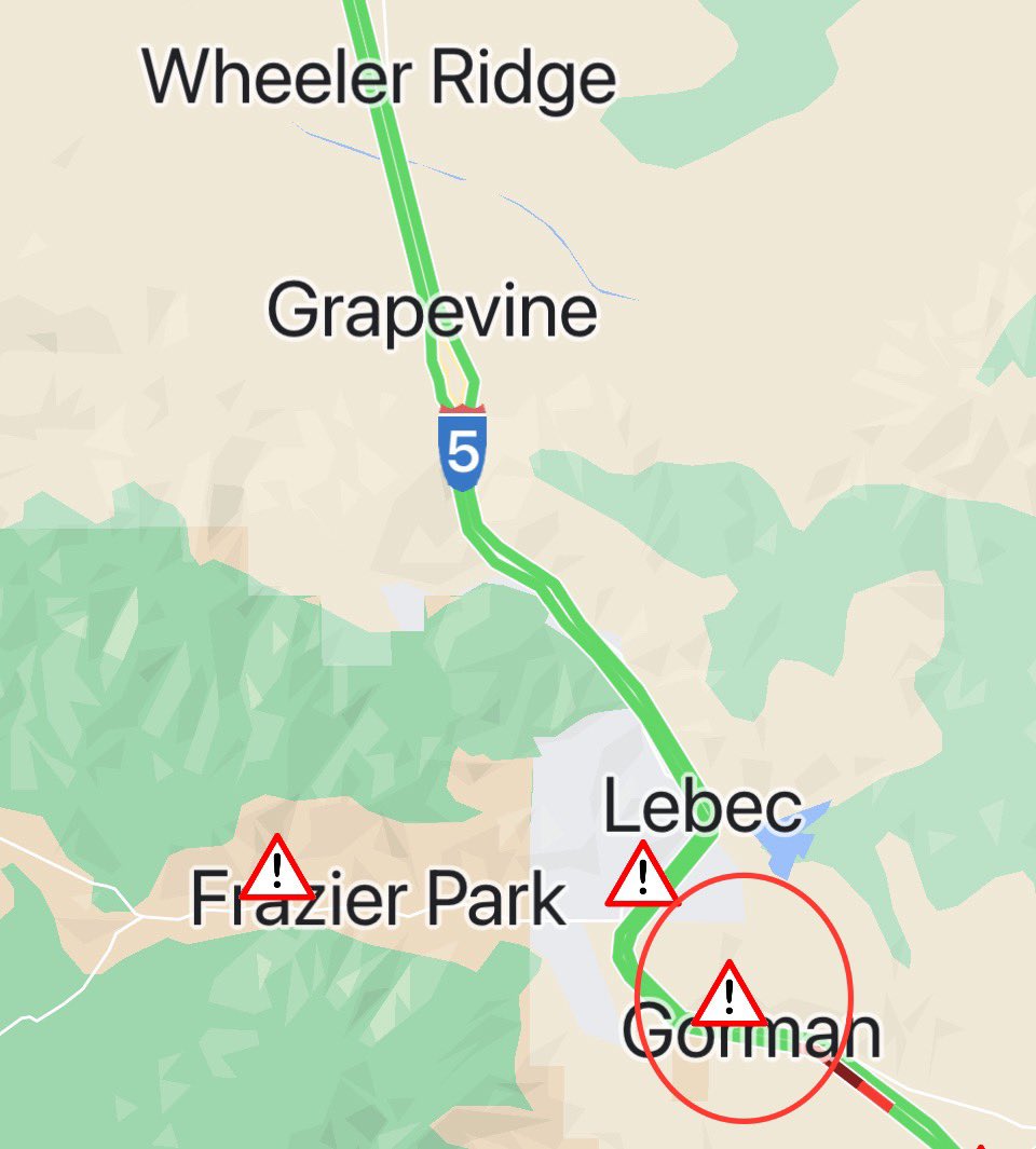
Photos from a friend of the GormanFire. Its burned over 12,000 acres at last check Southbound Interstate 5 at Gorman CLOSED due to grass fire Expect delays
The fire is approximately 300 acres. Structures continued to be threatened along W Dry Creek Road, north of Yoakim Bridge Rd and especially on the NE side of Bradford Mtn
Traffic Vegetation fire in Ocotillo threatens I-8
Earthquake of magnitude 4.9 - 169 km SE of Isen, Japan
Earthquake of magnitude 4.9 - Mid-Indian Ridge
Earthquake of magnitude 4.8 - Pagan region, Northern Mariana Islands