 1 year ago
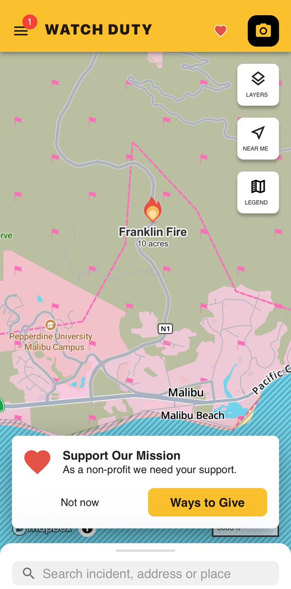
FranklinFire The Fire has jumped Puerco Canyon Road/Pacific Coast Highway, Evacuations for Malibu Beach RV Park
Earthquake of magnitude 4.6 - 75 km S of Fry, Greece
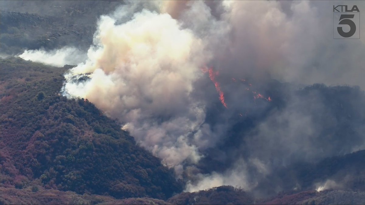
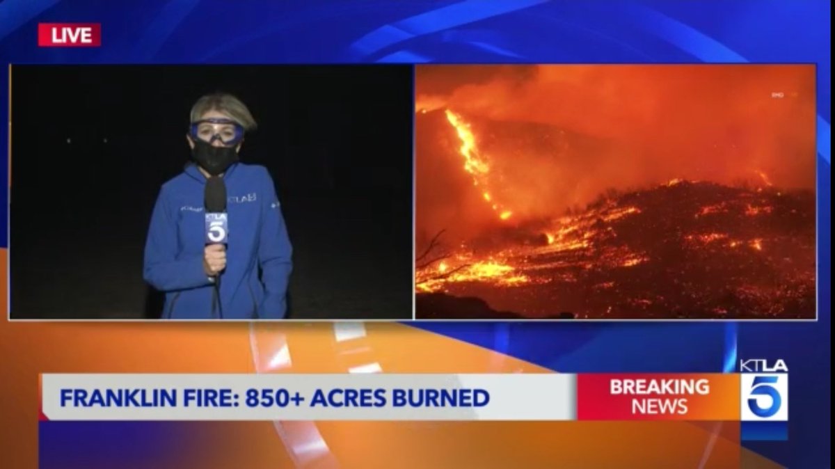
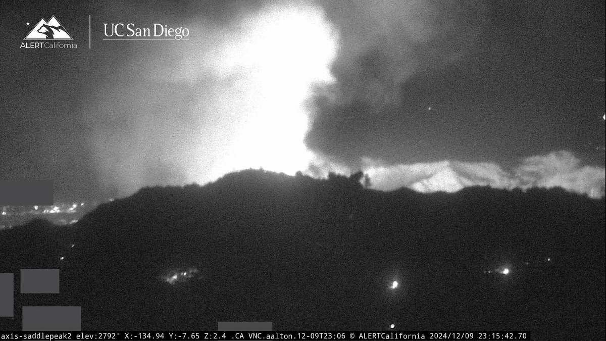
The Malibu wildfire that started on Monday has now spread to over 3,000 acres with 0% containment
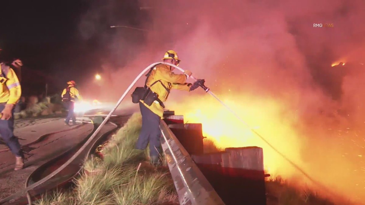
A wall of fire is burning towards the PCH near Puerco Canyon Road. Firefighters here are watching homes very closely Malibu FranklinFire
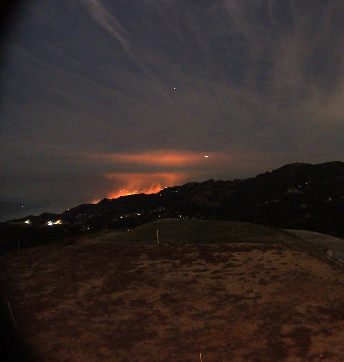
The wind is getting stronger tonight in Malibu, CA. The Franklin Fire appears to be spreading tonight near @pepperdine FranklinFire Malibu
Earthquake of magnitude 4.7 - 23 km ESE of Mawlaik, Myanmar
Earthquake of magnitude 4.7 - 155 km ESE of Pondaguitan, Philippines
 1 year ago
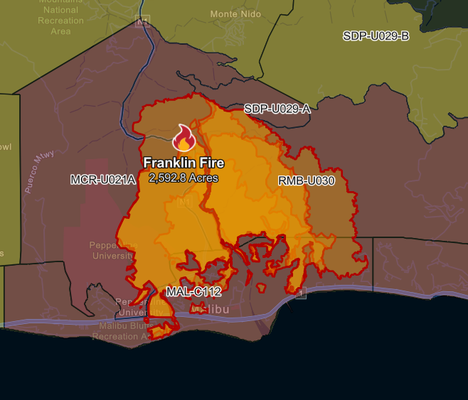
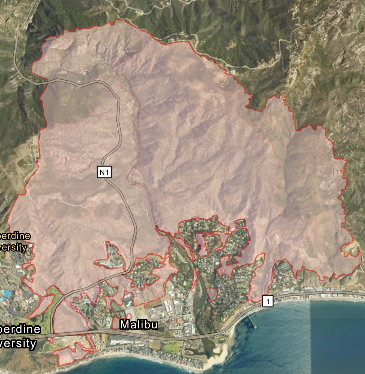
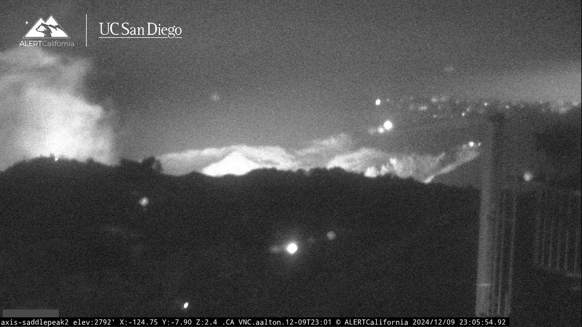
As of noon, the FranklinFire has scorched 2,667 acres, according to Cal Fire
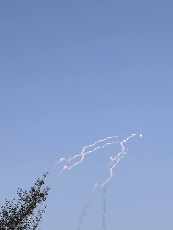
Fire breaks out along Highway 94 near U.S.-Mexico Border
 1 year ago
Border79Fire Air Tankers 71, 91 are overhead and Two Additional Helicopters were requested.OES Intel 24 is enroute
Border 79 Fire The fire is now 30 acres with a critical rate of spread and a potential for a major fire
 1 year ago
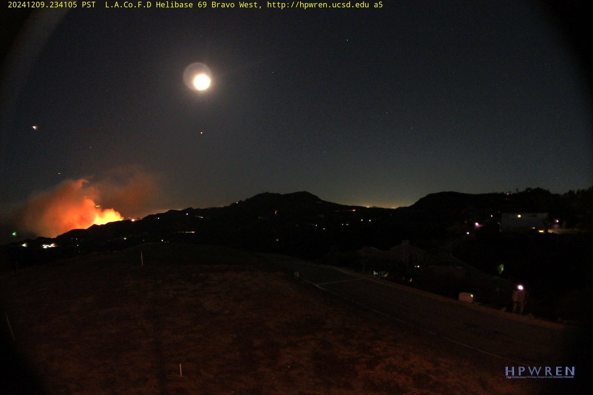
The Franklin Fire in Malibu has surpassed 2,500 acres as of late Tuesday morning
 1 year ago
FranklinFire OES Intel 24 has Mapped the Fire at 2,592 Acres
 1 year ago
US firefighters are battling a wildfire in Malibu, California that is prompting evacuations of about 6,000 people and more than 2,000 structures
 1 year ago
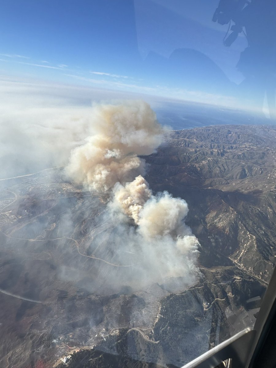
10am look at the FranklinFire from air7.Heavy fire activity on the west side
Earthquake of magnitude 5.8 - 93 km SSW of Adak, Alaska
Earthquake of magnitude 5.7 - 107 km SSW of Adak, Alaska
Earthquake of magnitude 5.7 - 110 km SSW of Adak, Alaska
@CoulsonAviation Chinook Helitanker 55 arriving back at Van Nuys Airport after a long night battling the franklinfire near Malibu. This aircraft can drop up to 3,000 gallons of water on a wildfire at a time
 1 year ago
FranklinFire in Malibu: Approximately 18,000 residents in the impacted area.8,100 structures are impacted: 2,043 under evacuation orders and 6,046 under warnings
At least 2.6 square miles had burned and structures were threatened
Earthquake of magnitude 4.8 - 15 km WSW of La Capilla, Peru
 1 year ago
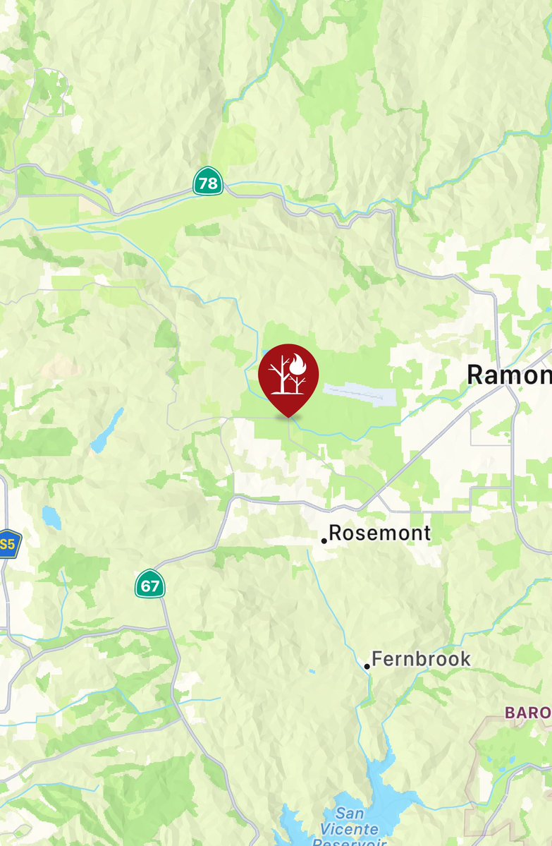
@CALFIRESANDIEGO is at scene of a vegetation fire near Highland Valley Road and Rangeland Road in the community of Ramona. The fire is 2 acres with a rapid rate of spread with a potential for an extended attack fire.
FranklinFire now at 1,822 acres
 1 year ago
The FranklinFire in Malibu has exploded to more than 1,600 acres.
The FranklinFire has made its way to PCH which is shut down in the Malibu area. This hillside is behind the Malibu campus of Santa Monica College.
 1 year ago
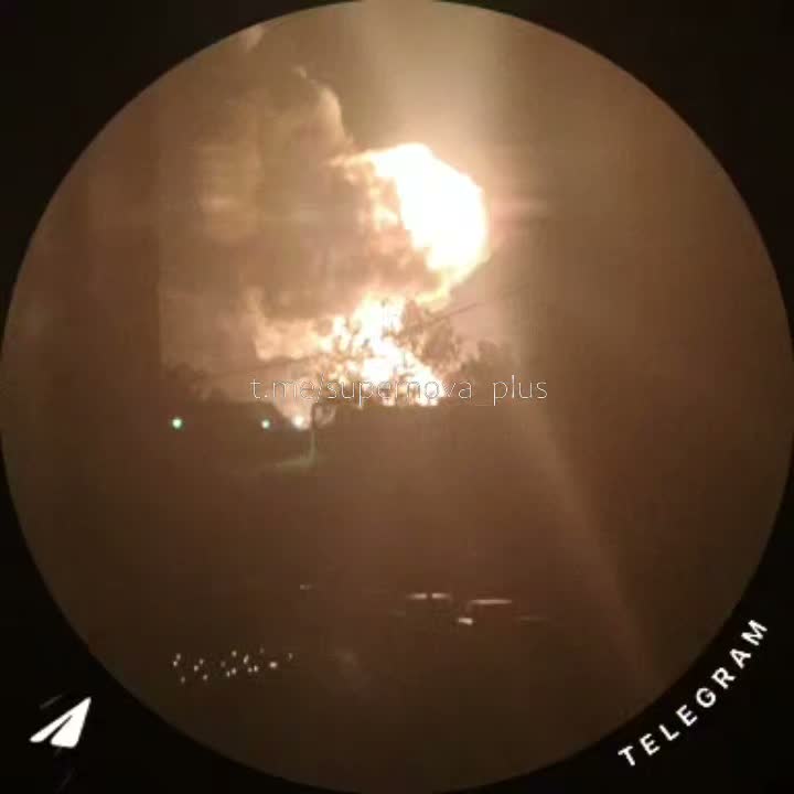
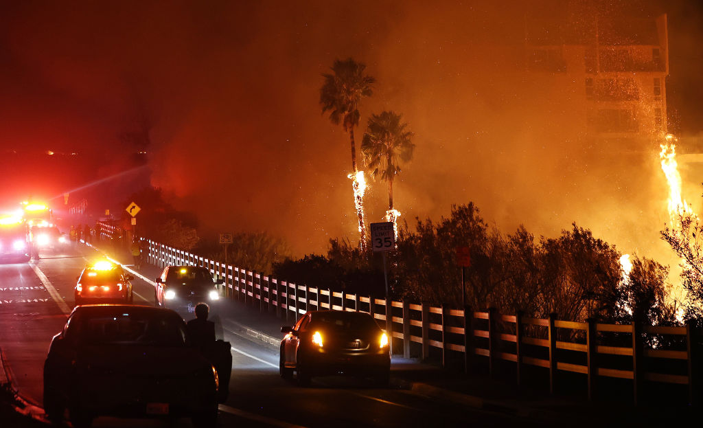
FranklinFire: The city of Malibu says flames have jumped Pacific Coast Highway and is nearing the Malibu Pier
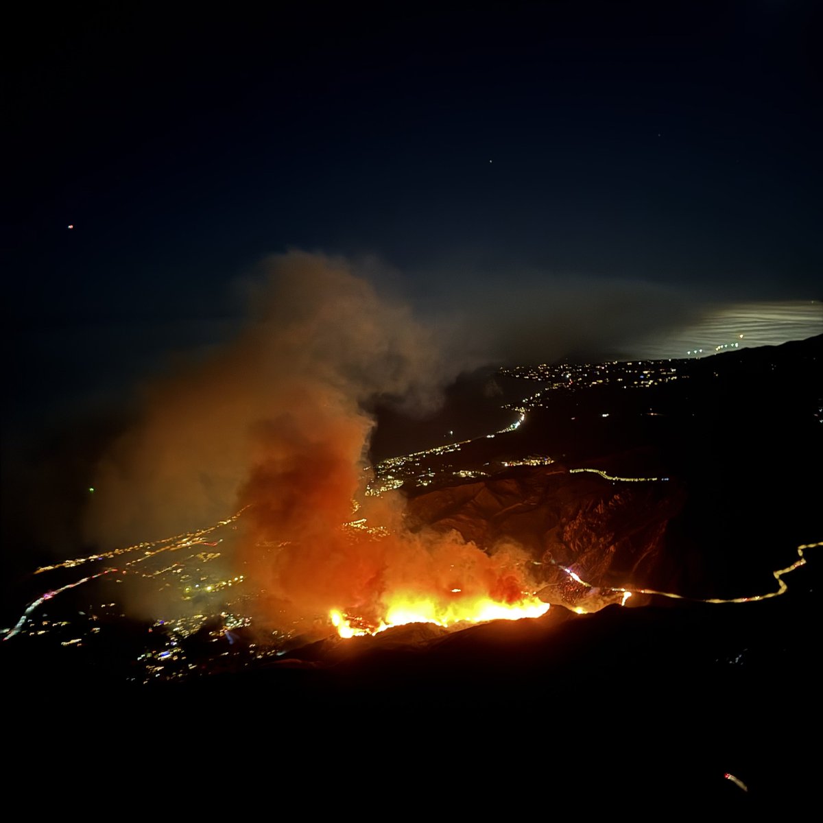
Flames and smoke from the Franklin Fire near a hotel along the Pacific Coast Highway in Malibu, California, grow as the blaze intensifies, prompting evacuations
 1 year ago
FranklinFire OES Intel 24 has Mapped the Fire at 1,674 Acres
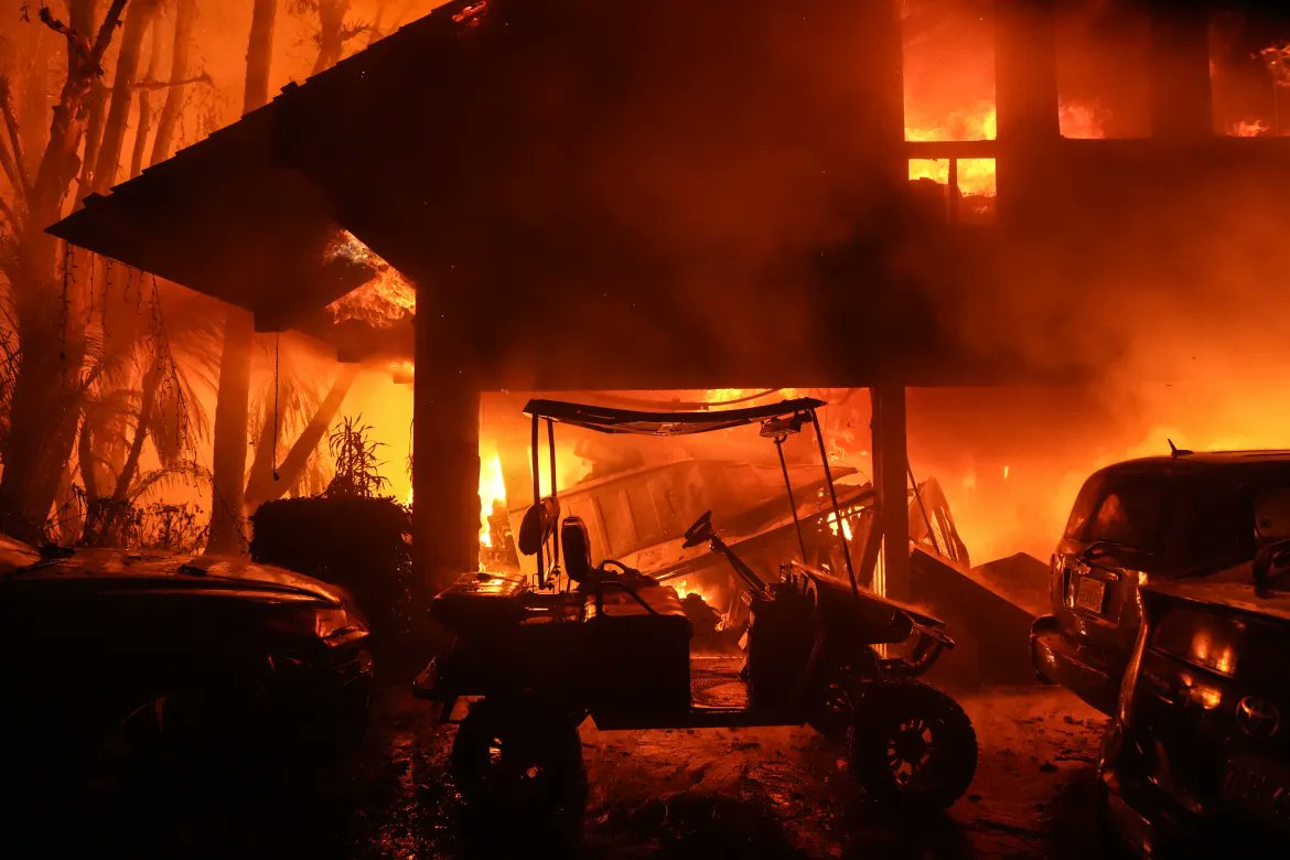
3463 Sweetwater Mesa, structure fire FranklinFire
 1 year ago
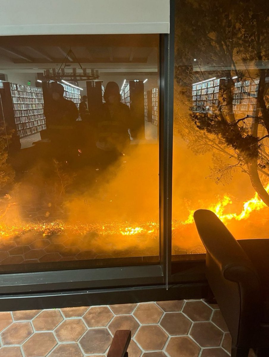
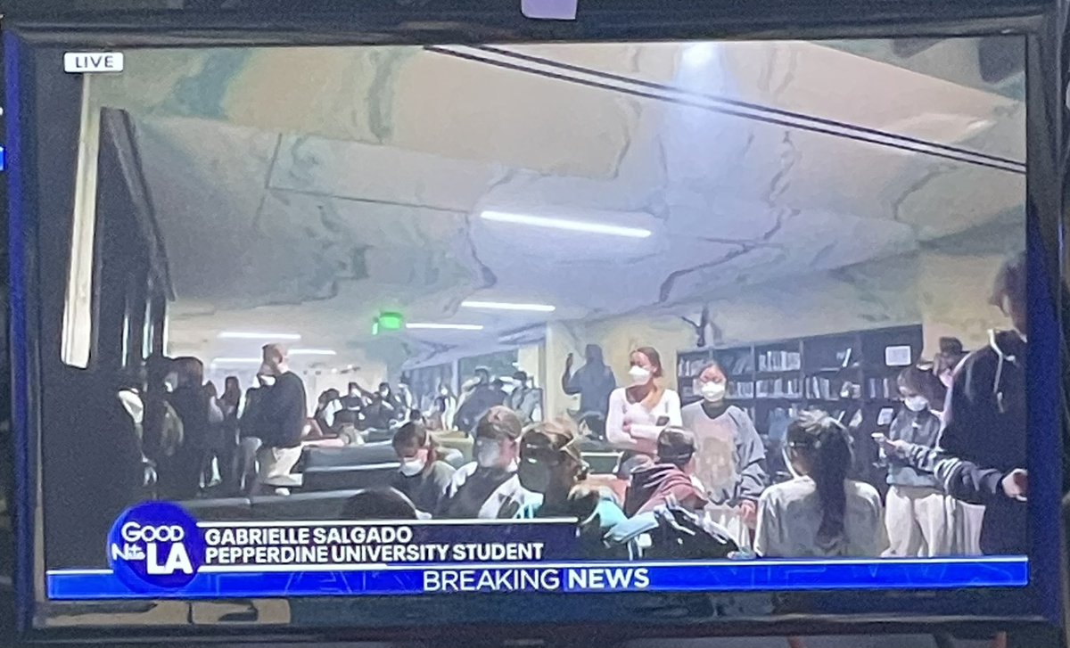
A student journalist at @pepperdine captured these images of the FranklinFire
3511 Coast View Dr currently on fire, multiple other structures in the area immediately impacted
Evacuation assistance needed at 3601 Vista Pacifica FranklinFire
 1 year ago
Student Gabrielle Salgado shows us how close the Franklinfire is to campus. The glow of the fire visible from the evacuation center on campus. Students are masked because of the heavy smoke, sheltering in place inside the University’s “fire resistant”
 1 year ago
FranklinFire Aircraft Assisting.OES Intel 24.LACoFD Copters 14, 15, 17, 22, Helitanker 55.OCFA Helitanker 47.Que Becs 1 and 2 are being requested to fly at First Light in the Morning
Structure immediately impacted at 24112 Malibu Rd FranklinFire
 1 year ago
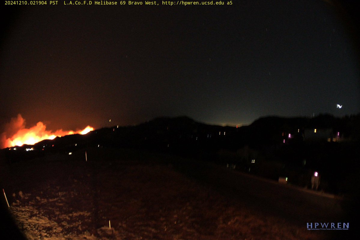
The FranklinFire in Malibu has been mapped at 853 acres, according to @LACoFDPIO
Large animal rescue in progress, about 27 horses FranklinFire
Earthquake of magnitude 4.7 - 14 km SSE of Jurm, Afghanistan
Active Vegetation Fire incident reported in Sawtelle, Los Angeles
 1 year ago
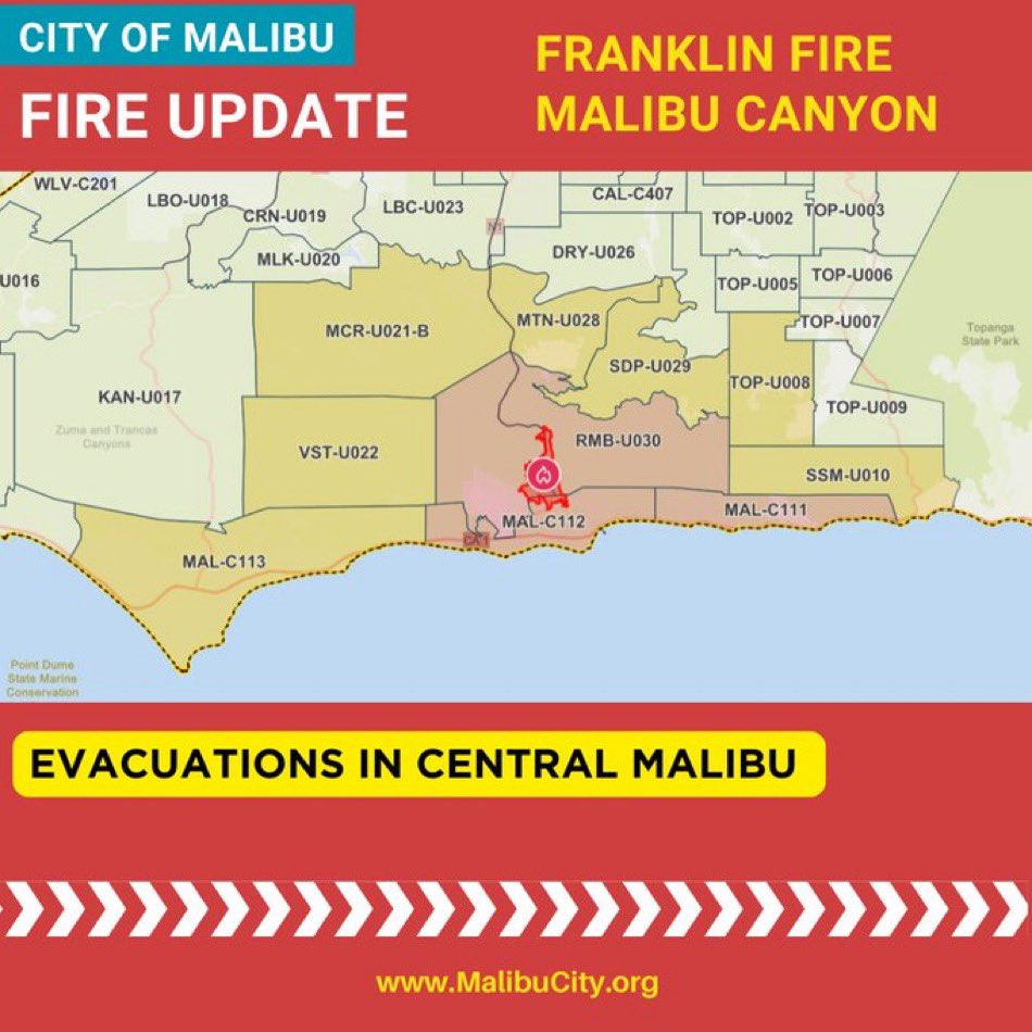
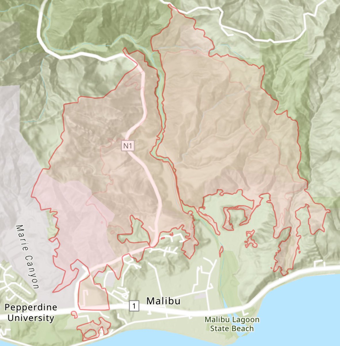
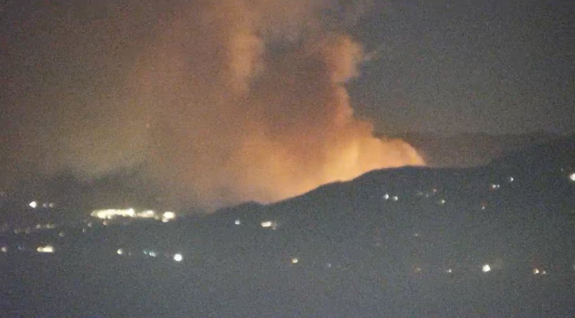
The FranklinFire in Malibu is spreading rapidly east of Malibu Canyon Rd in the direction of Serra Retreat, which is now under a mandatory EVACUATION ORDER
Earthquake of magnitude 5.3 - Southwest Indian Ridge
The FranklinFire is now at 100 acres.Multiple copters overhead dropping water.Mandatory evacuations for Cross Creek Rd & Palm Canyon is gonna impact the community within 20 minutes FranklinFire
 1 year ago
FranklinFire The North end of Serra Retreat Center is expected to be impacted in the Next 20 minutes, Potential impact for Malibu Crest Drive.Evacuations for Carbon Canyon Road/Corral Canyon Road
 1 year ago
FranklinFire Helco Fire will Impact Malibu Crest Drive.North End of Serra Retreat will be impacted shortly
 1 year ago
Mandatory evacuations for Cross Creek Rd & Palm Canyon is gonna impact the community within 20 minutes FranklinFireRequesting a 3rd alarm brush response. Fire is at 30 acres FranklinFire
There is now a structure threat on Palm Canyon Road and Serra Road. Strike teams and aircraft are now working to mitigate the structure threat. Evacuations are now underway.
 1 year ago
Requesting a 3rd alarm brush response. Fire is at 30 acres FranklinFire4 helicopters assigned to this is moving to the east and priority is structure protection.
 1 year ago
FranklinFire A Fixed wing aircraft was requested, only OES Intel and Air Attack 51 is able to fly.QRF Helitanker 55 is enroute. The Fire is pushing towards the East, Priority is protecting structures at the Head
 1 year ago
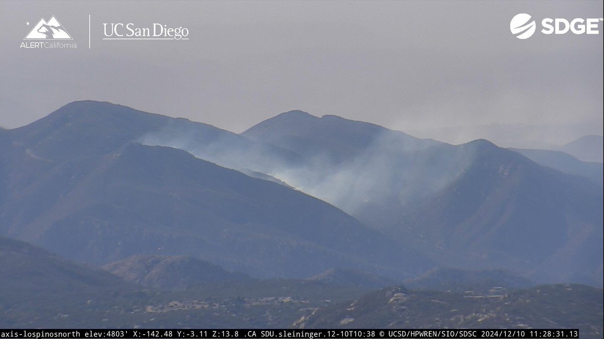
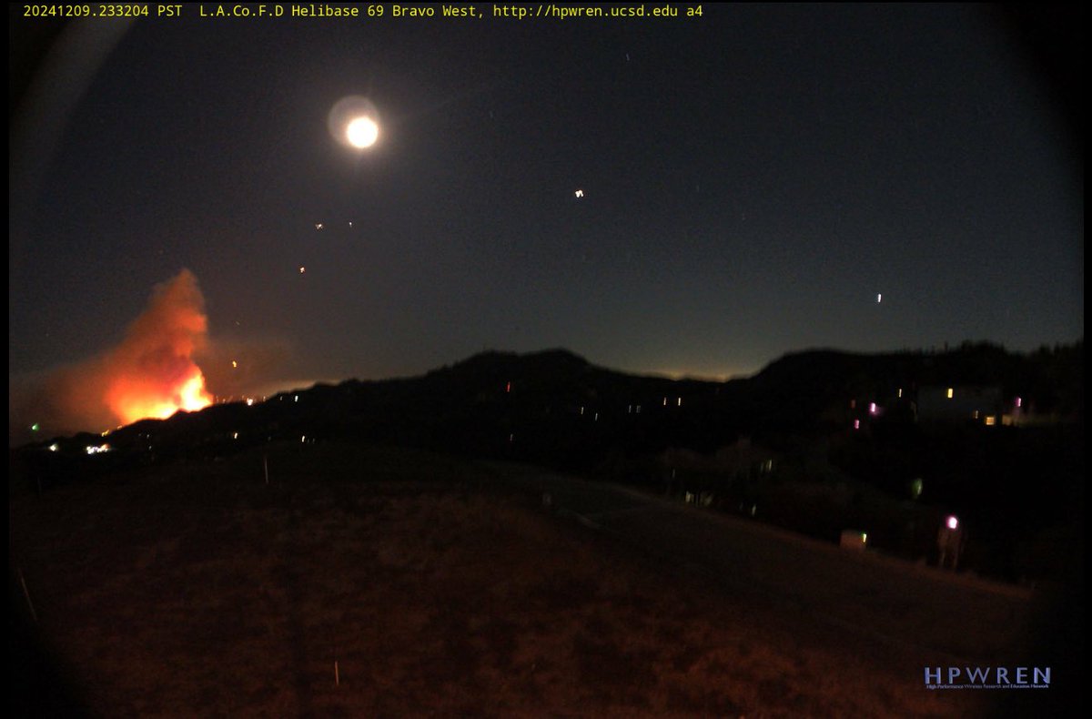
FranklinFire The fire is now 10 acres with rapid rate of spread & potential for 100 acres, a 2nd alarm is being requested per Incident Command. The fire is spotting across the canyon per radio traffic
 1 year ago
New Brush Fire Malibu Canyon Road/Fransisco Ranch Road, Malibu.10 acres, Rapid ROS, Potential for 100 acres.LACoFD Copters 14, 15, 17, are enroute
Earthquake of magnitude 4.8 - 232 km N of Tobelo, Indonesia
 1 year ago
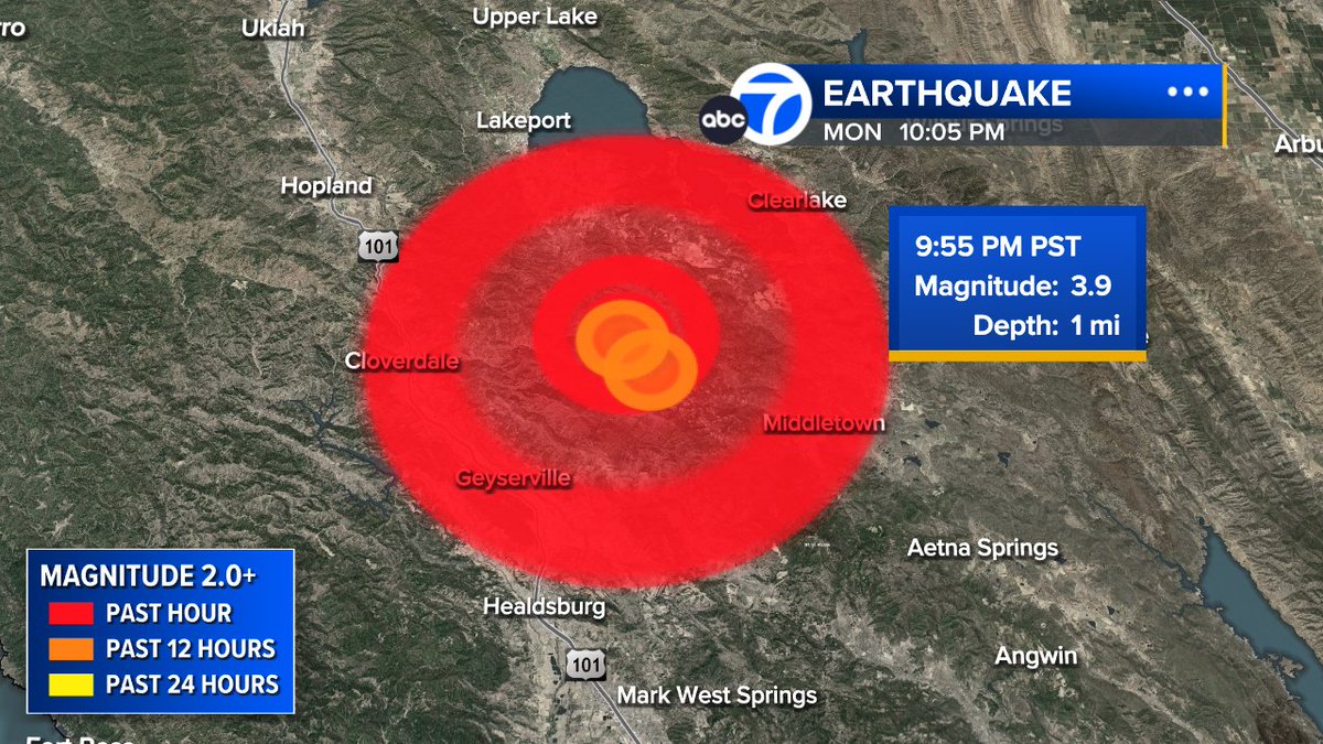
3.9 magnitude earthquake NNW of Geysers tonight.
 1 year ago
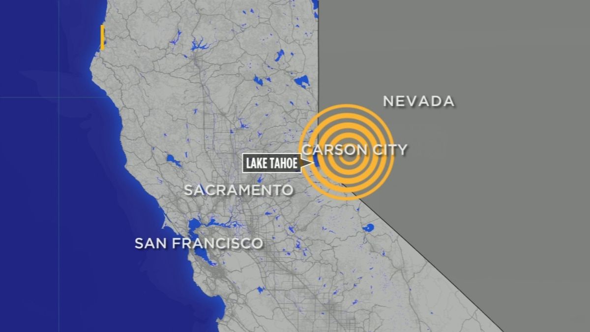
5.8 magnitude earthquake strikes near Carson City, felt in parts of Bay Area
Earthquake of magnitude 5.0 - 107 km SSW of Adak, Alaska
Earthquake of magnitude 5.1 - 100 km SSW of Adak, Alaska
Earthquake of magnitude 5.8 - 22 km NNE of Yerington, Nevada
Earthquake of magnitude 5.6 - 26 km NE of Yerington, Nevada
Earthquake of magnitude 5.8 - 28 km SE of Silver Springs, Nevada
Earthquake of magnitude 5.7 - 22 km NNE of Yerington, Nevada
3.3 magnitude earthquake. 14 mi from Weedpatch, CA, United States
Earthquake of magnitude 4.8 - 22 km ESE of Ōhara, Japan