TORNADO Dodge, Dane, Columbia, and Jefferson Counties in WI Severe line with radar indicated rotation moving East at 50mph over Beaver Dam
Earthquake of magnitude 4.9 - Pacific-Antarctic Ridge
Earthquake of magnitude 4.6 - Mariana Islands region
Earthquake of magnitude 4.7 - 107 km WNW of Höfn, Iceland
Earthquake of magnitude 4.7 - 82 km SW of Victor Raul, Peru
BonnyFire off the 45000 Block of Bonny Lane near Aguanga in Riverside County is 877 acres and 5% contained.
SunsetFire off of Mesa Street and Gilman Street, near Banning in Riverside County is 103 acres and 90% contained.
Earthquake of magnitude 5.6 - South Sandwich Islands region
Earthquake of magnitude 5.6 - Andaman Islands, India region
Earthquake of magnitude 4.8 - 70 km SE of Kokhanok, Alaska
Earthquake of magnitude 4.7 - Santa Cruz Islands
Earthquake of magnitude 5.0 - Fiji region
Earthquake of magnitude 4.8 - 75 km NE of Port-Olry, Vanuatu
Earthquake of magnitude 4.8 - South Sandwich Islands region
BonnyFire off the 45000 Block of Bonny Lane near Aguanga in Riverside County is 500 acres and 10% contained.
TurkeyFire off Turkey Creek Trail and Swedes Flat Road, near Bangor in Butte County is 65 acres and 80% contained.
Earthquake of magnitude 4.7 - West Chile Rise
Earthquake of magnitude 4.7 - south of the Fiji Islands
Earthquake of magnitude 4.7 - 116 km SW of Akhiok, Alaska
Earthquake of magnitude 4.8 - 102 km ENE of Port-Olry, Vanuatu
Earthquake of magnitude 5.9 - Southwest Indian Ridge
Earthquake of magnitude 4.7 - 125 km SE of Hiroo, Japan
Earthquake of magnitude 4.9 - Southwest Indian Ridge
Earthquake of magnitude 5.4 - Southwest Indian Ridge
Earthquake of magnitude 5.6 - Southwest Indian Ridge
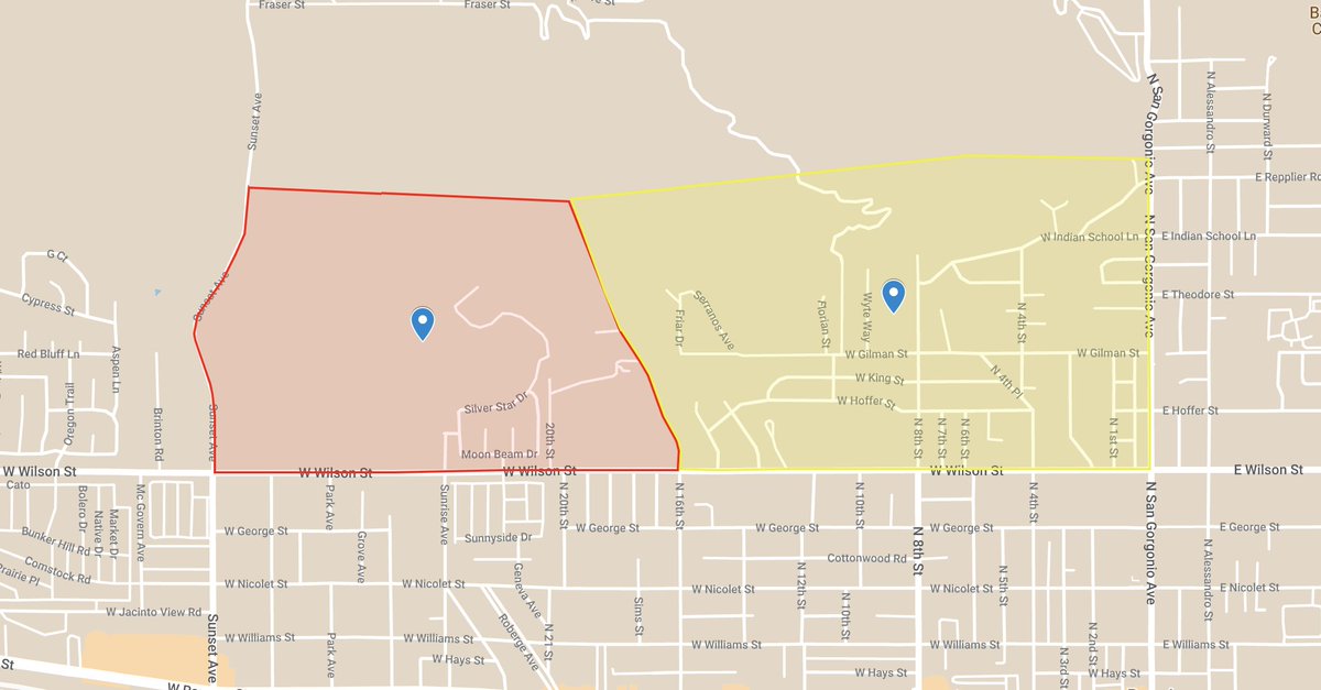
New Incident: SunsetFire off of Mesa Street cross of Gilman Street, near Banning in Riverside County is 103 acres and 50% contained
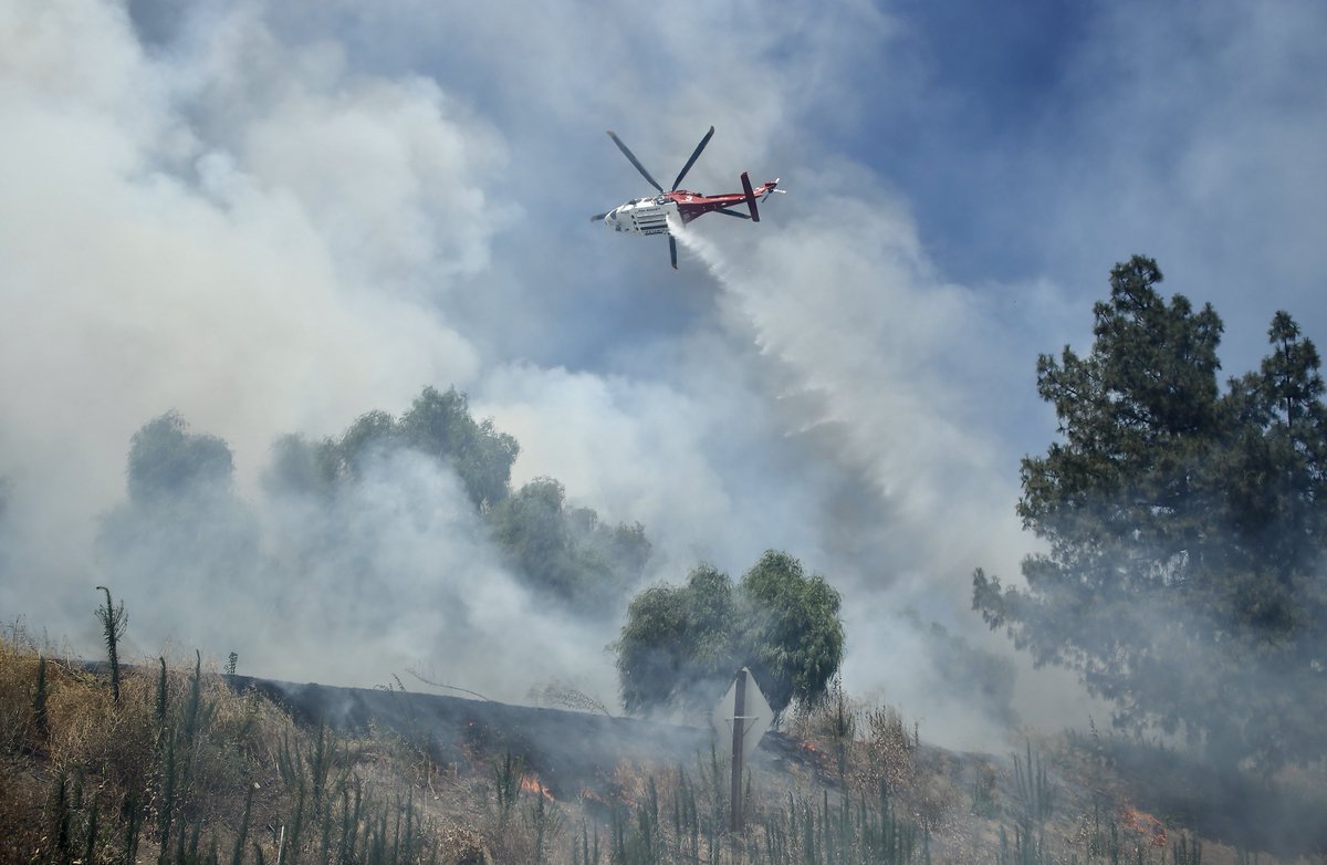
The SunsetFire has burned 103 acres in Banning. The fire is 50% contained. All evacuation orders and warnings remain in place
 2 year ago
An EVACUATION ORDER has been issued for the following area: South of Silver Star Drive, East of Sunset Ave, North of Wilson St and West of 16th St.nnAn EVACUATION has been issued for: North of Wilson Street, East of 16 th St
A brush fire that erupted near the Cahuilla Indian Reservation south of Aguanga in Riverside County has consumed roughly 225 acres
Earthquake of magnitude 4.6 - Eastern Xizang
Brush fire burning near Tecate, Calif., structures threatened
 2 year ago
brushfire along the 118 today in GrenadaHills
Earthquake of magnitude 4.7 - South Sandwich Islands region
Earthquake of magnitude 4.9 - south of the Mariana Islands
Earthquake of magnitude 4.8 - 94 km SSE of Sola, Vanuatu
Earthquake of magnitude 4.8 - 27 km SSW of Palora, Ecuador
Earthquake of magnitude 5.0 - 205 km NNE of Shi Yomi, India
Earthquake of magnitude 5.0 - 88 km ENE of Port-Olry, Vanuatu
Earthquake of magnitude 5.1 - central Mid-Atlantic Ridge
Earthquake of magnitude 4.9 - central Mid-Atlantic Ridge