Earthquake of magnitude 4.6 - 132 km ENE of Petropavlovsk-Kamchatsky, Russia
Earthquake of magnitude 5.5 - 32 km ESE of Neiafu, Tonga
Earthquake of magnitude 5.1 - 103 km SE of Dicabisagan, Philippines
Vegetation Fire:rpt@10:58 p.m. Approximately two acres of tamarisk trees burning adjacent to the railroad tracks. No threat to any structures
Earthquake of magnitude 5.2 - 8 km E of Bantay, Philippines
3.5 magnitude earthquake. 49 km from Pāhala, HI, UnitedStates
3.8 magnitude earthquake. 73 km from Loving, NM, United States
 3 year ago
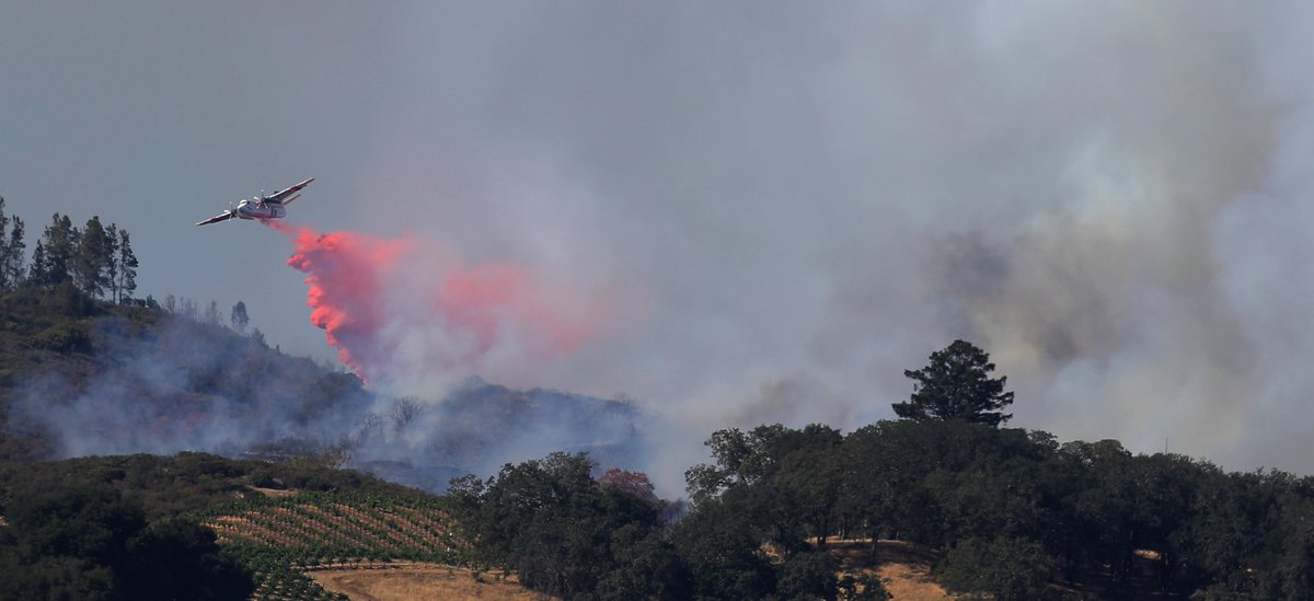
16:9 format day at the PineFire above Cloverdale, Tuesday. Highly visible from the valley floor, the fire burned about 14 acres
Earthquake of magnitude 4.7 - south of the Fiji Islands
Earthquake of magnitude 4.6 - 43 km ESE of Naalehu, Hawaii
Earthquake of magnitude 4.9 - 14 km ESE of Dolores, Philippines
Earthquake of magnitude 4.8 - 17 km SE of Bantay, Philippines
 3 year ago
CableFire (W/O PollockPines, El Dorado Co) - All aircraft have been released & AA stated the fire is looking good & there is hose lay + line around the entire fire as they departed. Little smoke left on cams, final update unless something changes
Earthquake of magnitude 4.7 - 6 km NNW of Bantay, Philippines
Earthquake of magnitude 5.0 - south of the Fiji Islands
Earthquake of magnitude 4.9 - 3 km NNW of San Ramon, Philippines
Earthquake of magnitude 7.1 - 11 km ESE of Dolores, Philippines
Earthquake of magnitude 5.0 - 94 km SSE of Kieta, Papua New Guinea
Tornado Warning including Cheyenne County, CO, Kit Carson County, CO until 6:15 PM MDT
Tornado Warning including Keith County, NE, Perkins County, NE until 5:15 PM MDT
Tornado Warning including Kit Carson County, CO until 5:45 PM MDT
Tornado Warning including Seibert CO until 5:30 PM MDT
Tornado Warning including Ogallala NE and Roscoe NE until 5:00 PM MDT
Earthquake of magnitude 4.7 - Fiji region
Tornado Warning including Vona CO until 5:15 PM MDT
Tornado Warning including Stratton CO until 5:15 PM MDT
Tornado Warning including Stratton CO until 4:30 PM MDT
Earthquake of magnitude 4.9 - 53 km SSW of Jurm, Afghanistan
4.0 magnitude earthquake. 223 km WSW of Adak, Alaska
 3 year ago
Drifting smoke from the massive Oak Fire burning near Yosemite will bring hazy skies to the Bay Area over the next few days, prompting air district officials to extend an air quality advisory through Wednesday
Earthquake of magnitude 4.6 - 28 km NE of Khawhai, India
 3 year ago
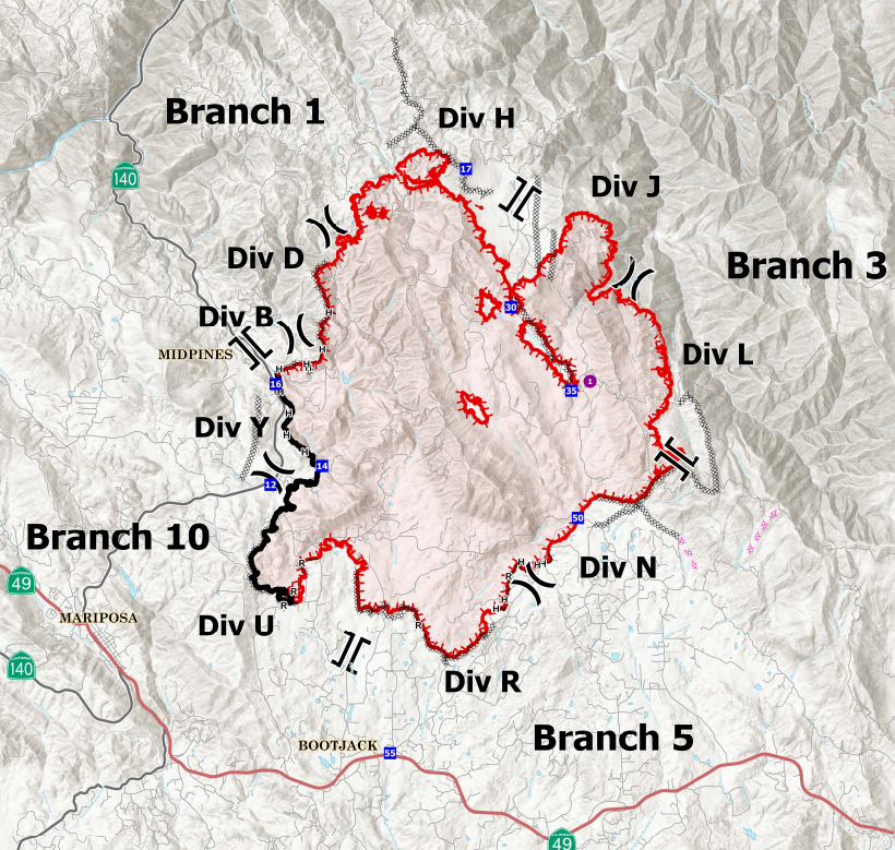
OakFire (Midpines, Mariposa Co) - Last update for tonight: very prominent on cams @ the north end, not hearing anything on it though. Ops map below: containment (black outline) showing for all of Hwy 140 S/O Carstens Rd. Night copter back @ base a while now, got too smokey
Earthquake of magnitude 4.9 - 48 km N of Finschhafen, Papua New Guinea
MillerFIre in Raymond, Madera Co: 3 acres in grass with structures threatened per first arriving resource, full response dispatched. Miller St & School St
Earthquake of magnitude 5.3 - 109 km NE of Gisborne, New Zealand
Earthquake of magnitude 5.0 - Owen Fracture Zone region
 3 year ago
Firefighters now have 16 percent containment on the OakFire, which has burned more than 17,000 acres.
Earthquake of magnitude 4.8 - 281 km S of Prince Rupert, Canada
Earthquake of magnitude 4.8 - 297 km S of Prince Rupert, Canada
As the OakFire burns in Mariposa County, we're keeping a close eye on its AirQuality impact around the Bay Area. The region is under an air quality advisory, but that didn't change the plans of some hikers
OakFire (Midpines, Mariposa Co) - Copter 903 now assigned to the incident & is currently en-route to do some night time water drops in Division J on the N/E side of the fire
Earthquake of magnitude 4.7 - Molucca Sea
Earthquake of magnitude 4.8 - Bonin Islands, Japan region