3 year ago
Dense Fog Advisory in Bay Area
Earthquake of magnitude 5.1 - Kermadec Islands, New Zealand
Earthquake of magnitude 5.3 - 93 km E of Port-Olry, Vanuatu
Earthquake of magnitude 5.4 - 66 km WNW of Abepura, Indonesia
Earthquake of magnitude 4.6 - 48 km NW of Nuku‘alofa, Tonga
Earthquake of magnitude 4.9 - South Sandwich Islands region
Structure Fire Working 7200 Charles Ct BC01; BC08; EN05; E 340089 01:29 A
Earthquake of magnitude 5.6 - South Sandwich Islands region
Earthquake of magnitude 4.6 - 42 km NNW of Oxapampa, Peru
3.9 magnitude earthquake. 50 km SE of Adak, Alaska
3.1 earthquake shakes parts of Riverside County
Earthquake of magnitude 5.0 - Southwest Indian Ridge
3.1 magnitude earthquake. 1 mi from Valle Vista, CA, United States
Earthquake of magnitude 4.6 - 51 km NNW of Nuku‘alofa, Tonga
Earthquake of magnitude 4.9 - 66 km SW of Masachapa, Nicaragua
Earthquake of magnitude 4.6 - 92 km ESE of Qom, Iran
Earthquake of magnitude 4.9 - 29 km WNW of Haveluloto, Tonga
Earthquake of magnitude 4.8 - 54 km WNW of Lebu, Chile
 3 year ago
Members of the HFD Tactical Deployment Division's Wild Land team deployed and worked overnight in Bastrop,Tx. So far, 785 acres have burned, and the fire is only 30% contained
 3 year ago
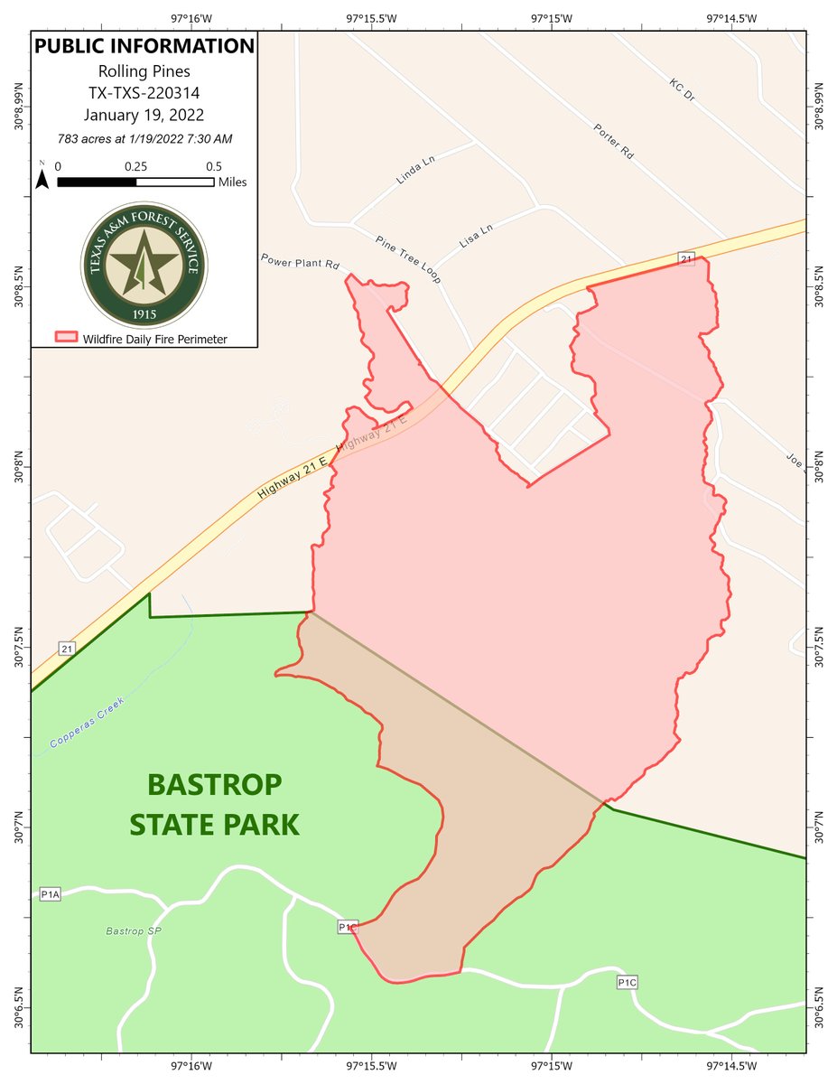
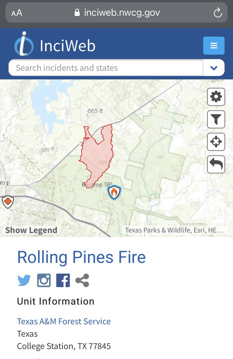
Public information map for the RollingPinesFire in Bastrop County showing 783 acres as of January 19, 2022
Earthquake of magnitude 4.9 - 174 km ENE of Katabu, Indonesia
 3 year ago
Rolling Pines Fire UpdateJanuary 19, 20229:00 amSize: 783 acresContainment: 30%
Earthquake of magnitude 4.7 - 82 km NNW of Bima, Indonesia
 3 year ago
Rolling Pines Fire grows to 783 acres and containment increases to 30%. from Bastrop County Office of Emergency Management
Earthquake of magnitude 5.5 - 219 km E of Amahai, Indonesia
 3 year ago
RollingPinesFire: @RemadnaKXAN says this morning there's no visible smoke, flames or even smell of smoke in Bastrop County - Hwy 21 still shutdown - At last check, 500 acres burned. 10% contained - 250 families evacuated
 3 year ago
RollingPinesFire has tamed with much lighter winds as compared to a few hours ago. Fire fighters able to attack from close range now. No update on containment. SH21 remains closed from FM1441 to South Shore Road
Earthquake of magnitude 4.6 - 21 km NW of Dogonbadan, Iran
Earthquake of magnitude 5.4 - southwest of Africa
Earthquake of magnitude 4.6 - 16 km WNW of Yopal, Colombia