 3 year ago
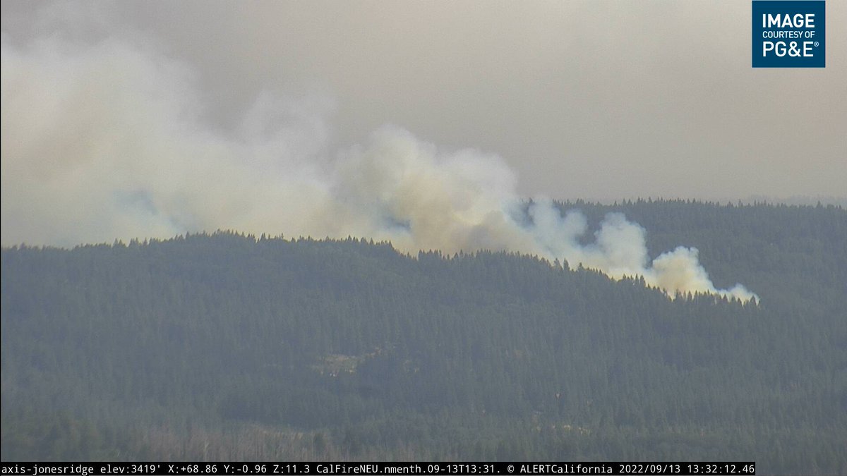
DutchFire 10+ acres, Tankers 88 and 89 working the fire, two helicopters at scene. Firefighters are providing structure protection. Two large tankers requested
DutchFire (DutchFlat, Placer Co) - IC reporting 5+ acres with multiple spot fires on the right flank & shoulder, diverted ground resources to access off Frost Hill Pl. Getting a type 3 engine strike team off the Mosquito. AA requested 3 more tankers, 1 to be a large air tanker
Earthquake of magnitude 5.1 - South Sandwich Islands region
 3 year ago
MosquitoFire flying in to Sacramento from vacation. It continues to burn — smoke filling the skies
DutchFire (DutchFlat, Placer Co) - AA230 calling it 10 acres now which includes numerous spot fires, requesting a 2nd large air tanker
 3 year ago
New start DutchFire westbound I-80 near Dutch Flat off ramp. Units at scene
 3 year ago
DutchFire near DutchFlat in Placer Co, I-80 & Ridge Rd: 3 acres with moderate rate of spread, 1 structure immediately threatened, addl engines requested. 2 retardant drops across the head so far
DutchFire westbound I-80 in Placer County. 3 acres, one structure immediately threatened. Augmented dispatch
Earthquake of magnitude 5.2 - 110 km SE of Burica, Panama
Earthquake of magnitude 5.1 - southern Mid-Atlantic Ridge
Earthquake of magnitude 4.7 - 67 km W of San Antonio de los Cobres, Argentina
Earthquake of magnitude 4.7 - Pagan region, Northern Mariana Islands
Earthquake of magnitude 4.9 - 179 km W of Naha, Japan
Earthquake of magnitude 4.7 - 75 km WNW of Barcelona, Venezuela
Earthquake of magnitude 4.6 - 209 km E of Namie, Japan
Earthquake of magnitude 4.9 - southern Sumatra, Indonesia
Earthquake of magnitude 4.8 - 275 km ESE of Katabu, Indonesia
Earthquake of magnitude 5.0 - south of the Fiji Islands
Tornado Warning including Kings County, NY, Queens County, NY until 5:00 AM EDT
3.2 magnitude earthquake. 68 km from Mentone, TX, United States
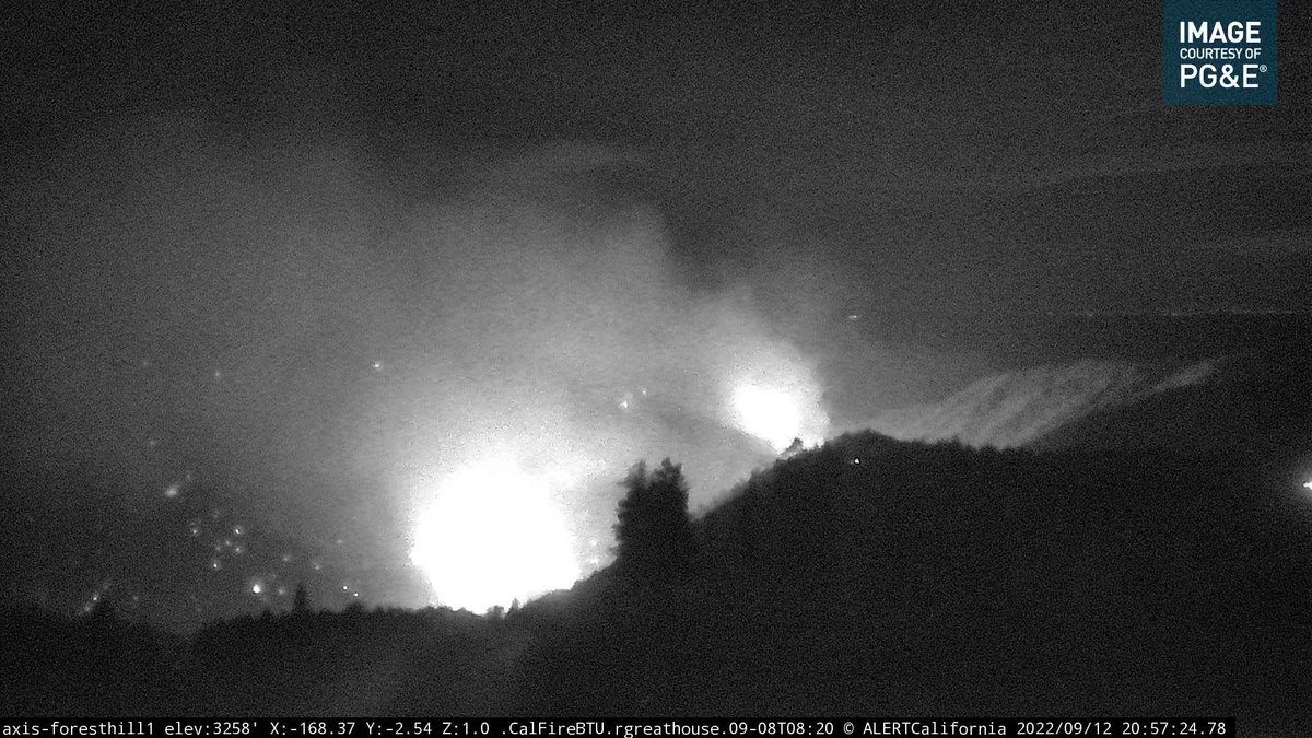 3 year ago
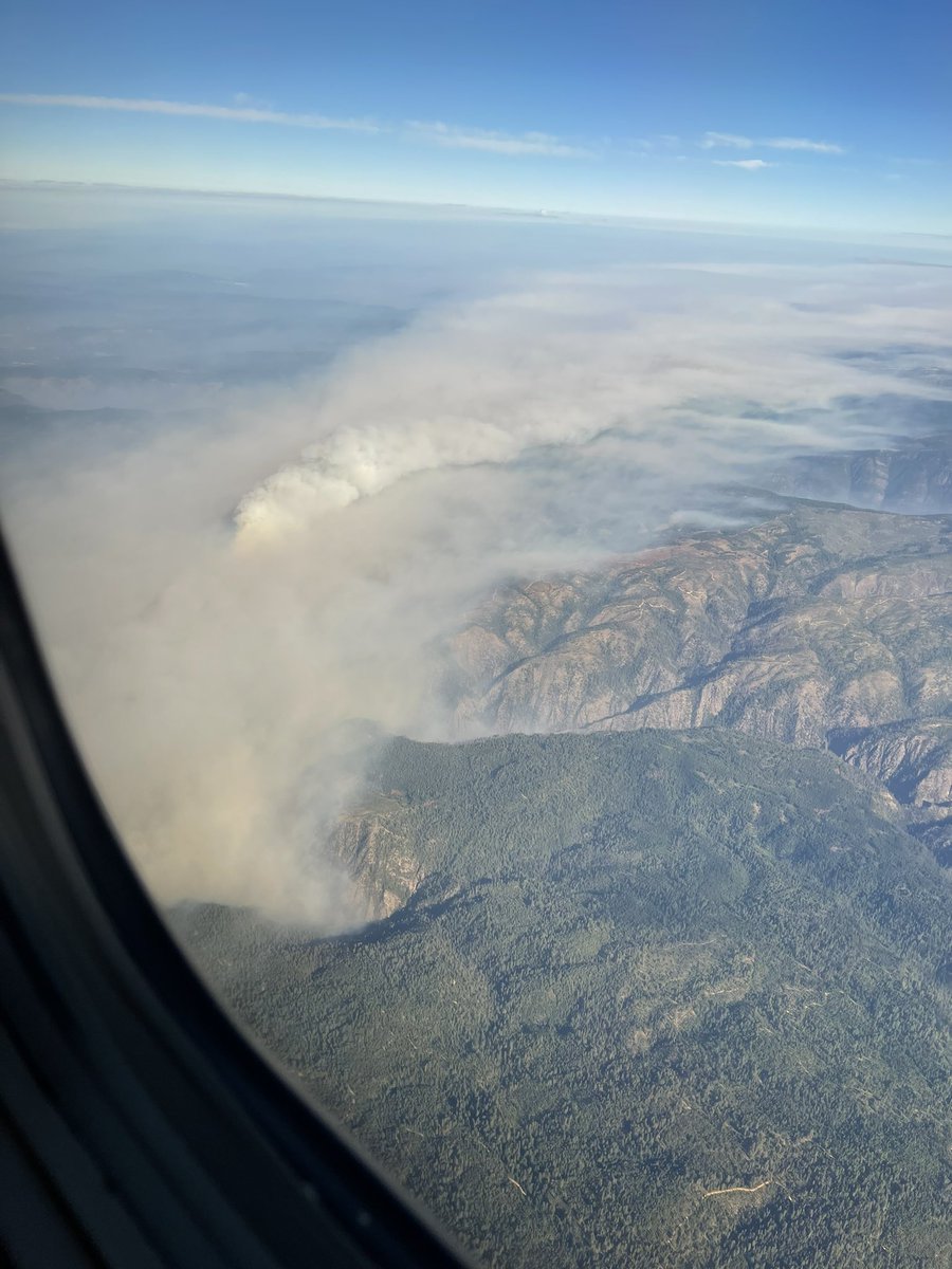
MosquitoFire (Foresthill, Placer Co/El Dorado Co) - Copter 305 overhead for night ops, reporting the S/W wind push has cleared all the smoke out on the S/W side. Some clearer views on cams too (left cam = Buckeye Point firing ops, good progress there per earlier meeting)
Incident: Vegetation Fire Agency: San Jose Fire Department 8:35 PM PDT 9/12/22 Responding Unit: B2 E2 E19 E619 10535 CROTHERS RD, SAN JOSE, CA
Earthquake of magnitude 5.0 - east of the South Sandwich Islands
MosquitoFire - There are preexisting fuel breaks on the eastern side, they're looking to utilize those in addition to old burn scars in the area. Continuing mop up in the Quintette through Volcanoville areas. Successful day in the Buckeye Point area too, looking good there
MosquitoFire - Little bit of wind movement today with persistent S/W wind flow, pushing fire deeper into forest areas. They're expecting air flow to increase tomorrow & Wednesday, expecting a bit of an uptick in fire behavior. 1 more arrest in El Dorado Co for a total of 8 now
MosquitoFire - N/E: contingency lines are being proposed, plans being developed for coming across the N & E sides. Pretty active on the east side still, in the N/E portion they observed torching & crowning of trees in groups, the fire started to move with limited air flow today
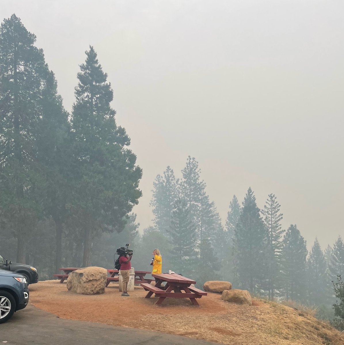
Mosquitofire shows officer driving through flames to rescue elderly couple. The fire has burned 46,000 acres and is at 10% containment
Earthquake of magnitude 4.7 - 216 km WNW of Abepura, Indonesia
Earthquake of magnitude 4.9 - 80 km ENE of Mutsu, Japan
Earthquake of magnitude 4.8 - 72 km N of Tabas, Iran
Tornado Warning including Pima County, AZ, Pinal County, AZ until 4:30 PM MST
Tornado Warning including Cherry Hill VA, Triangle VA and Dumfries VA until 5:15 PM EDT
All evacuation warnings in place for the RadfordFire have been lifted. Please use caution in the area and be mindful of emergency personnel and equipment still working. Many forestry locations remain closed & non-resident traffic is discouraged in the burn areas
 3 year ago
MOSQUITO FIRE Homes by the historic Last Chance Trail on Michigan Bluff Road are still standing , but a quarter mile down the road many structures and homes are destroyed by the fire
Tornado Warning including Remington VA until 3:00 PM EDT
Federal Resources are responding to a reported wildfire in the area of Ellsworth Canyon, Approximately 45 miles Southwest of Austin NV
Earthquake of magnitude 4.6 - 83 km SE of Hihifo, Tonga
Earthquake of magnitude 4.9 - Southwest Indian Ridge
Earthquake of magnitude 4.8 - southern Mid-Atlantic Ridge
 3 year ago
MosquitoFire Firefighters continue to work towards hooking the southwest corner near Buckeye Point. Crews have successfully built a control line consisting of dozer and hand lines to the Middle Fork of the American River
2.8 magnitude earthquake. 0 mi from CanogaPark, CA, United States
Earthquake of magnitude 5.2 - 48 km E of Kainantu, Papua New Guinea
Earthquake of magnitude 4.8 - 46 km E of Kokopo, Papua New Guinea
Earthquake of magnitude 4.9 - 109 km SW of Jinchang, China