Earthquake of magnitude 4.6 - South Indian Ocean
 2 year ago
Multiple TMFR units have stopped forward progress on approx 5 acre brush fire in Cold Springs off of Mud Springs Rd. No structures impacted, no injuries reported. Cause under investigation
Earthquake of magnitude 5.3 - South Sandwich Islands region
Earthquake of magnitude 4.9 - South Sandwich Islands region
Earthquake of magnitude 4.9 - 65 km S of Isangel, Vanuatu
Earthquake of magnitude 4.6 - 24 km ENE of Picton, New Zealand
Earthquake of magnitude 4.9 - 54 km NE of Rāvar, Iran
Earthquake of magnitude 4.6 - 2 km NNE of Honmachi, Japan
 2 year ago
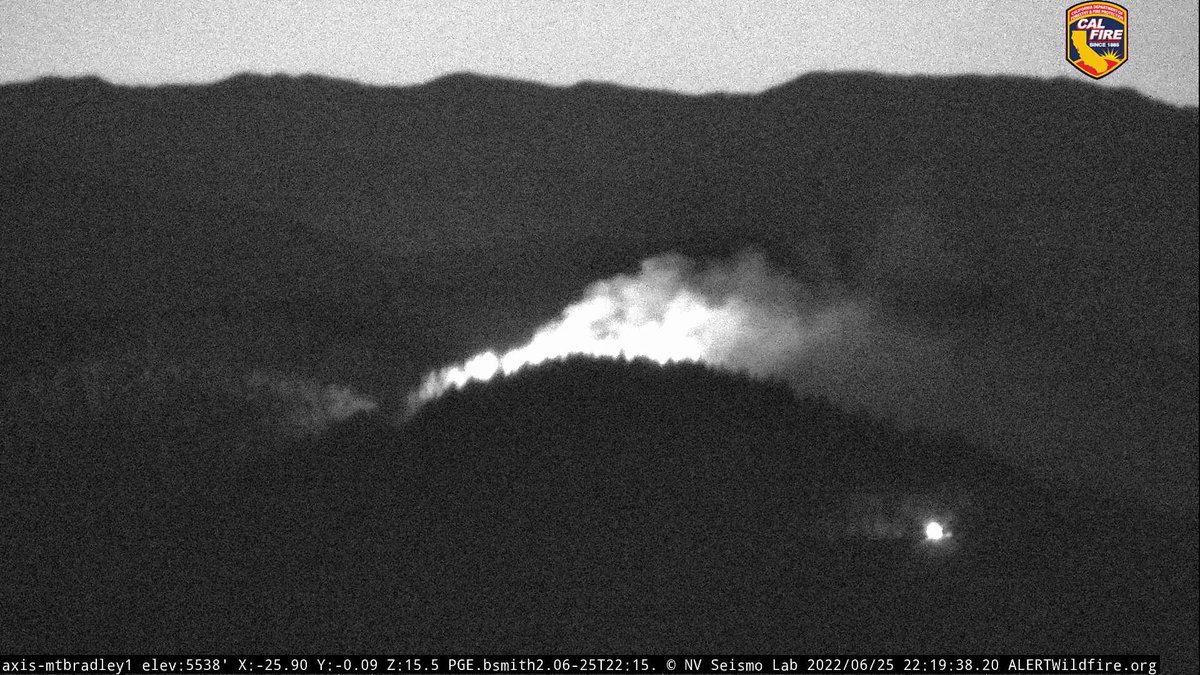
RidgeFire (W/O MtShastaCity, Siskiyou Co) - There is now a spot fire visible on cameras & local government resources are being dispatched to it, reporting to the Wyehka Way area
 2 year ago
RidgeIncident- Fire is 10+ acres and is burning in heavy timber on Rainbow Ridge. CAL FIRE is in Unified Command with U.S. Forest Service - Shasta-Trinity National Forest.Access is challenging firefighters efforts to gain containment. Fire remains under investigation
Earthquake of magnitude 4.9 - 109 km WNW of Isangel, Vanuatu
 2 year ago
RidgeIncident- Fire resources have made access to a 3 area vegetation fire that is burning timber on Rainbow Ridge above Lake Siskiyou,just west of Mt. Shasta City. No evacuations at this time and the cause remains under investigation
2.5 magnitude earthquake. 3 mi from Calexico, CA, United States
A 3.4 earthquake has occurred just northeast of Columbia, South Carolina according to the USGS
Lake Los Angeles,ca: 904B(brush fire) 205th St e and Palmdale blvd, large brush fire in the area
Earthquake of magnitude 4.6 - 6 km NNE of El Tejar, Guatemala
 2 year ago
Evacuation orders for some 2,600 homes have been upgraded to an evacuation warning, Cal Fire Riverside officials said
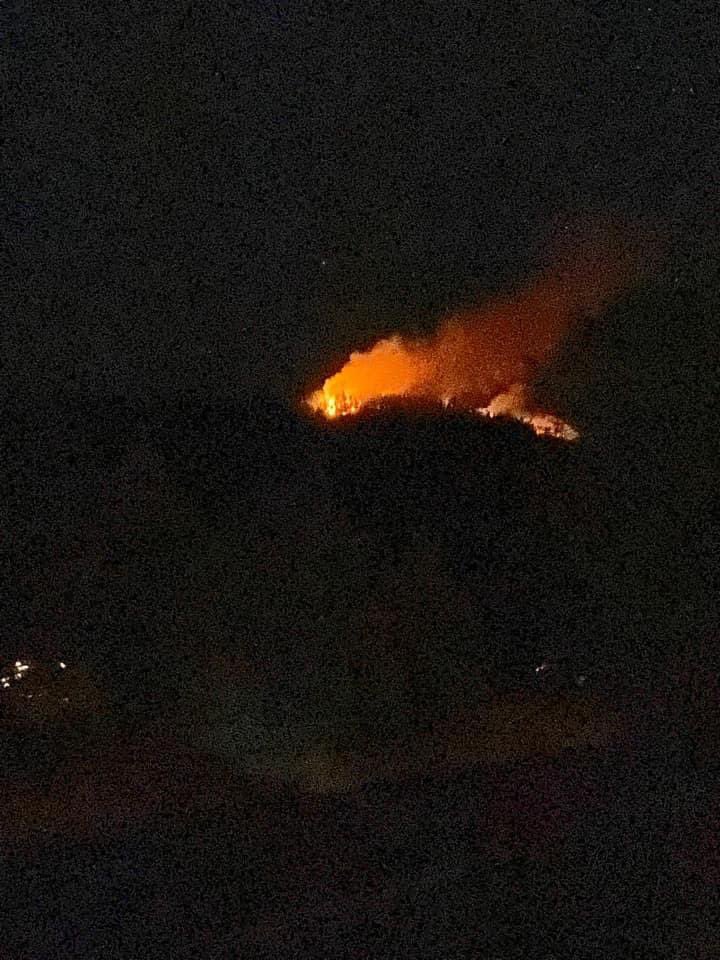
 2 year ago
3 different views of it. Still unknown acreage as units are trying to find best access. Rough coordinates given are 41 18.638 -122 22.036. Units from Castella, Dunsmuir, and McCloud are en route as well
 2 year ago
RidgeFire west of MountShasta city (west of I-5) in the Rainbow Ridge area. Possibly multiple fires, difficult access at this time & resources still looking for a way in. Coordinates given as 41 18.638 -122 22.036 - approx 2.5 miles west of I-5
 2 year ago
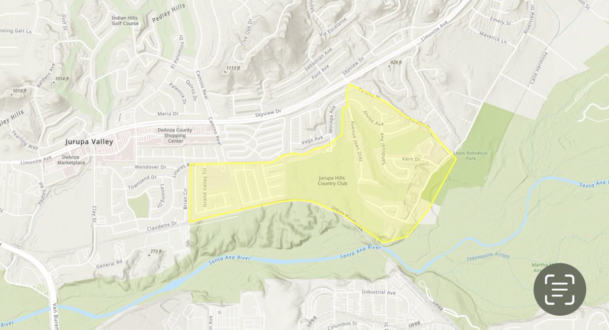
UnionFIRE 6/25/22 10:00 PM - Evacuation ORDERS for areas S/of Limonite, N/of Riverview, E/of Ave Juan Diaz and W/of Maverick Ln have been upgraded to Evacuation
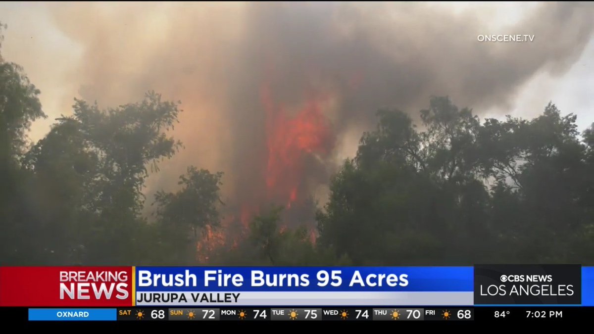
Firefighters are responding to a vegetation fire in the vicinity of Patterson Pass Rd x Cross Rd portion of the Altamont area of Livermore. First units at scene reported the fire to be 20+ acres in size CrossFire
CrossFire (E/O Livermore, Alameda Co) - IC reporting the fire is now 50 acres & spotted across Patterson Pass, slope driven, requesting 5 additional CAL FIRE engines & a 2nd alarm from Alameda Co to respond in via Midway Rd
 2 year ago
CrossFire (E/O Livermore, Alameda Co) - 5 acres burning on both sides of Patterson Pass Rd with arcing wires & powerlines down. Potential for 15-20 acres
Earthquake of magnitude 4.7 - South Sandwich Islands region
Earthquake of magnitude 5.7 - Off the coast of southern Peru
Earthquake of magnitude 4.8 - South Sandwich Islands region
Earthquake of magnitude 4.8 - 76 km ENE of San Ignacio, Peru
Earthquake of magnitude 4.9 - 39 km SSW of Hualien City, Taiwan
Earthquake of magnitude 5.0 - southeast of the Loyalty Islands