Earthquake of magnitude 4.8 - 75 km NNW of Nuku‘alofa, Tonga
Earthquake of magnitude 4.6 - 29 km WNW of San Pedro de Atacama, Chile
Earthquake of magnitude 4.7 - 17 km E of Dursunbey, Turkey
 3 year ago
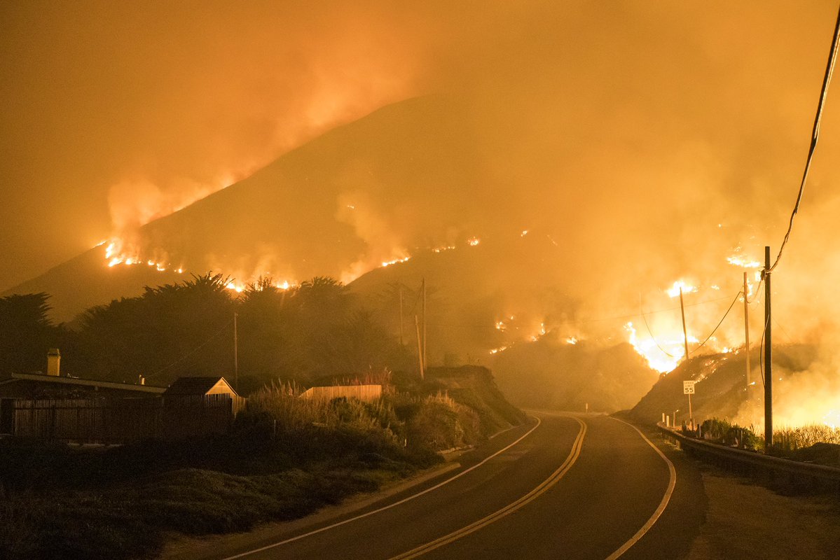
ColoradoFire in BigSur forces evacuations; Highway 1 closed in both directions
3.0 magnitude earthquake. 1 km from Pāhala, HI, United States
ColoradoFire off Palo Colorado Canyon, Big Sur, south of Carmel-by-the-sea in Monterey County is in the 1500 acres and 5% contained. In Unified Command with @CALFIREBEU and Mid Coast Fire
 3 year ago
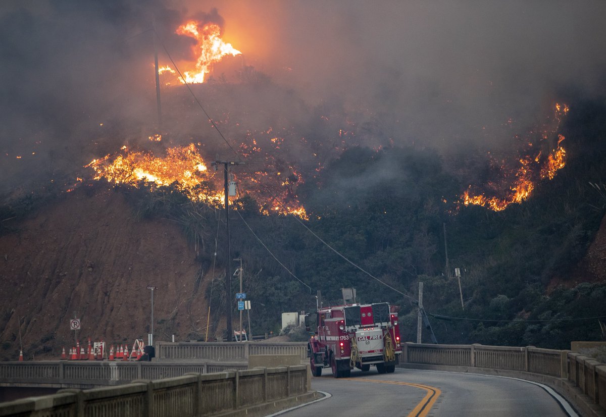
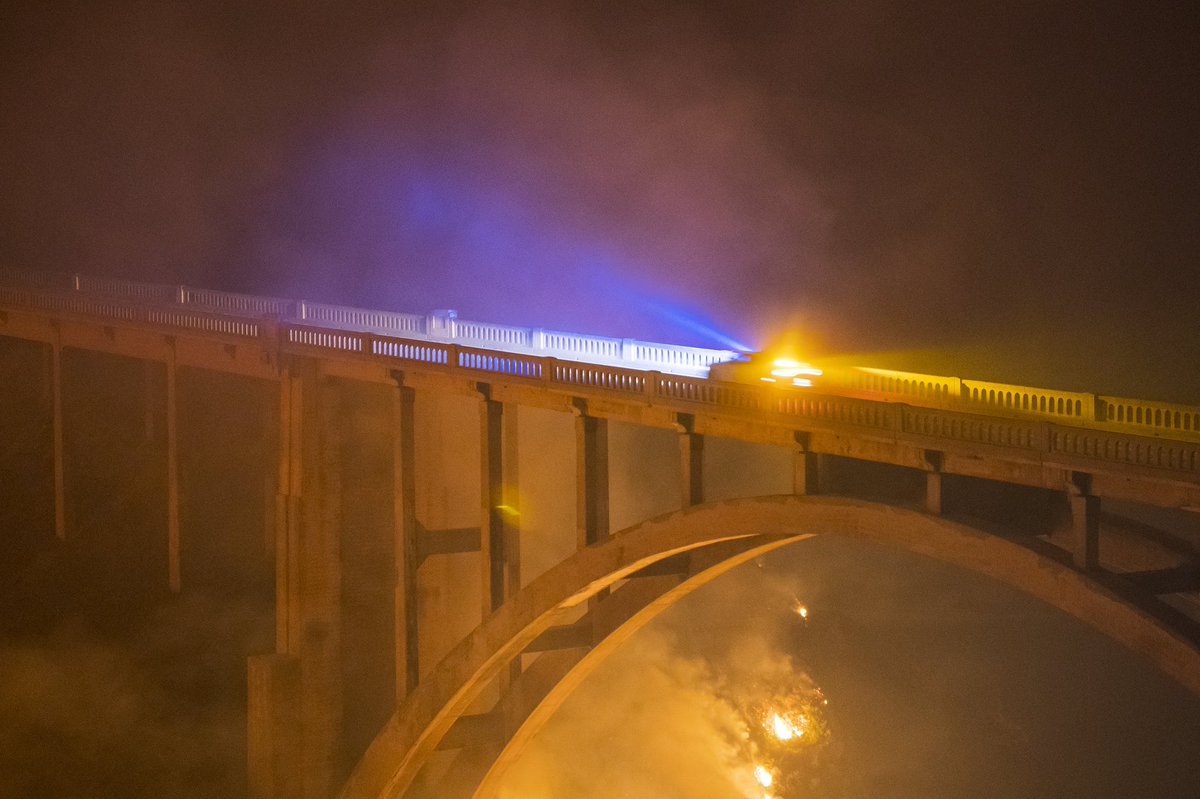
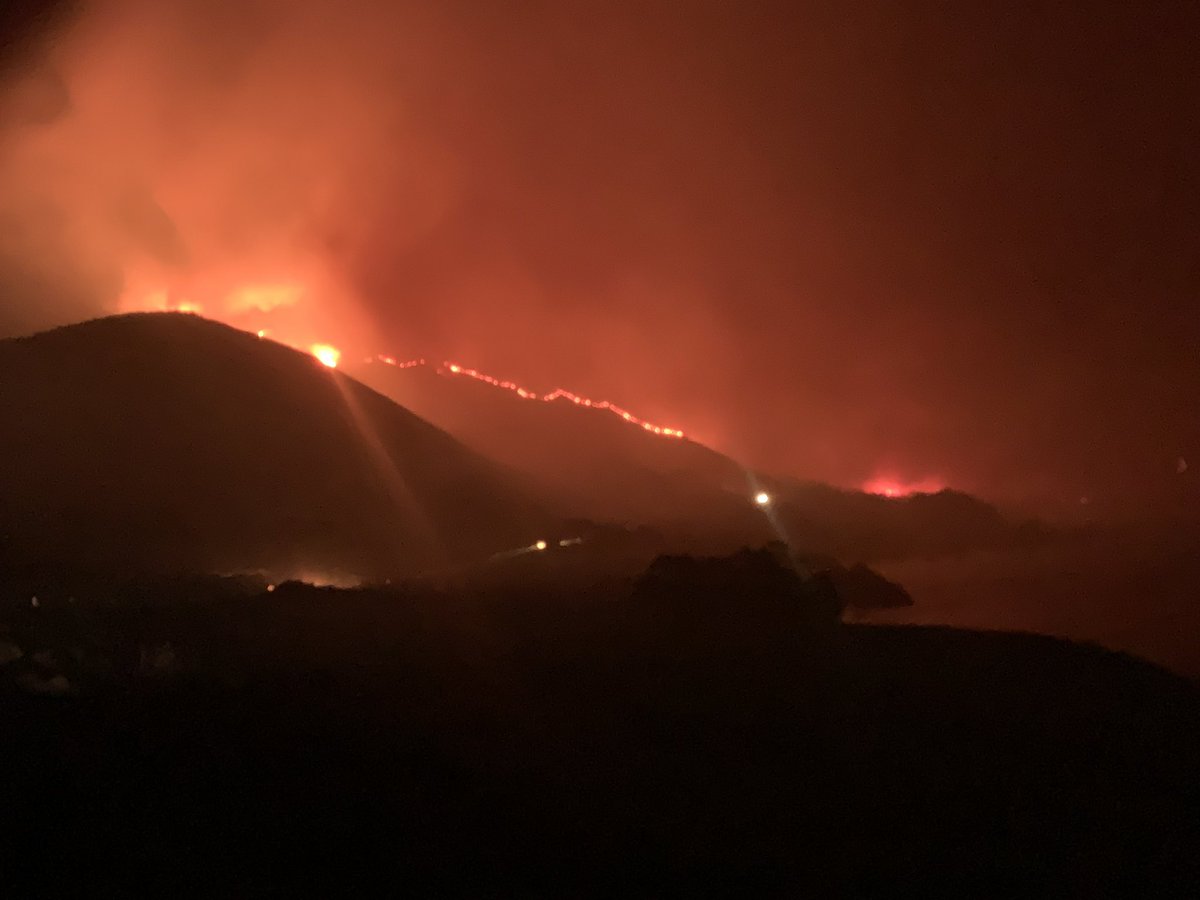
The ColoradoFire burns above the Bixby Bridge as dawn breaks in Big Sur.
The fire burning along the Big Sur coast has burned 1500 acres and is 5% contained
Earthquake of magnitude 5.1 - Ascension Island region
Earthquake of magnitude 5.3 - West Chile Rise
 3 year ago
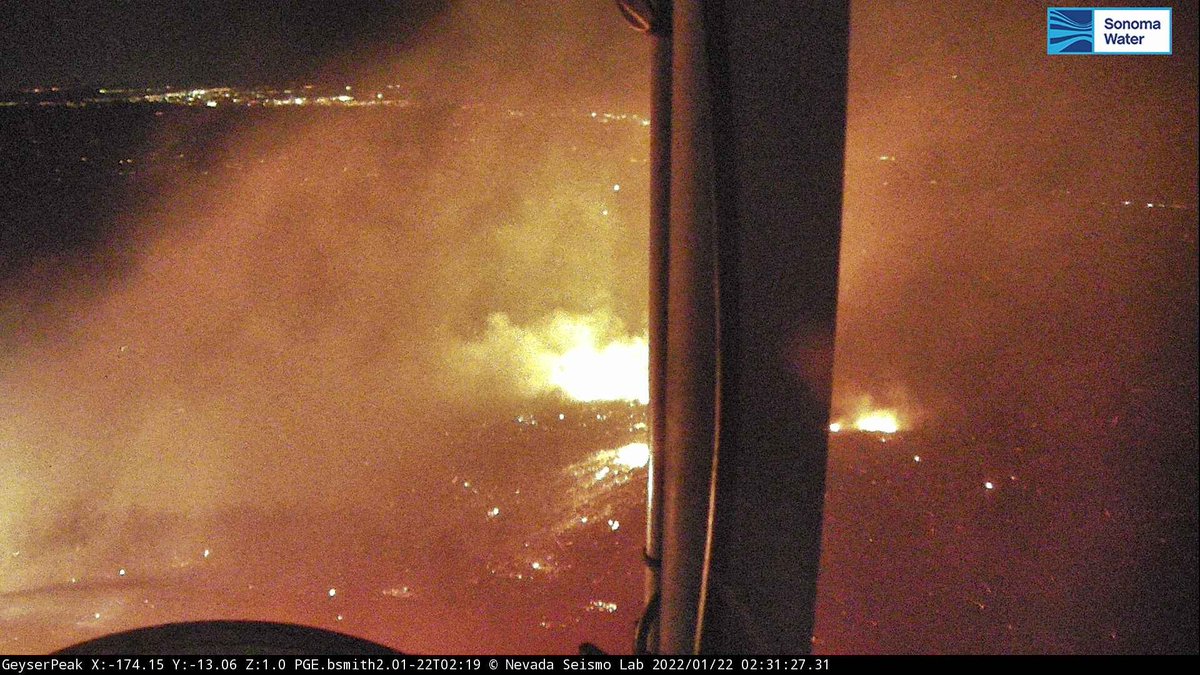
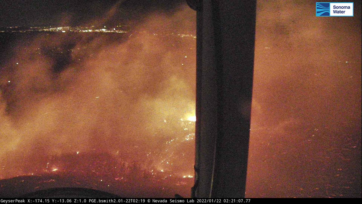
The GeyserFire above Alexander Valley burns on Geyser Peak, Saturday, pushed by 70-80mph offshore winds. Fire is out, unknown acreage. The area has received over a dozen inches of rain this winter and was under a coating of snow just a month ago
Earthquake of magnitude 4.9 - 134 km NNW of Tobelo, Indonesia
 3 year ago
China: Several earthquakes of magnitude 6.9 and 5.2 a few days ago damaged the Qilian Mountain Tunnel in Menyuan County, Qinghai Province
 3 year ago
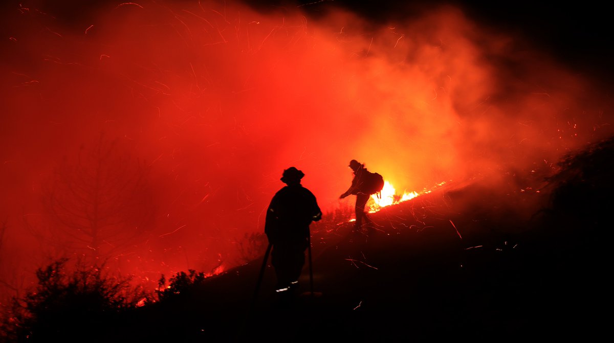
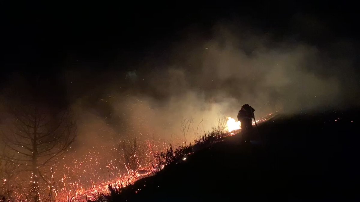
Out covering the ColoradoFire with @erika_kion - images between 1-2AM. Winds lighter, humidity up-still occasional flares
 3 year ago
More geyserfire in Sonoma county
Earthquake of magnitude 4.6 - 60 km NNW of Nuku‘alofa, Tonga
 3 year ago
Geyserfire. Very windy, difficult to stand
 3 year ago
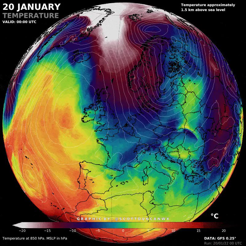
Heavy snow and cold incoming for South East Europe
 3 year ago
GeysersFire (Geysers Peak, Sonoma Co) - IC reporting 3-5 acres moving downhill away from the repeater site towards the south, significant winds, slow-moderate rate of spread. No evacuations needed & no obvious signs of powerlines down
 3 year ago
Geysers Peak in Sonoma Co, units still en-route reporting a 1/2 acre vegetation fire w/ strong winds on it, addl resources being requested. Visible on several cameras (believe the first camera is very close to the fire/zoomed in
Earthquake of magnitude 4.8 - 83 km NE of Neiafu, Tonga
 3 year ago
The ColoradoFire burns below Rocky Creek Bridge on Highway 1 near BigSur California on Friday, Jan. 21, 2022.
 3 year ago
The ColoradoFire burns along Highway 1 near BigSur California on Friday, Jan. 21, 2022.
2.9 magnitude earthquake. 75 km from Salcha, AK, United States
 3 year ago
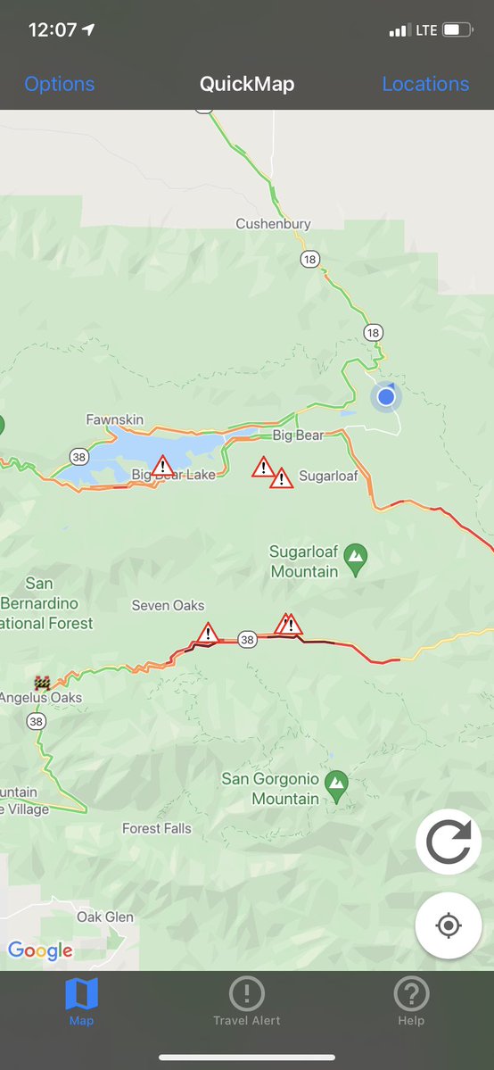
SR-38 All lanes closed at Forest Falls due to high winds and icy conditions. Unknown duration of clear
 3 year ago
Gusts still 50-60 mph around the North Bay and Diablo Range. Note Pine Flat reporting gusts > 60 (78 mph of late, gust to 80 mph earlier) and gusts 50 mph+ from Mt Diablo down into Danville and Windemere/San Ramon CAwx
 3 year ago
ColoradoFire * Per CHP Cad The Fire is now 1,500+ Acres/ Fire Concentrating on the W Side of Palo Colorado and will be doing RE EVACS again/ Taping off each home to confirm it's been Evacuated
The American Red Cross is opening a shelter for residents of the Palo Colorado area of Monterey County who received mandatory evacuation orders because of a fast-growing vegetation fire that also shut down Highway 1 south of Carmel. ColoradoFire
 3 year ago
ColoradoFire (BigSur, Monterey Co) - Per the CHP CAD notes this fire is now 1,500 acres. Minimal audio available online still. Law enforcement will be doing evacs on Palo Colorado again to ensure all houses are evacuated
 3 year ago
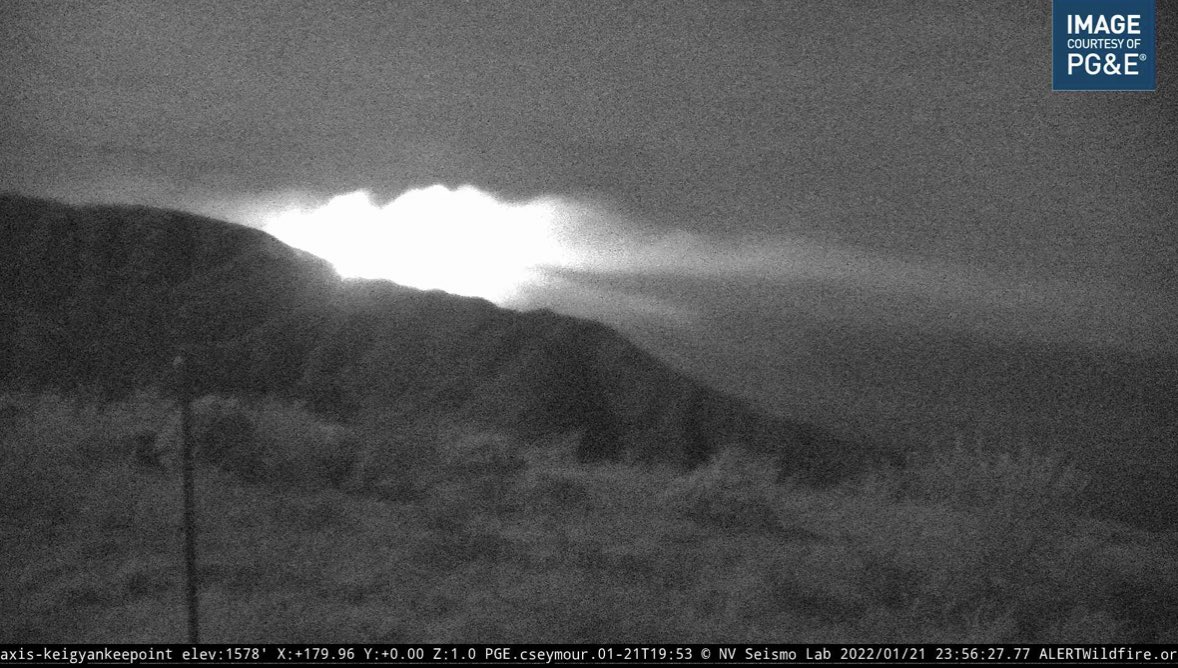
Here is a look at the ColoradoFire over the last hour from an @AlertWildfire camera facing northwest. As you can see, the smoke plume has seemed to die down in elevation, but the fire progresses spreading towards the coast