 3 year ago
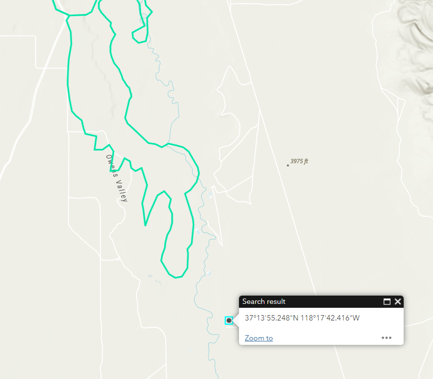
AirportFire (Bishop, Inyo Co) - Another updated fire perimeter has popped up in the last couple hours, putting it within 1/2 mile of the Caltech Observatory (coordinates in first image), resources are there for structure protection. The fire is approx 8.5 miles end to end
Incident: Vegetation Fire Agency: San Jose Fire Department 11:43 PM PST 2/16/22 Responding Unit: E2 Location: S JACKSON AV & CAPITOL EX, SAN JOSE, CA
Cal Fire San Bernardino said the "Airport Fire" near the Bishop Airport has spread over 1,800 acres and is 0% contained as of 8 p.m. on Wednesday night
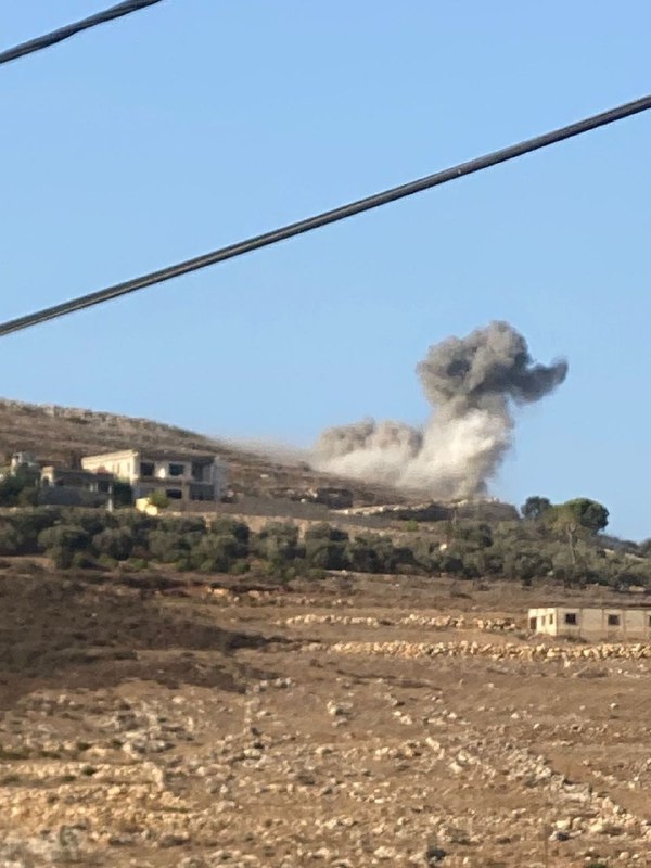
Airport Fire spreads rapidly southeast of Bishop, California
 3 year ago
AirportFire views / cams
 3 year ago
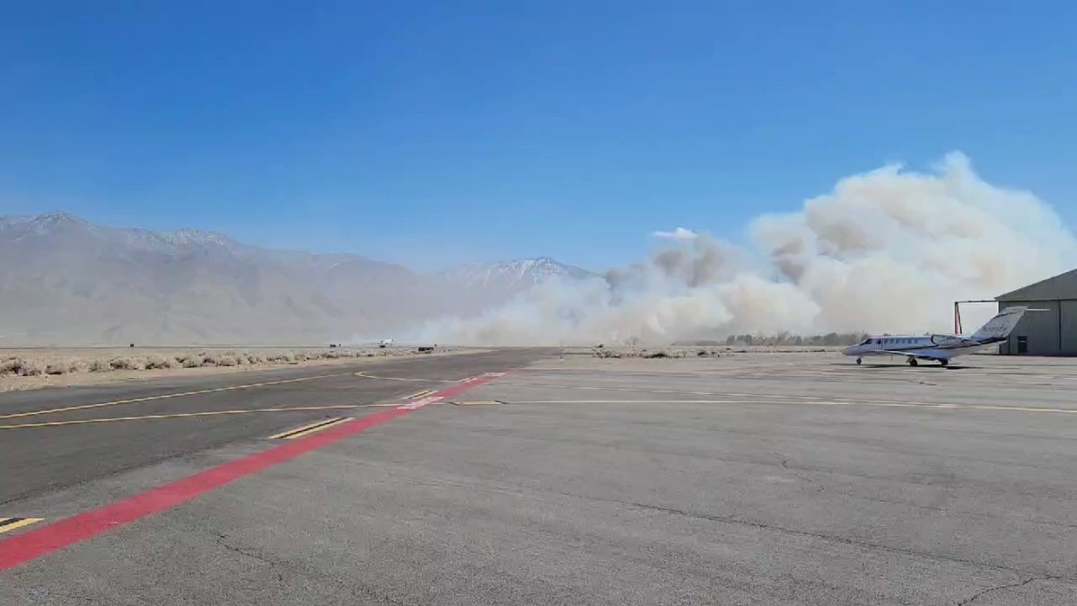
Some wild winds today at BIH. We saw a small fire start at the edge of airport just after Denver landed.
 3 year ago
The AirportFire in Inyo County has grown to 1,800 acres. No buildings have burned.
AirportFire off Airport Road and East Line Street, east of Bishop in Inyo County is 1,800 acres and 0% contained
AirportFire : 1800 acres 0% Contained. No new evac orders/closures. Equipment is prepared to protect the CalTech Radio Observatory. No damage to structures, no injuries reported. Cause under Investigation. @InyoSheriff Multiple Inyo/Mono resources also assisting
Earthquake of magnitude 5.5 - South Sandwich Islands region
AirportFire off Airport Road and East Line Street, east of Bishop in Inyo County is 1,500 acres and 0% contained
 3 year ago
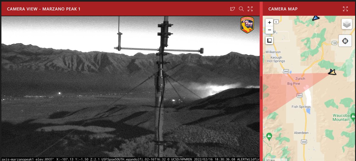
AirportFire (Bishop, Inyo Co) - Nothing much to pass on lately - 5 tankers + AA ordered & to be over the fire tomorrow morning around 7am. This camera is looking towards Big Pine & some fire is visible on the right side of the shot
 3 year ago
The glow of the AirportFire can be seen here as the sun sets. The east side of BigPine is under a mandatory evacuation order. For the most part that's anything on the east side of Hwy 395
Earthquake of magnitude 5.0 - central Mid-Atlantic Ridge
Earthquake of magnitude 6.8 - south of the Fiji Islands
Earthquake of magnitude 6.6 - south of the Fiji Islands
 3 year ago
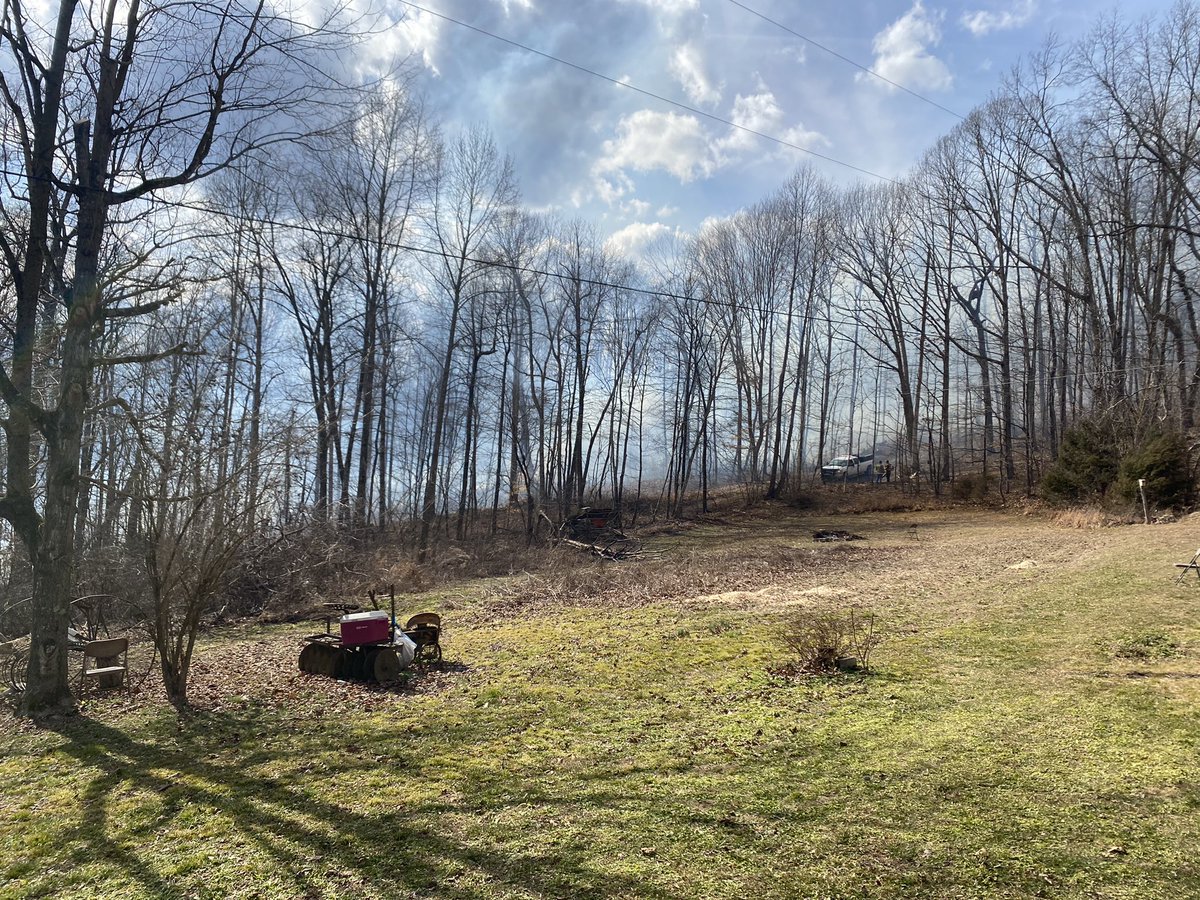
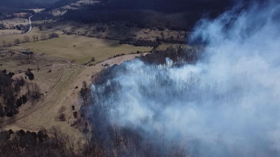
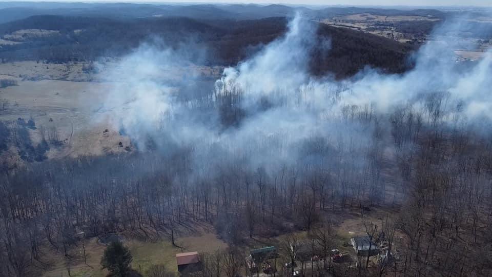
Scene of a 15-20+ acre forest fire in Rockcastle County that is spreading rapidly due to high winds.
 3 year ago
Crews on scene of an active forest fire in Rockcastle County
 3 year ago
Officials say the fire is near Bright Shade Lane, off Sand Springs Road, south of Mt. Vernon. Firefighters say the wind got in some power lines, caused a short, which caught a utility pole on fire, followed by the nearby woods. 15 to 20 acres are burning
Earthquake of magnitude 4.7 - Nicobar Islands, India region
2.7 magnitude earthquake. 6 mi from SantaPaula, CA, United States
Earthquake of magnitude 4.6 - 3 km NW of Telica, Nicaragua
Earthquake of magnitude 5.0 - 47 km NW of Nuku‘alofa, Tonga
Earthquake of magnitude 6.2 - 0 km SSE of Nueva Concepción, Guatemala
Earthquake of magnitude 4.9 - south of the Fiji Islands
Earthquake of magnitude 5.5 - South Sandwich Islands region
Earthquake of magnitude 4.8 - 37 km S of São Martinho, Portugal
Earthquake of magnitude 4.6 - 114 km WNW of Naha, Japan
Earthquake of magnitude 4.7 - 121 km ESE of Gorontalo, Indonesia
Earthquake of magnitude 4.6 - Vanuatu