 3 month ago
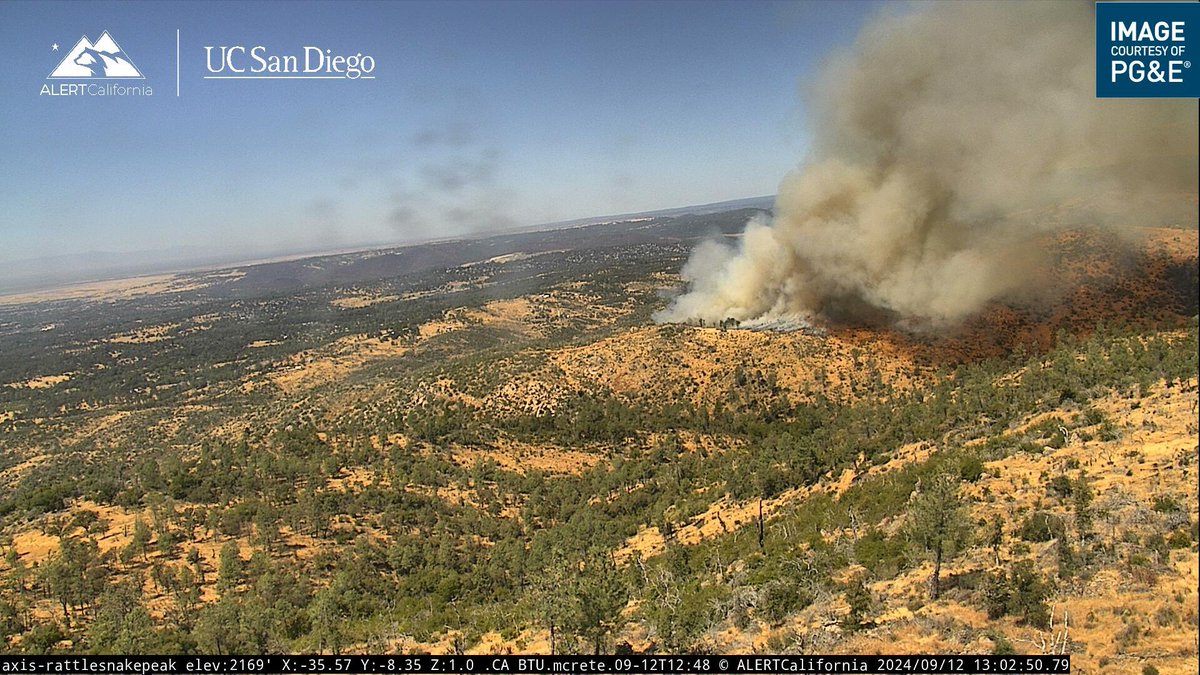
QuincyFire(update) The fire is currently 8 acres moving at a moderate rate of spread. Additional aircraft and equipment are responding
 3 month ago
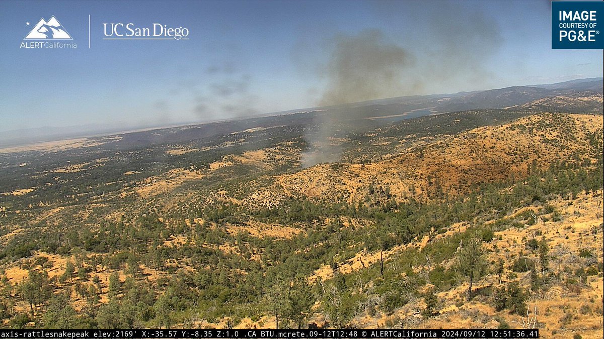
Units are at scene of a 1/4 acre vegetation fire near Oroville Quincy Highway and Forbestown Rd
Evacuations underway due to fast-moving Siphon Fire
Earthquake of magnitude 4.6 - 134 km ESE of Madang, Papua New Guinea
Earthquake of magnitude 4.7 - south of the Kermadec Islands
Magnitude 4.7 earthquake rattles the Los Angeles area
3.5 magnitude earthquake. 4 mi from Malibu, CA, United States
2.7 magnitude earthquake. 2 mi from Malibu, CA, UnitedStates
3.4 magnitude earthquake. 4 mi from Malibu, CA, United States
4.6 magnitude earthquake. 4 mi from Malibu, CA, UnitedStates
5.1 magnitude earthquake. 4 mi from Malibu, CA, United States
A preliminary 4.7 magnitude earthquake struck the Malibu area, rattling Southern California Thursday morning, according to the U.S. Geological Survey
Earthquake of magnitude 4.7 - 7 km N of Malibu, CA
Earthquake of magnitude 5.1 - 4 km NW of Malibu, California
Earthquake of magnitude 4.7 - Bonin Islands, Japan region
Earthquake of magnitude 4.8 - 1 km ENE of Yalí, Colombia
Earthquake of magnitude 4.9 - 226 km WSW of Bariq, Saudi Arabia
2.9 magnitude earthquake. 11 mi from Shandon, CA, UnitedStates
Incredible photo of the Bridge Fire line fire
The Bridge Fire has burned 50,394 acres with 0% containment.Governor Gavin Newsom today announced that California has secured a Fire Management Assistance Grant (FMAG) from the Federal Emergency Management Agency (FEMA) to help ensure the availability of vital resources
Earthquake of magnitude 4.9 - 226 km WSW of Bariq, Saudi Arabia
 3 month ago
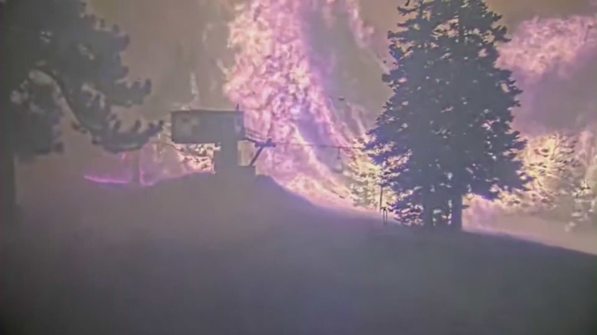
Video showing Mountain High Resort surrounded by flames from the BridgeFire, and erroneous reports that the resort had burned to the ground, officials announced that the property had dodged a bullet
The Bridge Fire - the largest active wildfire in California - has destroyed 20 homes in the Mount Baldy area and more than a dozen in Wrightwood
Earthquake of magnitude 4.7 - 225 km W of Ad Darb, Saudi Arabia
Earthquake of magnitude 5.1 - 169 km SW of Merizo Village, Guam
 3 month ago
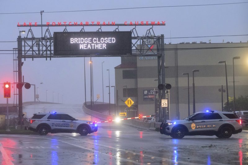
Hurricane Francine struck Louisiana on Wednesday evening as a Category 2 storm that forecasters warned could bring deadly storm surge, widespread flooding and destructive winds to the northern U.S. Gulf Coast
Major flooding in Metairie, LA
Tens of thousands in the dark as Hurricane Francine strikes Louisiana with 100 mph winds
Brave hero Battalion Chiefs risks it all to save a woman walking through the flames of the AirportFire
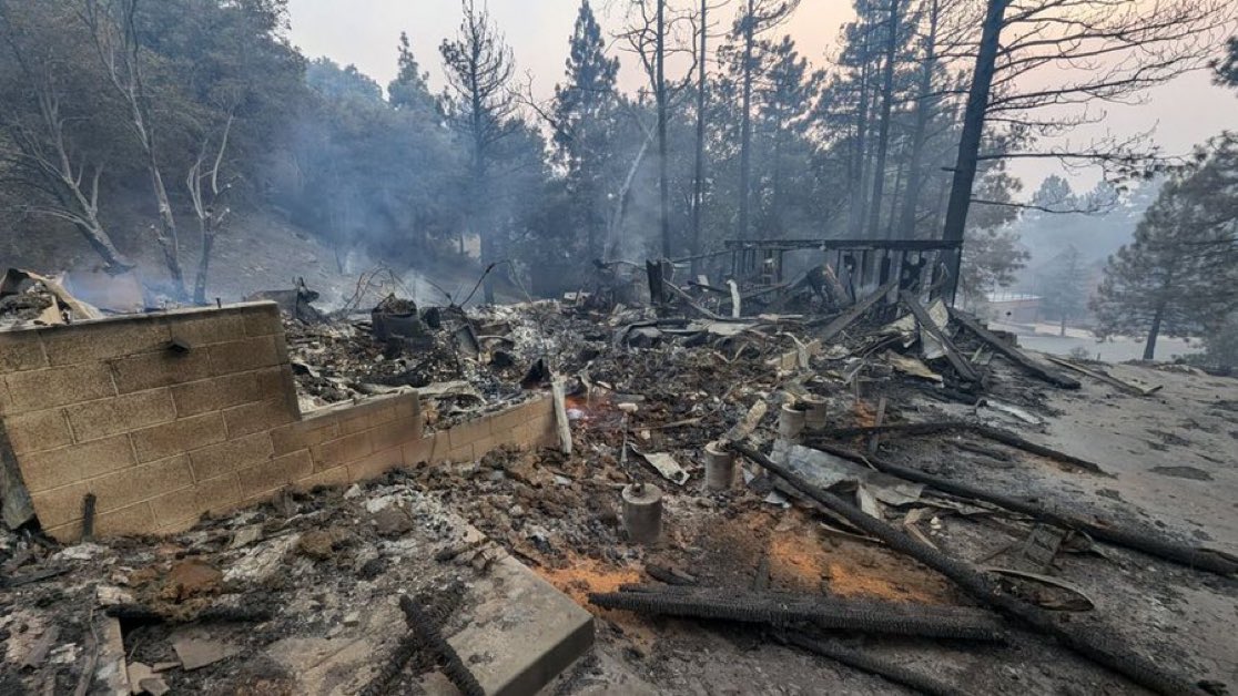
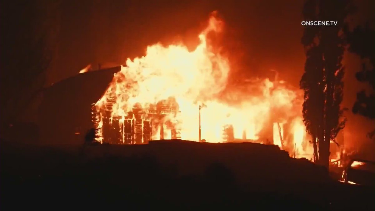
A chimney is all that is left of one home that was destroyed by the BridgeFire in Wrightwood
 3 month ago
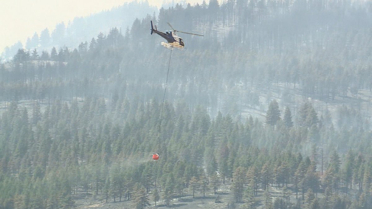
The DavisFire has reached 5,824 acres and containment has increased to 37% as of Wednesday night despite unfavorable conditions for most the day
Checked out neighborhood at Lark and Oriole in Wrightwood Firefighters staged for structure protection
More than a dozen homes destroyed in Wrightwood 20 homes gone in MountBaldy Luckily the couple who lives inside safely evacuated
A fire at a repair shop near the Yuba County Airport forced nearby homes to evacuate, the sheriff's office says
Willow Fire near Concord spreads to 50 acres, zero percent contained: Firefighters respond to 15-acre brush fire north of Concord
50 Acres New Start No name yet, located in Box Elder Co. West of Promitory Point. It is est. 50 acres & running. Structures are threatened, a couple homes are being evacuated east of Promitory. Human-caused
Firefighters are responding to a brush fire near Highway 4 in Contra Costa County
Firefighters respond to 15-acre brush fire north of Concord
 3 month ago
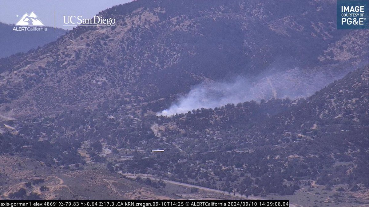
Within several minutes afternoon winds spread the fire through multiple yards and spotted across Walnut Trail. Fire crews were able to jump on the spot fire and knocked it down before it could get into a nearby structure
 3 month ago
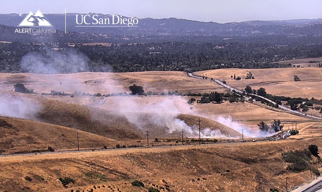
Fire crews are on the way to a brush fire near the Concord PF weapons range at Willow Pass Road near Hwy 4 in Contra Costa County
 3 month ago
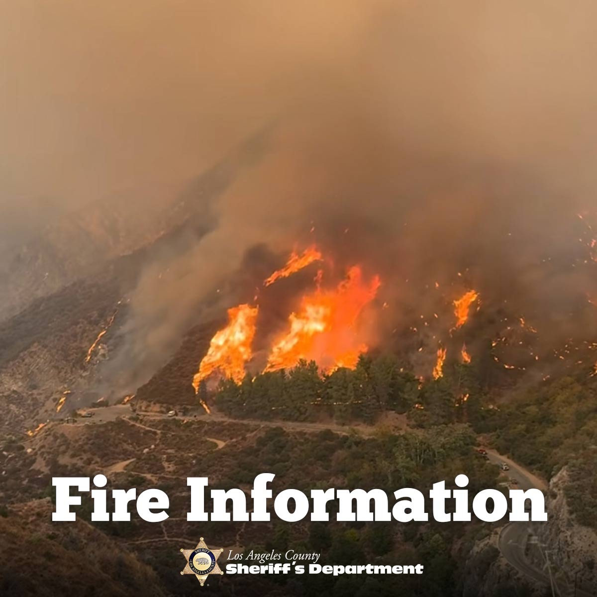
Attention LA County Residents The Bridge Fire has now grown to nearly 48,000 acres and remains 0% contained. As evacuations are underway, it's crucial to be prepared. Follow these steps to ensure your safety:1.Brush Clearance: Make sure to clear any brush around your home
Earthquake of magnitude 4.9 - 113 km ENE of Luganville, Vanuatu
Earthquake of magnitude 4.9 - 117 km ENE of Luganville, Vanuatu
 3 month ago
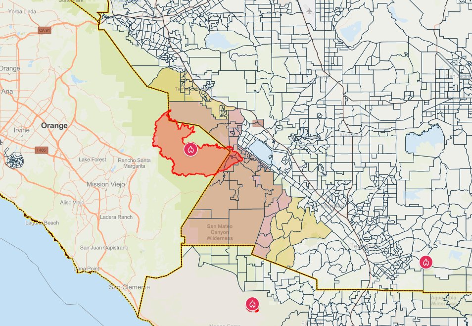
AirportFire: current fire evacuation zones
Earthquake of magnitude 5.8 - 98 km ENE of Luganville, Vanuatu
Earthquake of magnitude 5.1 - 88 km ENE of Luganville, Vanuatu
Earthquake of magnitude 5.8 - 107 km ENE of Luganville, Vanuatu
Earthquake of magnitude 4.6 - 49 km NW of Pototano, Indonesia
Earthquake of magnitude 4.6 - Pagan region, Northern Mariana Islands
 3 month ago
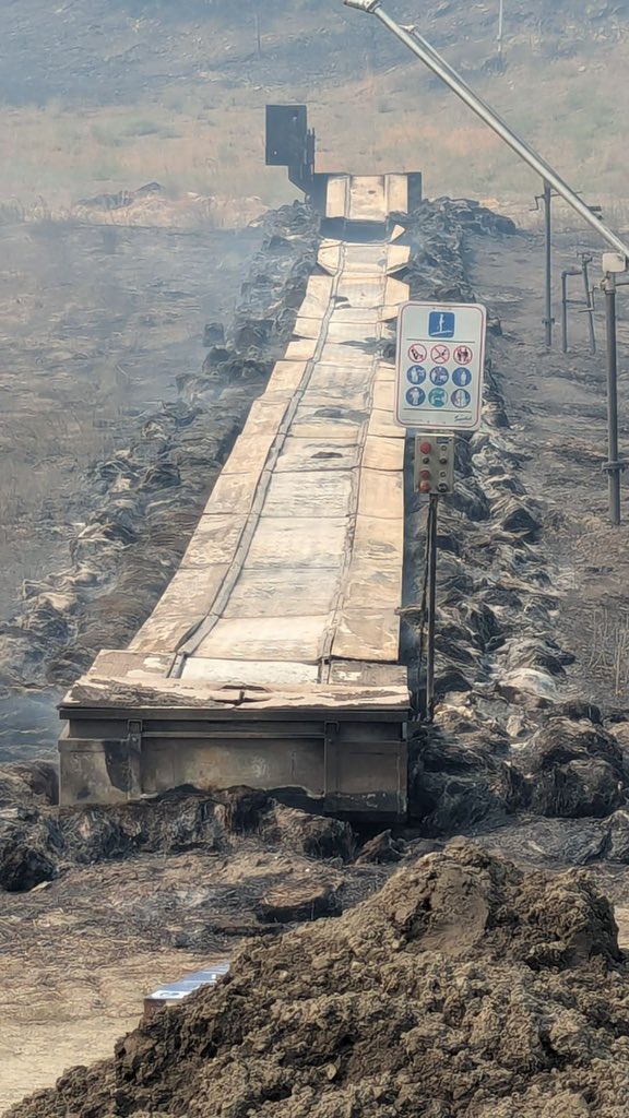
Magic Carpet at Mountain High East appears to be a total loss
 3 month ago
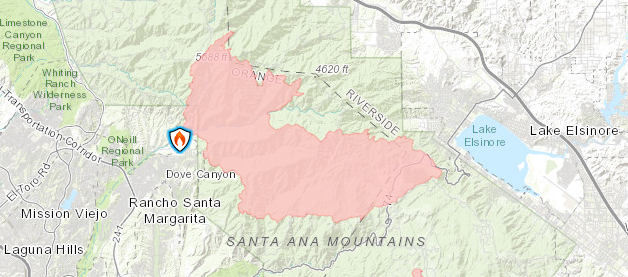
The updated AirportFire perimeter map as of 9:30 a.m. Wednesday
AirportFire update: The wildfire burning in Orange and Riverside counties has destroyed homes and led to seven injuries reported as it scorched 22,000 acres
Earthquake of magnitude 6.3 - 170 km SW of Lorengau, Papua New Guinea
Earthquake of magnitude 4.6 - Kermadec Islands region
 3 month ago
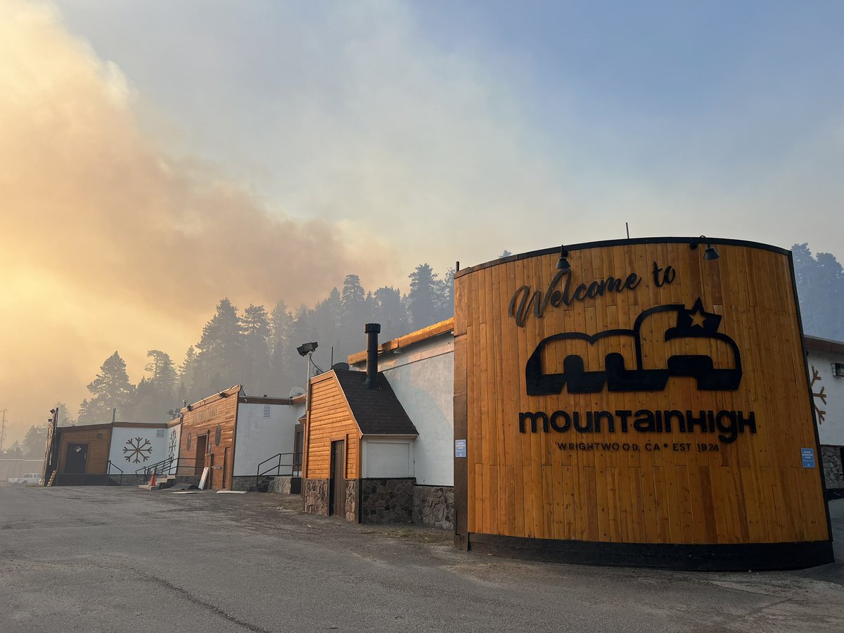
Mt. High Resort is largely undamaged from BridgeFire. Big Pines Lodge still standing
 3 month ago
First look at some of the loss caused by the BridgeFire in Wrightwood. LosAngeles News Stringer OSTV bridgefire linefire wrightwood
AirportFire destroys multiple homes near Lake Elsinore, more than 22,000 acres burned
 3 month ago
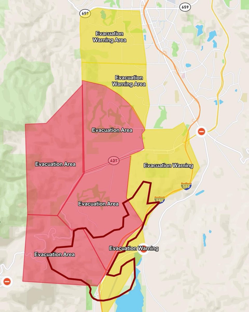
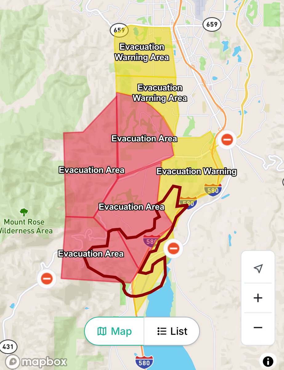
DavisFire Evacuation Warning Areas. Red Flag Warning today due to dangerously forecasted strong winds, up to 70 mph on ridgelines. Prepare a go-bag and be ready to leave
 3 month ago
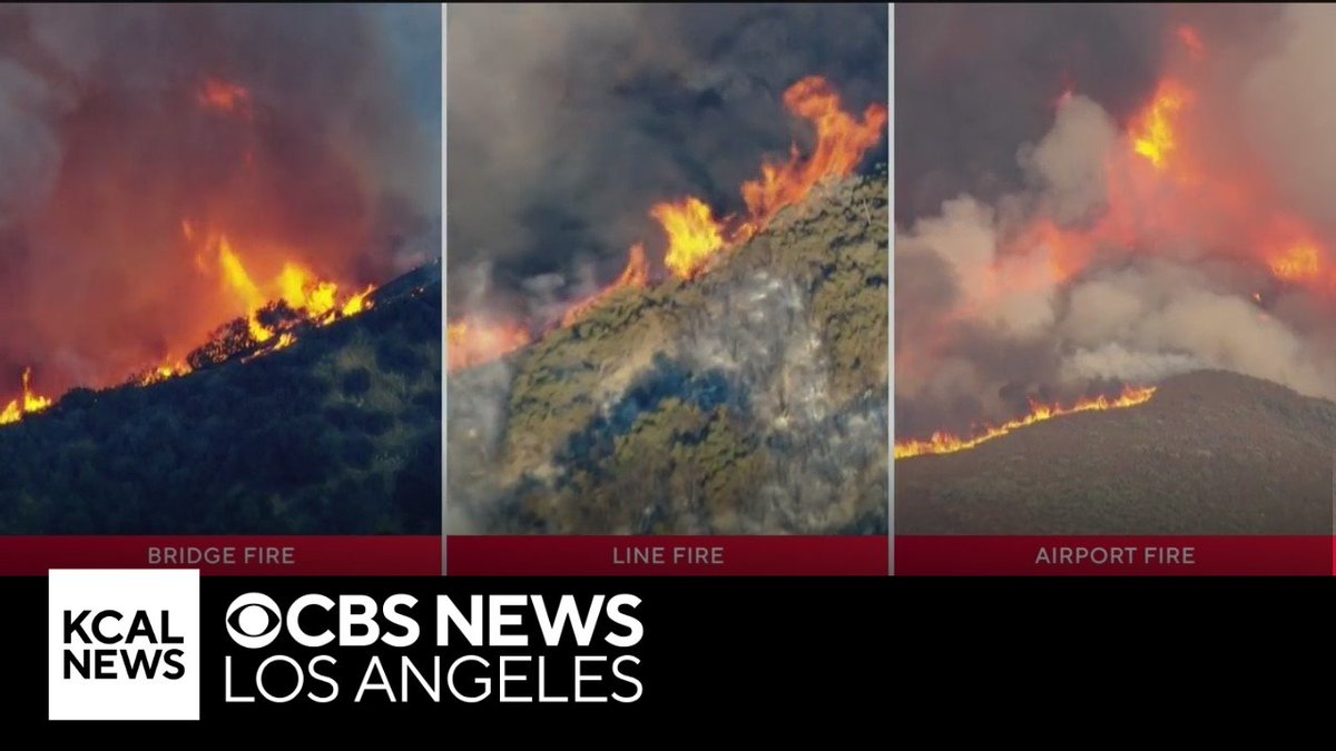
Three fires continue to burn across SoCal. Bridge fire: 0% contained, 46,600 acres burned, burning Mountain High ski resort. Airport fire: 0% contained, 22,000 acres burned, started in Orange County spread to Riverside County.Line Fire: 14% contained, 13,000 acres burned
A 3.5 magnitude earthquake occured at 7 km WNW of Hiko, Nevada
Earthquake of magnitude 5.4 - 31 km W of Karor, Pakistan
 3 month ago
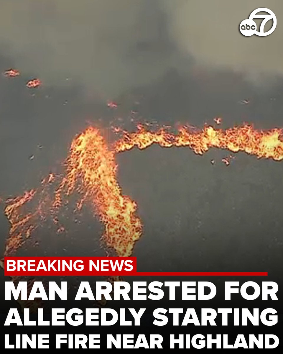
A 34-year-old Norco man has been arrested for arson for allegedly starting the Line Fire, which has spread to more than 34,000 acres and is now threatening Big Bear
 3 month ago
continue to defend the communities affected by the AirportFire
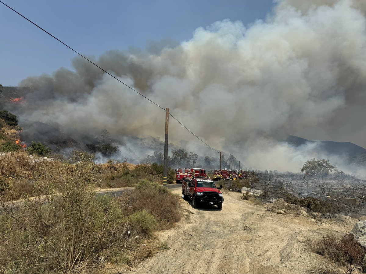
The LineFire has been burning right along the southern edge of Running Springs, CA. The Line Fire is now more 32,900 acres in size.
Sleepless nights, flames and heat for O.C. residents threatened by Airport Fire
Evacuation orders have been issued in Kelseyville due to a wildfire
 3 month ago
The Bridge Fire- LA County ( Angeles National forest ) 34,240 acres actively burning. Live shots as of 10:52Pm ( 9/10/24) from the Cal Fire cameras. 6 cameras in the area have gone down and are out for service
 3 month ago
A state of emergency was declared Tuesday night as the Bridge Fire grew to over 34,000 acres, destroying homes and threatening communities.
Bridge Fire making a pass around the town of Wrightwood. Firefighters provide structure defense. 72° and 28 mph wind gusts.bridgefire wrightwood linefire breakingnews BridgeFire wildfires ForestFire AirportFire Fire California
The fast-moving Airport Fire in Trabuco Canyon in the hills southeast of Irvine had burned 9,333 acres by Tuesday afternoon, according to Cal Fire, and more than doubled to 19,028 acres by the evening
The homes being lost bridgefire Wrightwood
The LineFire has been burning right along the southern edge of Running Springs, CA. At least one structure looks like a total loss. The Line Fire is now more 32,900 acres in size
Fire crews are doing everything they can to save MtBaldy Village.
Extreme Fire Bridgefire MtBaldy linefire wrightwood
Earthquake of magnitude 4.6 - 24 km NNE of Levídion, Greece
 3 month ago
Evacuation warnings have been extended for the DavisFire ranging all the way from the Arrowcreek area and stretching to McCarran Blvd.
The LineFire is burning in the mountains above San Bernardino. Sadly, this epic fire is now approaching Big Bear Lake where there is now a mandatory evacuation order on the south shore. In this shot, you can see the fixed wing tankers hunkered down for the night, until dawn
 3 month ago
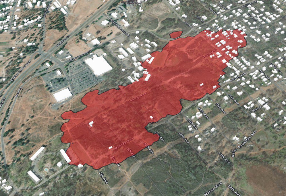
BoylesFire via Lake County FPD:- Fire remains 50% contained.- Damage inspection process continues, but preliminary reports show 33 residential structures destroyed, 6 residential structures damaged, 22 outbuildings destroyed and 80 vehicles destroyed
Earthquake of magnitude 4.9 - 49 km SE of Palca, Peru
Earthquake of magnitude 5.0 - South Sandwich Islands region
Earthquake of magnitude 5.7 - South Sandwich Islands region
Earthquake of magnitude 5.0 - South Sandwich Islands region