Earthquake of magnitude 5.4 - 104 km NNW of Tatsugō, Japan
VEGETATION FIRE Gillman Springs Rd. x Alessandro Blvd. in the City of Moreno Valley. Crews are on scene of a 10-acre fire with light, flashy fuels and moderate rate of spread. Additional ground and air resources have been requested. Firefighters will be
 1 día atrás
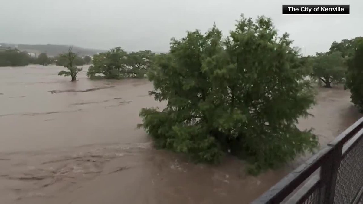
Six confirmed dead in Kerr County flooding as rescue and evacuation efforts continue
VEGETATION FIRE Gillman Springs Rd. x Alessandro Blvd. in the City of Moreno Valley. Crews are on scene of a 10-acre fire with light, flashy fuels and moderate rate of spread. Additional ground and air resources have been requested
Earthquake of magnitude 4.7 - 101 km N of Tatsugō, Japan
 1 día atrás
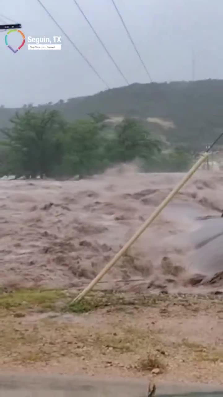
Multiple deaths reported in Texas, rescue efforts underway as flash flooding threatens communities
A small brush fire broke out Thursday night near the site of a fireworks show in McFarland
Earthquake of magnitude 4.8 - 121 km ESE of Iwaki, Japan
Earthquake of magnitude 4.7 - 97 km N of Tatsugō, Japan
A new wildfire dubbed the “Tabby Three Fire” has ignited on Stansbury Island in Tooele County, according to Utah Fire Info. Early estimates show the fire mapped at 25 acres
2.4 magnitude earthquake. 7 mi from SanPedro, CA, United States
 1 día atrás
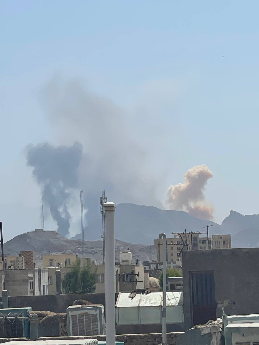
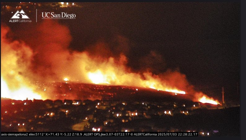
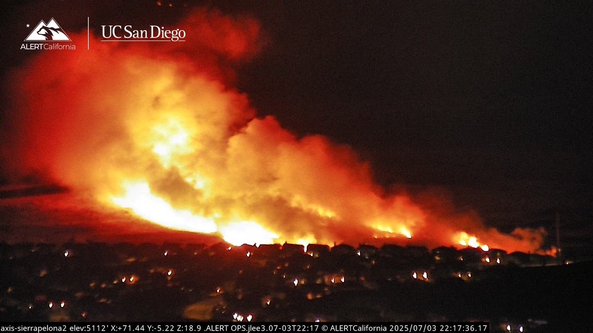
Siria: menos de 24 horas separan estas dos fotos, captadas por el radar de FIRMS, que muestran incendios en la zona rural del norte de Latakia.
 1 día atrás
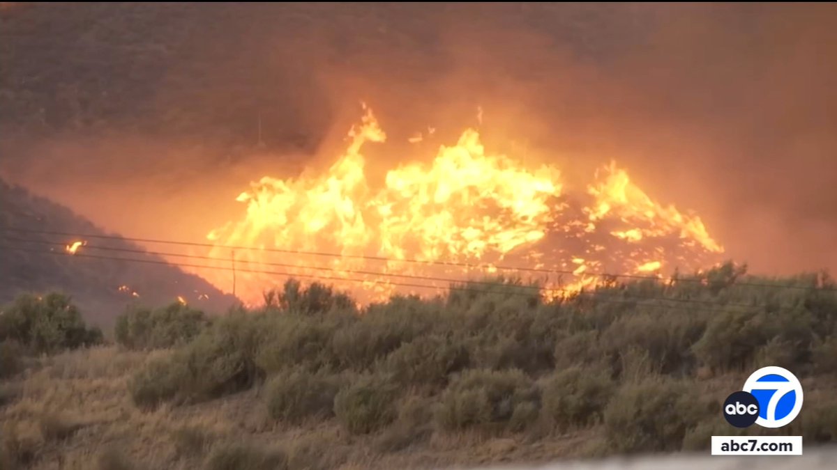
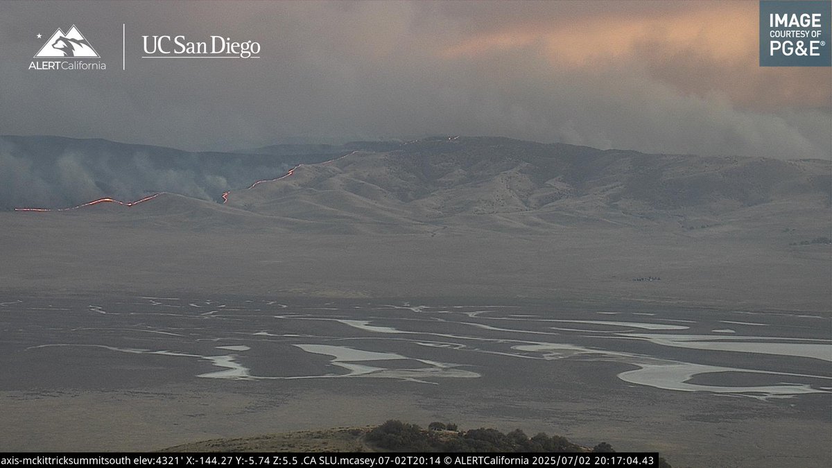
52,000-acre wildfire in San Luis Obispo County is currently the largest in California
JamesFire - INCIDENT - Firefighters are at scene of a 3 acre vegetation fire near the 7200 block of Pope Valley road, Pope Valley. The fire is in grassy oak woodland with moderate rate of spread. If traveling in the area use caution
Earthquake of magnitude 5.6 - 253 km SSE of Ushuaia, Argentina
Earthquake of magnitude 4.9 - 62 km SSE of Pondaguitan, Philippines
 1 día atrás
Varias personas han fallecido tras las catastróficas inundaciones repentinas en el centro de Texas. El río Guadalupe se desbordó en plena noche y está inundando pequeñas comunidades rurales. Las zonas incluyen Kerrville, Center Point, Ingram, Comfort y otras.
 1 día atrás
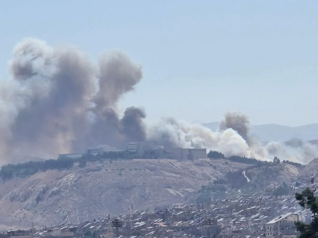
Incendios en los bosques que rodean el Palacio del Pueblo en Damasco
Earthquake of magnitude 4.7 - 106 km N of Tatsugō, Japan
Earthquake of magnitude 4.9 - 73 km SSW of Paracas, Peru
Earthquake of magnitude 4.7 - 45 km W of Sabang, Indonesia
Earthquake of magnitude 4.6 - 56 km WNW of Sabang, Indonesia
Firefighters are now on the scene of FOUR Pacoima homes affected by a fireworks explosion. One patient has been transported in critical condition, and several animals are severely injured.This follows a home explosion in Simi Valley this morning, handled by Ventura County Fire.If you are storing or considering using fireworks this weekend, we beg you to reconsider and attend a professional show. The most immediate way to render your fireworks inert is to soak them in water.
Earthquake of magnitude 5.2 - 32 km NW of Sabang, Indonesia
 1 día atrás
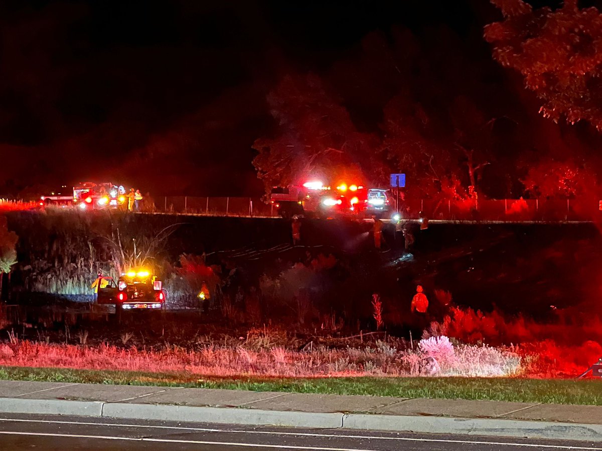
Multiple callers reporting their yards on fire. This now the Subida Incident
 1 día atrás
Fire is at 30 acres still running. SubidaFireStrong winds in the area,Copters enroute. SubidaFire
Palmdale,ca: 904B(brush fire ) The Groves and W Ave S, at Ana Verde. 5 acre fire burning light to medium fuel no structures threatened
 1 día atrás
CottonwoodHeights BrushFire crews did an exceptional job controlling this fire. The fire is out and under control and no homes were lost. They are in the mop up stages
 1 día atrás
SLCFD on scene of a working GrassFire. Avoid east Capitol near 300 North and Memory Grove.
Lancaster,ca: 904B(brush fire ) 80th st w and Ave K-8, acre fire burning towards a residence. Fire department has a good protective line around the house
 1 día atrás
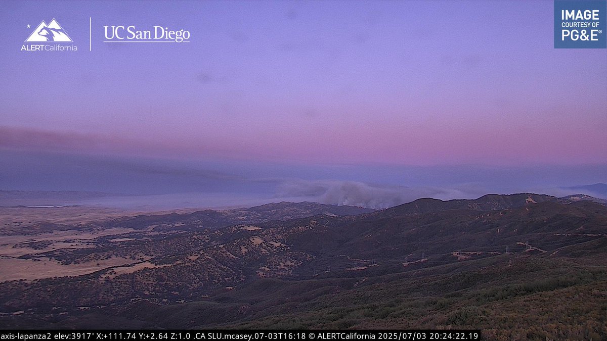
MadreFire As of right now it doesn’t seem like Helicopters are coming out for Night Flying, unknown when an Intel Plane will come back.Current View.MadreFire All Air Tankers and Helicopters are being Released for the Evening.
 1 día atrás
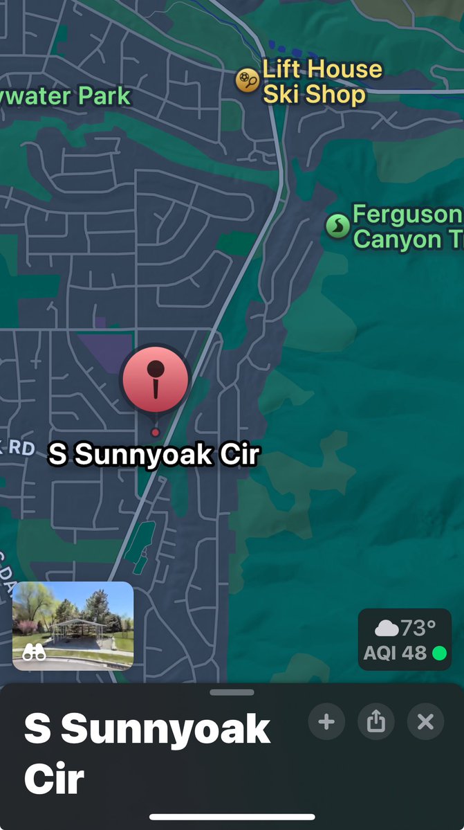
UFA 8000 S Wasatch Blvd. Major Brush Fire Is threatening multiple homes in Sunnyoak Circle. Homes in that circle are being evacuated. Possibly started by fireworks. Crews are on structure protection and needing additional resources
Earthquake of magnitude 4.6 - 285 km SSE of Port Blair, India
Earthquake of magnitude 4.6 - 26 km SSE of Uyuni, Bolivia
Earthquake of magnitude 4.9 - Kuril Islands
Earthquake of magnitude 5.0 - Carlsberg Ridge
2.7 magnitude earthquake. 6 mi from Isla Vista, CA, United States
Earthquake of magnitude 5.0 - 78 km NW of Isangel, Vanuatu
Earthquake of magnitude 4.7 - Carlsberg Ridge
Earthquake of magnitude 4.7 - 291 km SSE of Port Blair, India
Earthquake of magnitude 4.7 - 7 km ENE of Ruteng, Indonesia
Earthquake of magnitude 5.4 - Pacific-Antarctic Ridge
Earthquake of magnitude 5.2 - 140 km S of ‘Ohonua, Tonga
 2 día atrás
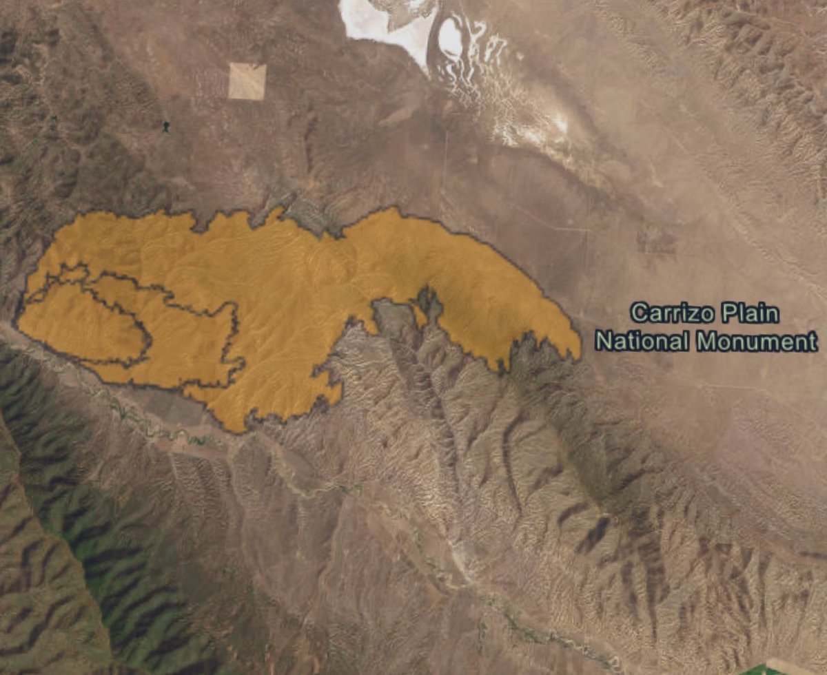
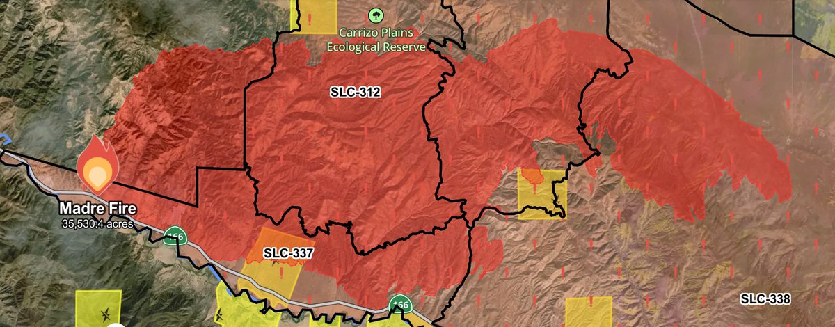
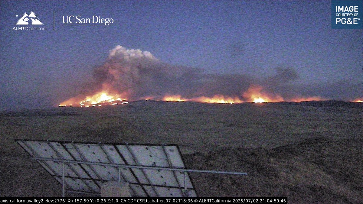
MadreFire Helitanker 7PJ remains overhead, 4 other Copters times out for the Night.There is a Report of Structures being Impacted at 18888 Chimineas Ranch Road.OES Intel 24 has Mapped the MadreFire at 35,530 acres
Earthquake of magnitude 5.5 - 108 km N of Tatsugō, Japan
 2 día atrás
NnSantaMaria / California nnThe FIRIS Intel 24 plane has remapped the MadreFire and it is now listed at 35,530 acres. Average burn rate of 3,230 acres
 2 día atrás
My final guess for this monster is 37,971 acres. I hope it’s not even above 20k but looking at intel it’s probably well above that… madrefire
Earthquake of magnitude 5.1 - 96 km N of Tatsugō, Japan
Earthquake of magnitude 4.9 - 29 km SSW of El Hoyo, Argentina
Earthquake of magnitude 5.0 - 101 km N of Tatsugō, Japan
Earthquake of magnitude 5.4 - 99 km SSW of Uyuni, Bolivia
Earthquake of magnitude 4.8 - 94 km N of Tatsugō, Japan
 2 día atrás
OES Intel 24 is enroute to map the MadreFire .MadreFire Night Ops Aircraft Assisting.Helco Copter 8AS.SBCoFD Copter 964.Helitankers 4PJ, 7PJ.ANF Copter 531
 2 día atrás
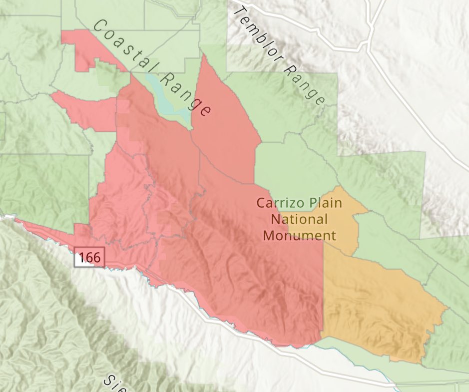
MadreFire Current Evacuation Map.Evacuation Orders for Zones SLC-226, 264, 265, 312, 337, 338.Evacuation Warnings for Zones SLC-313, 358
 2 día atrás
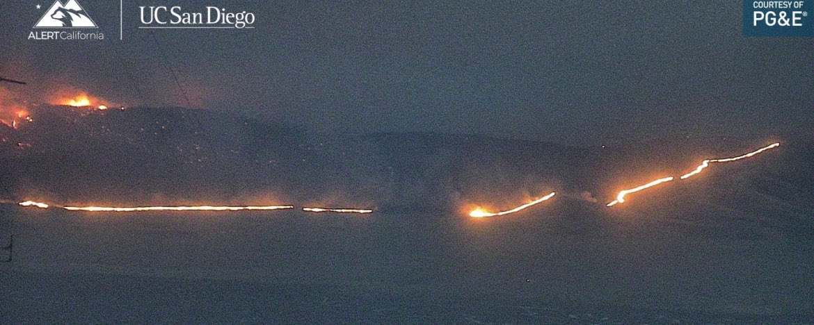
MadreFire the Fire still remains North of Highway 166 no reports of any spot fires across the Highway, its Progressed all the way to the Carrizo Plains.
Earthquake of magnitude 4.6 - 116 km SW of Banda Aceh, Indonesia
Earthquake of magnitude 5.3 - 219 km NW of Lautoka, Fiji