Earthquake of magnitude 4.9 - southeast of the Loyalty Islands
Earthquake of magnitude 4.6 - Kermadec Islands region
 2 rok temu
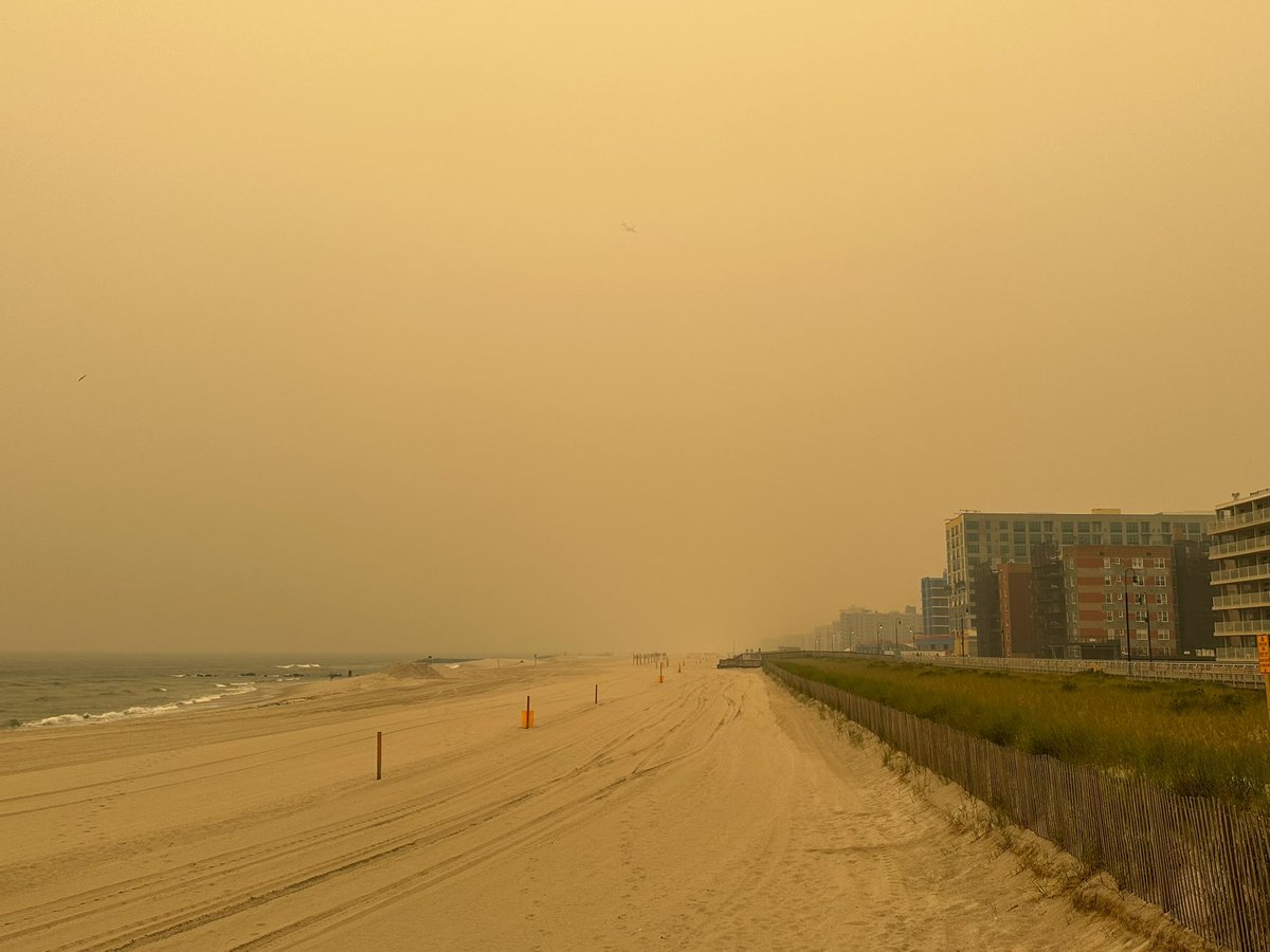
The Canadian wildfires smoke over Long Beach, NY
 2 rok temu
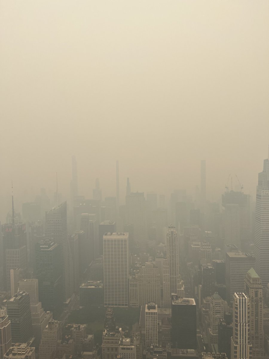
The smoke from the Canadian Wildfires at the George Washington Bridge in New York City.
 2 rok temu
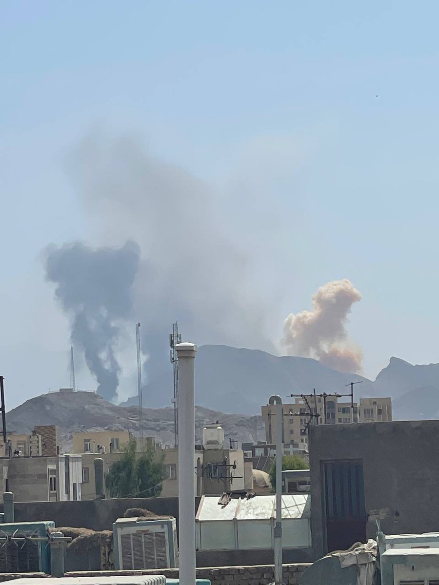
Scene in Area 51: Invasion on the Empire State building
Earthquake of magnitude 5.1 - 53 km WSW of Bahía Solano, Colombia
Earthquake of magnitude 5.6 - 139 km S of Wonosari, Indonesia
Hawaii Kilauea volcano started to erupt early Wednesday morning, according to an alert released by the Hawaiian Volcano Observatory
Earthquake of magnitude 4.9 - South Sandwich Islands region
Po ponad 36 godzinach od zawalenia się tamy Putin nakazał szefowi rosyjskiego EMERCOM pomoc ludziom na zalanych terenach okupowanych terenów obwodu chersońskiego
 2 rok temu
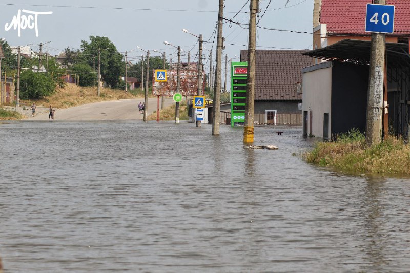
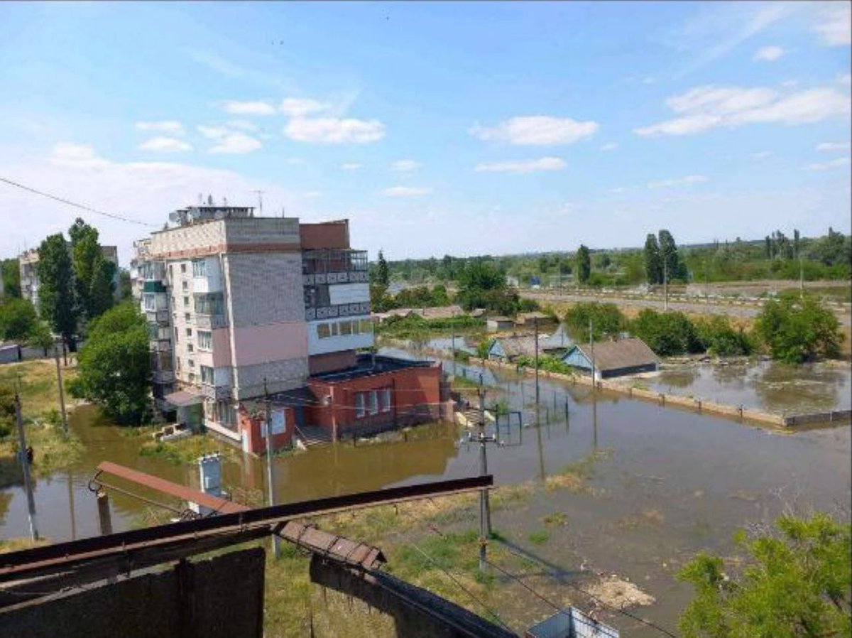
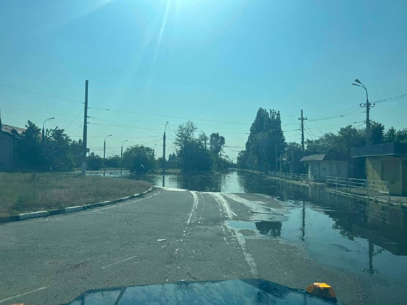
Droga między Antonivką a Chersoniu została zalana
 2 rok temu
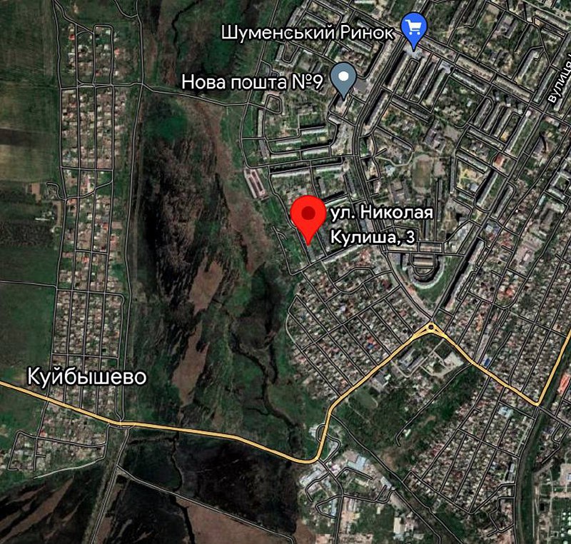
Powódź w rejonie Szumenskim w Chersoniu
Earthquake of magnitude 4.6 - Bulgaria
 2 rok temu
Powódź w dzielnicy Korabelny w Chersoniu
Rosyjskie wojsko nie zezwala ludności cywilnej na ewakuację zalanych terenów
Earthquake of magnitude 4.8 - near the south coast of Myanmar
2.7 magnitude earthquake. 3 km from Cherry Valley, CA, United States
 2 rok temu
Crews working to contain Ocean County, NJ wildfire; 30 structures threatened
 2 rok temu
New York City now has the worst air quality of any city on Earth as canadian Wildfires Blanket Northeast States in Apocalyptic Haze Much of the Northeast has been enveloped in an apocalyptic haze as smoke from Canadian wildfires blankets
Earthquake of magnitude 5.1 - South Sandwich Islands region
Earthquake of magnitude 5.2 - southeast of the Loyalty Islands
Earthquake of magnitude 5.2 - 280 km E of Vao, New Caledonia
Earthquake of magnitude 4.9 - 279 km E of Vao, New Caledonia
Earthquake of magnitude 4.7 - 4 km SSE of Fântânele, Romania
Earthquake of magnitude 4.7 - 142 km ENE of Hasaki, Japan
Earthquake of magnitude 4.7 - 141 km S of False Pass, Alaska
Earthquake of magnitude 4.7 - Molucca Sea
 2 rok temu
Małe domy całkowicie zalane w Oleszkach
Earthquake of magnitude 4.9 - 9 km NE of Les Abricots, Haiti
Earthquake of magnitude 4.8 - 67 km SW of Banjar, Indonesia
 2 rok temu
W Chersoniu obszary Hydroparku i Naftogavanu zostały już zalane. Na wyspie trwa ewakuacja ludzi z trzech punktów zbiórki
Woda dociera do Dnipriany
Poziom wody w Chersoniu nadal rośnie
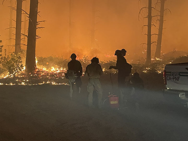 2 rok temu
Challenge Rx Burn on the @USFSPlumas As of 10 p.m., firefighters have completed approximately 150 acres of nearly 200 acres of ignitions. As conditions remain favorable, it is anticipated that all ignitions will be completed by midnight
Zoo „Kazkova Dibrova" zostało podobno zalane w Nowej Kachowce
Po zniszczeniu zapory Kachowka wezwano policję i jednostki EMERCOM do informowania i ewakuacji ludności cywilnej z potencjalnych stref powodziowych na prawym brzegu Dniepru: Mykolayivka, Olhivka, Lvove, Tiahynka, Ponyativka, Ivanivka, Tokarivka, Ponyativka, Prydniprovske, Sadove i wyspa Korabeliv w mieście Chersoniu