Earthquake of magnitude 4.6 - 15 km WSW of Dompu, Indonesia
Earthquake of magnitude 5.7 - South Indian Ocean
Earthquake of magnitude 4.7 - South Indian Ocean
Earthquake of magnitude 4.9 - 159 km S of ‘Ohonua, Tonga
Earthquake of magnitude 4.7 - 1 km ESE of Nueva Italia de Ruiz, Mexico
Earthquake of magnitude 4.6 - 27 km NE of Ambunti, Papua New Guinea
A 6.1 magnitude earthquake occurred 36.04mi NNE of Eloúnda, Greece.
Earthquake of magnitude 6.1 - 58 km NNE of Eloúnda, Greece
VEGETATION FIRE - Tin Mine Rd. X La Sierra Ave. in El Cerrito. Firefighters are on scene of a 20-acre vegetation fire at the above location and have stopped the forward rate of spread. Aircraft was requested to assist with ground efforts
Earthquake of magnitude 5.2 - South Sandwich Islands region
Earthquake of magnitude 4.7 - 269 km NE of Saipan, Northern Mariana Islands
Earthquake of magnitude 5.2 - South Sandwich Islands region
Earthquake of magnitude 4.6 - 122 km S of Kokopo, Papua New Guinea
Earthquake of magnitude 4.6 - 52 km SW of Hihifo, Tonga
Earthquake of magnitude 4.6 - 84 km NW of Fef, Indonesia
Earthquake of magnitude 4.6 - Izu Islands, Japan region
Earthquake of magnitude 4.7 - Kermadec Islands, New Zealand
Cedar Fire burning near Oracle
Earthquake of magnitude 5.5 - 242 km SSE of Ushuaia, Argentina
Earthquake of magnitude 4.6 - south of the Fiji Islands
Earthquake of magnitude 5.0 - Pacific-Antarctic Ridge
Earthquake of magnitude 4.6 - 226 km SSE of Ushuaia, Argentina
Earthquake of magnitude 4.6 - Fiji region
Earthquake of magnitude 4.9 - Mauritius - Reunion region
2.5 magnitude earthquake. 9 mi from Muscoy, CA, United States
Earthquake of magnitude 4.9 - central Mid-Atlantic Ridge
 3 maand geleden
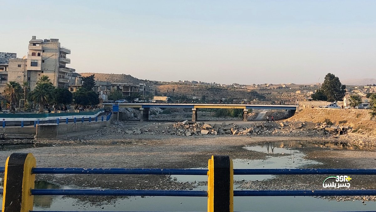
Syrië kampt met een van de ergste droogtes in de recente geschiedenis. In Damascus is het waterpeil van de bron Ain Fijah aanzienlijk gedaald en niet langer voldoende om aan de behoeften in de provincie te voldoen, wat in veel gebieden leidt tot frequente wateronderbrekingen. Er is een noodplan geactiveerd, dat onder meer het gebruik van zoveel mogelijk waterputten parallel aan de bron omvat. In het noorden kampt de Orontes ook met lage waterstanden, waardoor zowel de toegang tot water als de irrigatie in de landbouw in verschillende gebieden in gevaar komt.
Earthquake of magnitude 6.6 - 116 km NE of Angoram, Papua New Guinea
Earthquake of magnitude 6.4 - 81 km ENE of Angoram, Papua New Guinea
Earthquake of magnitude 6.6 - 111 km NE of Angoram, Papua New Guinea