 10 month ago
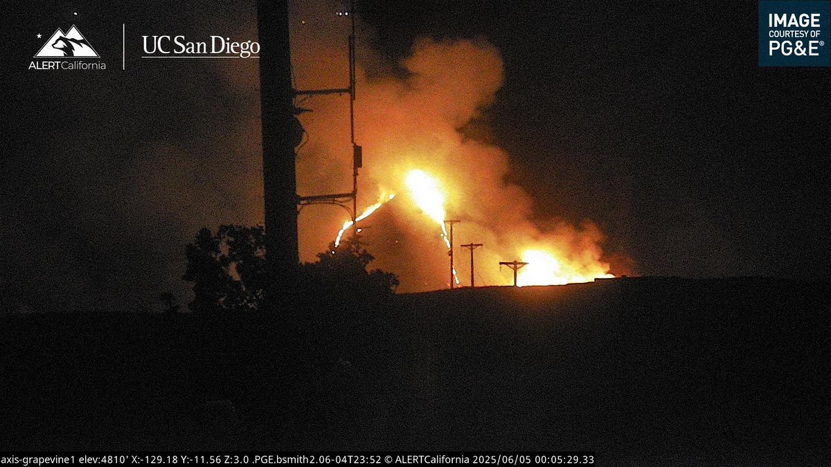
New Brush Fire Fort Tejon Road/S I-5, Grapvine, Kern County.5 acres running uphill
Earthquake of magnitude 4.7 - 35 km NW of Mýrina, Greece
Earthquake of magnitude 4.9 - 63 km NW of Ocampo, Mexico
Earthquake of magnitude 5.7 - 299 km SW of Arenas, Panama
Earthquake of magnitude 5.0 - 23 km NNW of Zibihu, China
Tornado sirens went off a couple of minutes ago in Maryland Heights.
Earthquake of magnitude 4.6 - 81 km SSE of Kushiro, Japan
3.6 magnitude earthquake. 5 mi from Idyllwild, CA, UnitedStates
Earthquake of magnitude 5.0 - 137 km SSE of Lata, Solomon Islands
Earthquake of magnitude 5.2 - 156 km WSW of Fakfak, Indonesia
Earthquake of magnitude 4.6 - Izu Islands, Japan region
 10 month ago
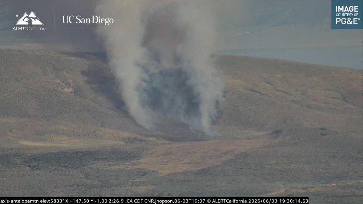
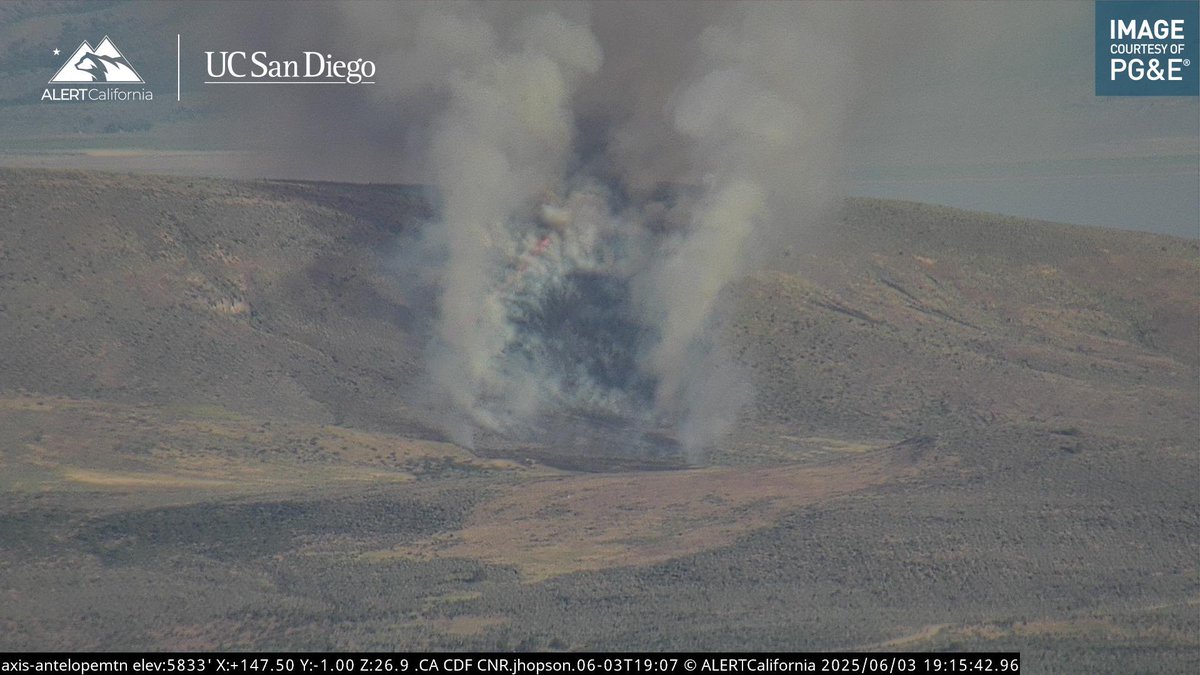
Byers Fire AA210 is requesting two additional Type 3 Air Tankers.The Fire is 60 acres, pushing to the East, still potential for 100 acres
 10 month ago
New Brush Fire Byers Pass Road, Janesville, Lassen County.15 acres, Moderate ROS, Potential for 100 acres, no structures threatened
Earthquake of magnitude 4.7 - western Xizang
Earthquake of magnitude 4.6 - 55 km WNW of Te Anau, New Zealand
Earthquake of magnitude 4.7 - 43 km W of Adak, Alaska
Earthquake of magnitude 4.7 - 22 km W of Adak, Alaska
Earthquake of magnitude 5.0 - 45 km W of Adak, Alaska
 10 month ago
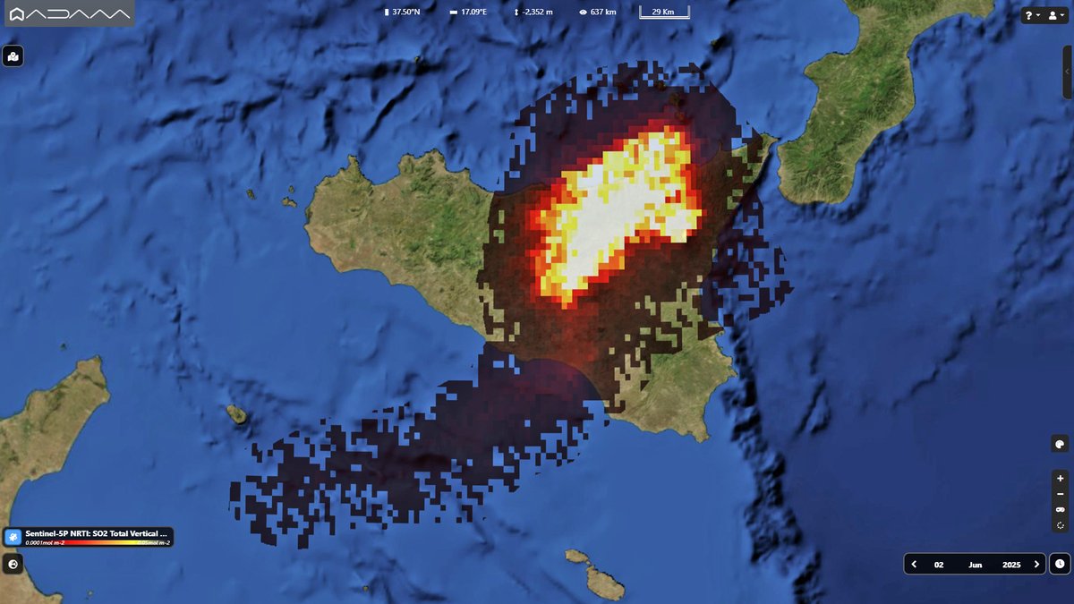
The first paroxysm of Etna in the last 18 months from space. nThe Copernicus Sentinel5p map on June 2 shows the SO2 plume related to the eruption at Southeast Crater
Earthquake of magnitude 5.0 - 57 km SSE of Hiroo, Japan
Earthquake of magnitude 4.9 - 9 km SSE of Ierápetra, Greece
Earthquake of magnitude 5.2 - 177 km NNW of Arawa, Papua New Guinea
Earthquake of magnitude 4.9 - 120 km E of Bitung, Indonesia
Earthquake of magnitude 5.0 - 83 km S of Finschhafen, Papua New Guinea
Earthquake of magnitude 4.7 - Kermadec Islands region
6.2-MAGNITUDE Earthquake STRIKES GREECE NEAR TURKEY BORDER A 6.2-magnitude earthquake hit the Dodecanese Islands of Greece early Tuesday, close to the Turkish border, according to the European Mediterranean Seismological Centre
Earthquake of magnitude 4.6 - 2 km E of Lázaro Cárdenas, Mexico
Earthquake of magnitude 5.8 - 5 km S of İçmeler, Turkey
Earthquake of magnitude 4.6 - Banda Sea
Earthquake of magnitude 4.6 - Kermadec Islands region