Earthquake of magnitude 4.7 - Kuril Islands
Earthquake of magnitude 4.7 - Vancouver Island, Canada region
SequioaFire; FF's are making access to a brush fire in the foothills of @City_SimiValley near Sequoia and Aspen St. The fire is approximately 1 acre in light fuels and being pushed by about a 2-4 mile wind.
Earthquake of magnitude 5.3 - 39 km W of San Pedro de Atacama, Chile
70 homes in Cherokee destroyed by flooding
McCain Fire now 50% contained, Cal Fire says 1,362 acres burned
 2 mois il y a
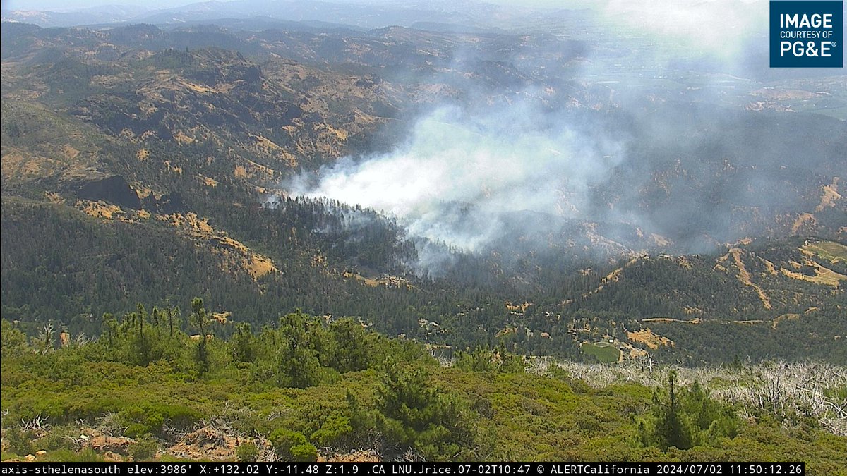
The TollFire north of Calistoga off Old Lawley Toll Rd is 20% contained. Temperatures remained in the mid-80s overnight. Control lines were wind-tested with 18-25 mph gusts, but firefighters held the fire in its current footprint at 40.6 acres
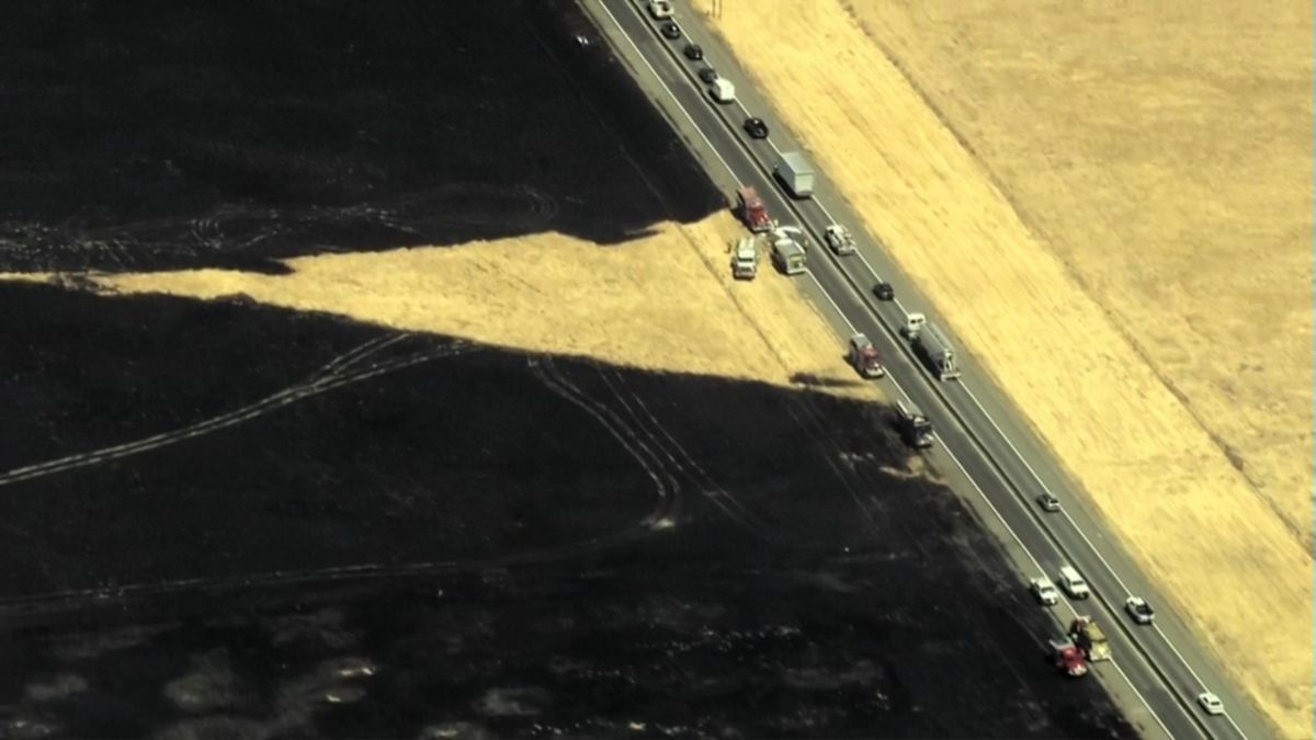
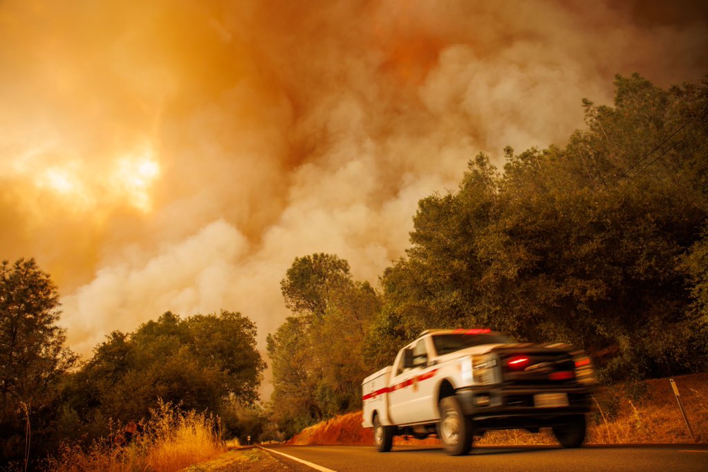
Four homes destroyed, 13k remain evacuated as Thompson Fire burns 3,000 acres in Butte County
Earthquake of magnitude 4.7 - 276 km WSW of Tual, Indonesia
Earthquake of magnitude 5.3 - 78 km NNE of Loreto, Mexico
Earthquake of magnitude 4.8 - 124 km ESE of Lata, Solomon Islands
Earthquake of magnitude 5.2 - southern Mid-Atlantic Ridge
Thompson Fire EVACUATION ORDER7. The Butte County Sheriff’s Office is issuing an Evacuation Order for zone 817 in Oroville due to a fire burning in the area. For more information, including a map of the area, please visit
 2 mois il y a
Crews battle 25-acre brush fire near Travis Air Force Base in Fairfield, CAL FIRE says
Stonefire burning near Hansen dam. Fire crews getting a good handle
For those who are displaced due to the moccasin fire, the Cameron Park CSD, 2502 Country Club Dr. Cameron Park is open as an overnight shelter
VEGETATION FIRE - Rpt at 3:34 p.m. Lukens Lane/Metz Road in unincorporated Perris. Firefighters on scene of 3 acres burning in light grass at a moderate rate of spread. Additional resources responding
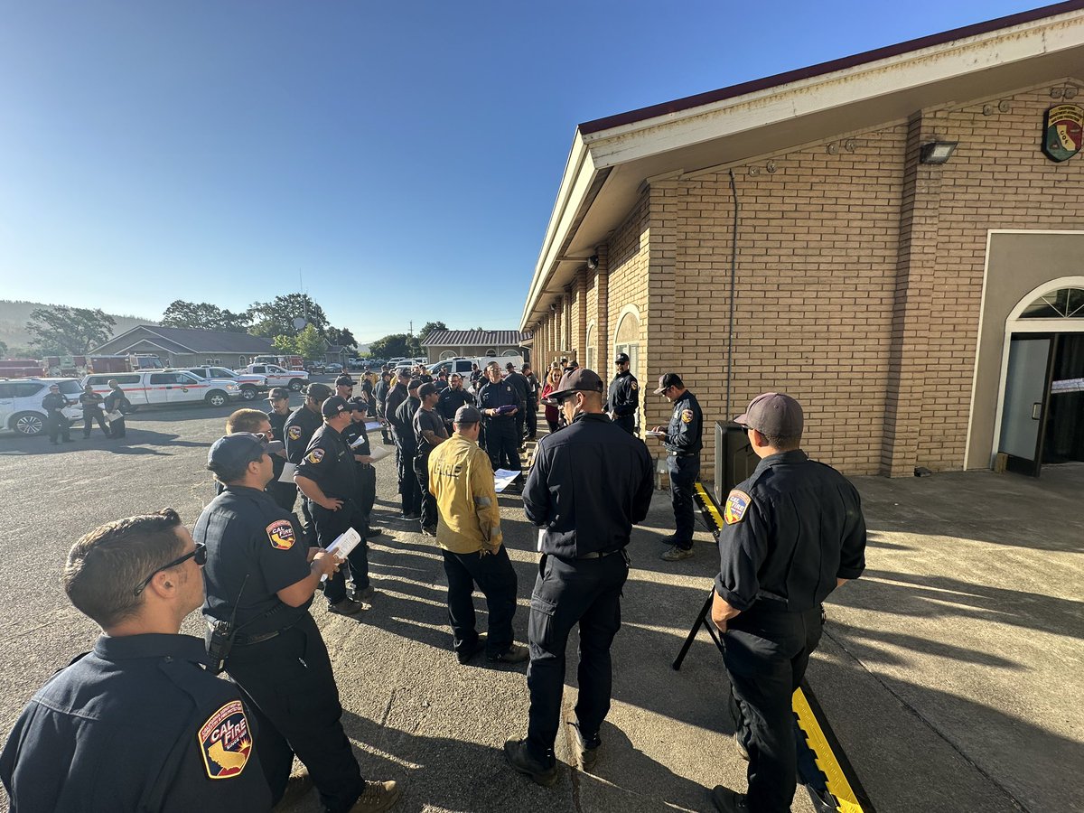
San Francisco Fire Department is sending 18 firefighters on one task force of four type-6 fire engines, one type-1 fire engine and one supervisor.This task force of 18 SFFD firefighters is going to the Thompson fire in Northern California on an immediate need request
Active Vegetation Fire incident reported in Griffith Park, Los Angele
CAL FIRE said some evacuation warnings have been lifted near the Toll Fire, north of Calistoga
 2 mois il y a
ThompsonFire for @AP as it burns Tuesday, July 2, 2024, in Oroville, Calif.
 2 mois il y a
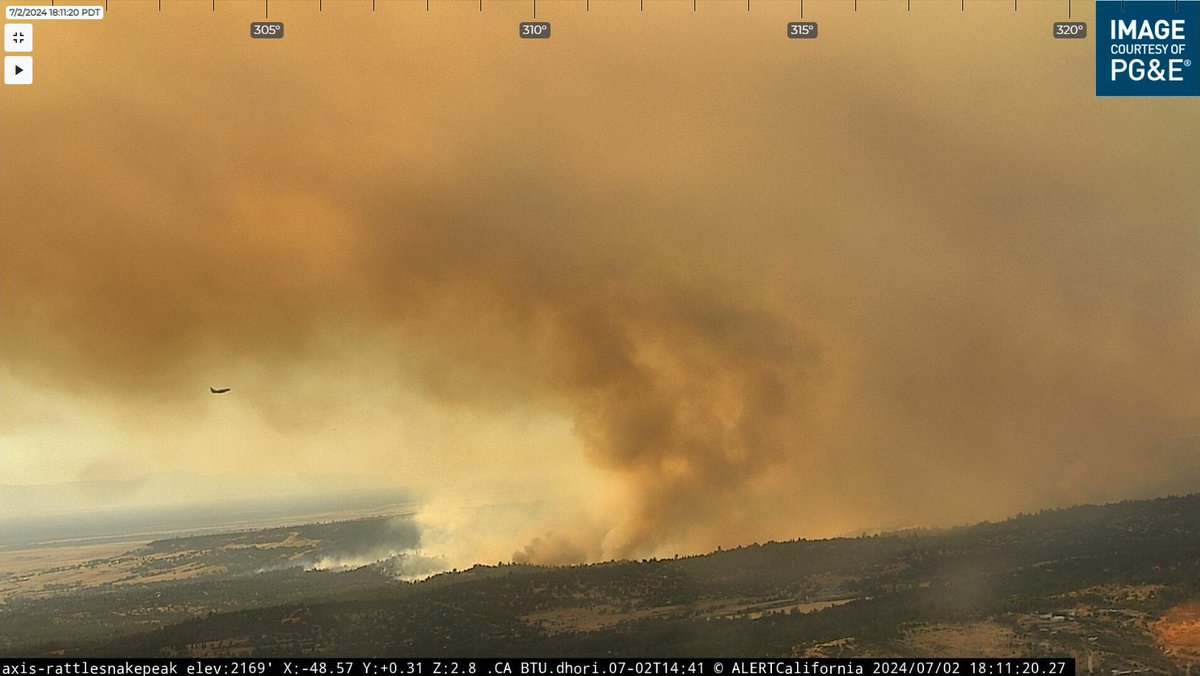
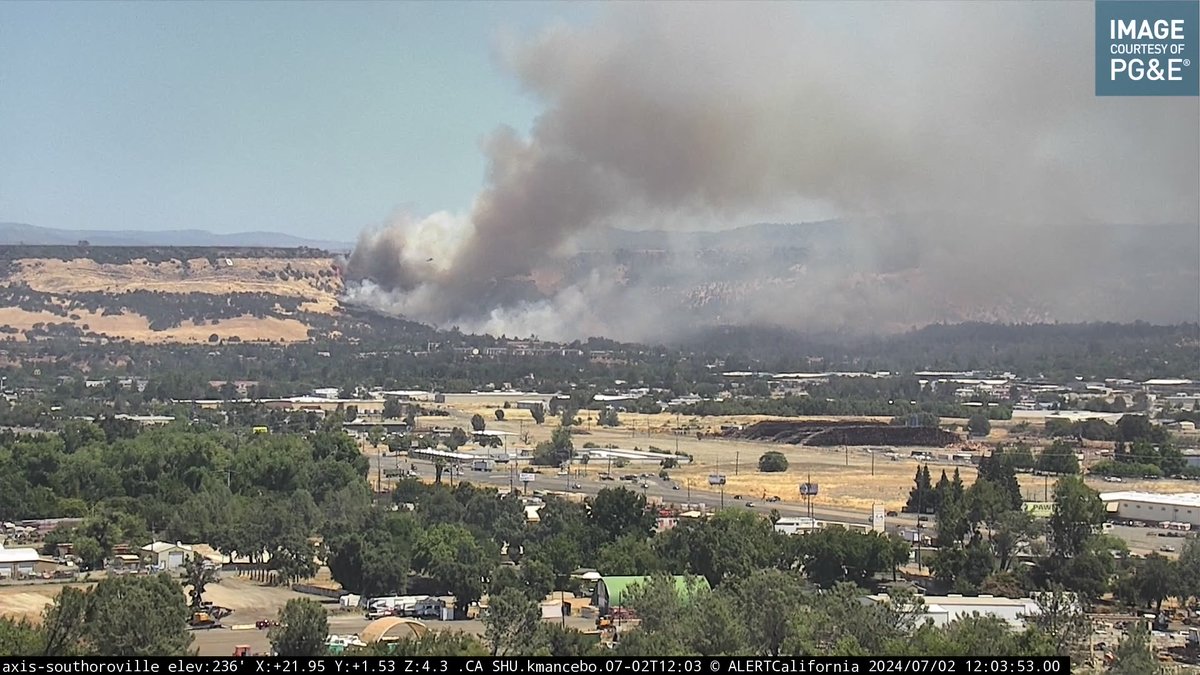
Communities downwind of the ThompsonFire by the Oroville Dam. The fire has burned more than 2,000 acres. Temperature in Oroville (6pm): 106 degrees
 2 mois il y a
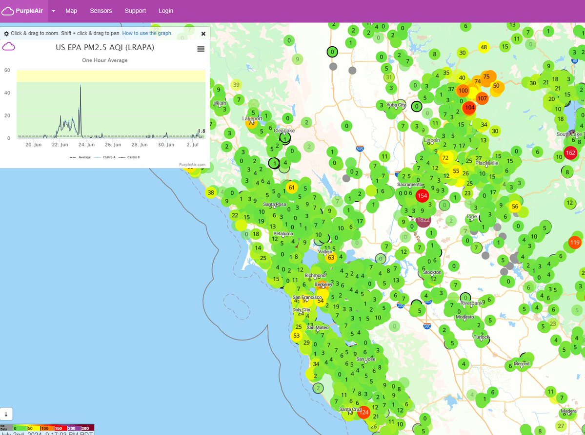
Upper air smoke drifting into view near San Francisco, moving into the region from the ThompsonFire due to northeasterly wind aloft. Not much showing on lower level sensors/surface smoke as of the 9pm hour, but will monitor into Wednesday.
Forward progress has been stopped on the Toll Fire north of Calistoga on Tuesday afternoon and the blaze is at 10% containment, according to CAL FIRE
 2 mois il y a
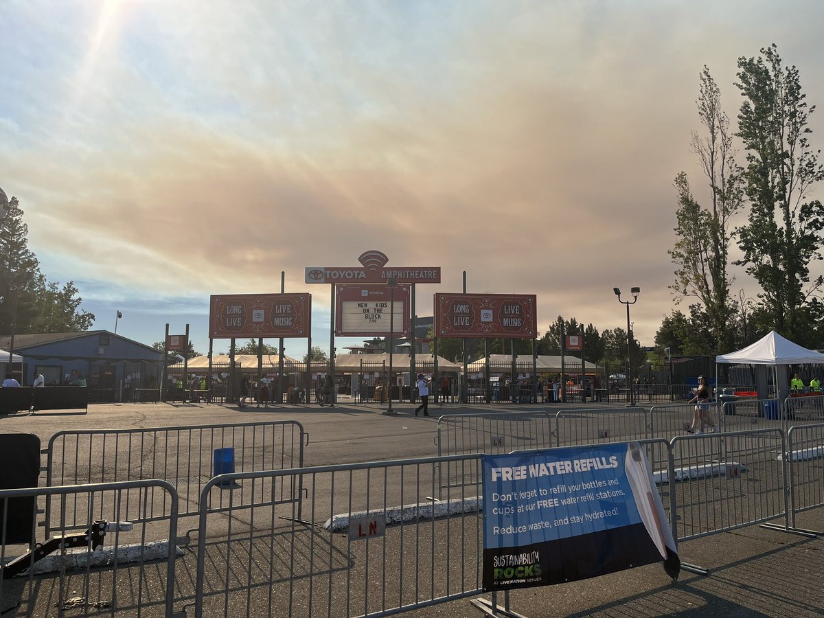
Smoke from a fire in Oroville is the backdrop for the New Kids on the Block concert at the Toyota Amphitheatre in Wheatland tonight.Hundreds of fans are finding ways to handle the triple digit temperatures ahead of tonight
 2 mois il y a
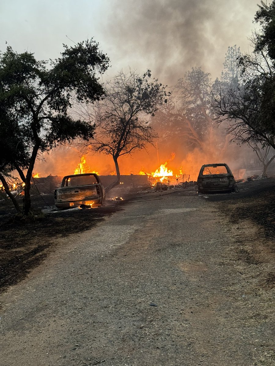
Multiple structures destroyed on Bessie Lane due to the ThompsonFire
Earthquake of magnitude 4.7 - 48 km ESE of Gilgit, Pakistan
Earthquake of magnitude 5.0 - North Pacific Ocean
Earthquake of magnitude 4.6 - 166 km SW of Nikolski, Alaska
Earthquake of magnitude 4.6 - 36 km NNW of Luwuk, Indonesia
Earthquake of magnitude 4.8 - 24 km S of Moíres, Greece
 2 mois il y a
The TollFire as seen from a couple of @ALERTCalifornia cameras. This is burning to the north of Calistoga, growing to the southwest. With the offshore wind, smoke is likely to blow toward Santa Rosa and other communities in Sonoma county
 2 mois il y a
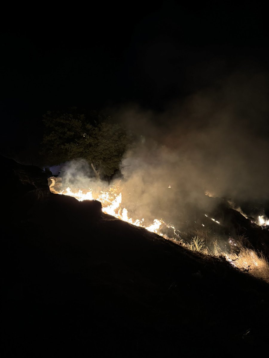
A bunch of other fires burning around the state already as well, including this nasty-looking one just north of Oroville.
DenvertonFire burning north of Highway 12 in rural Solano County is now 10 acres in size, moderate rate of spread, but no structures threatened
Vegetation fire burning near Highway 12 in Denverton, no structures threatened at this time, per fire official on scene
CAL FIRE, San Mateo County firefighters are responding to a small grassfire on San Bruno Mountain. Crews are making access. Fire is estimated a few acres or less.
The Butte County Sheriff's Office is issuing an EVACUATION ORDER for Zone 536 in the Cherokee area of Oroville due to a fire burning in the area. For more information, including a map of the area, visit
Earthquake of magnitude 4.8 - 32 km S of Moíres, Greece
Earthquake of magnitude 5.0 - 12 km ENE of Santa Monica, Philippines
Earthquake of magnitude 4.7 - 173 km E of Hasaki, Japan
Earthquake of magnitude 4.6 - 183 km SE of Kokopo, Papua New Guinea
3.1 magnitude earthquake. 8 mi from Casa Conejo, CA, United States
Earthquake of magnitude 5.1 - east of the North Island of New Zealand
Evacuation orders lifted for Boulder View Fire near Scottsdale; 80% contained
 2 mois il y a
A fire just broke out on in the Oakland Hills after someone set off fireworks
3.1 magnitude earthquake. 8 mi from Seeley, CA, UnitedStates
3.1 magnitude earthquake. 8 mi from Seeley, CA, United States
Earthquake of magnitude 4.6 - 183 km N of Hirara, Japan
Earthquake of magnitude 4.8 - east of the North Island of New Zealand
Earthquake of magnitude 5.0 - Banda Sea
Earthquake of magnitude 5.3 - Bonin Islands, Japan region